Updating search results...

Search Resources

558 Results

View
Selected filters:
  • Biology
What's So "Key" About A Keystone Species
Restricted Use
Copyright Restricted
Rating
0.0 stars

The resource is a video and a web quest to introduce students to keystone species and trophic cascades. I use both activities after students learn about food chains & webs and energy pyramids. The students work individually or in small groups to complete the web quest. I show the video before the activity to the entire class. The video can be viewed at home. Teachers can extend the activity by having students share the keystone species they researched in small groups or whole class.

Subject:
Biology
Life Science
Material Type:
Diagram/Illustration
Learning Task
Primary Source
Reading
Provider:
HHMI Biointeractive
Date Added:
06/21/2016
What's in the Water? Marketing Presentation CATE Lesson Plan
Conditional Remix & Share Permitted
CC BY-NC-SA
Rating
0.0 stars

This lesson would be used to follow up with the “What’s in the Water? Lab Activity.”

You are employees of competing Water Testing companies. You recently received a request from the municipality of Cavour to test their water for an unknown/suspected parasite that they suspect has been causing nausea and intestinal distress in their community.

Your mission after developing the Method for testing for the parasite found in the City of Cavour’s water is to submit your report for approval by the City of Cavour.

Your report and presentation will be used to determine whether Cavour accepts your bid for the contract.

Subject:
Biology
Chemistry
Environmental Science
Life Science
Physical Science
Material Type:
Assessment
Lesson Plan
Author:
Steve Kircher
Date Added:
12/22/2017
What's in the Water? Water Quality Analysis Lab CATE Lesson Plan
Conditional Remix & Share Permitted
CC BY-NC-SA
Rating
0.0 stars

You are employees of competing water testing companies. You recently received a request from the municipality of Cavour to test their water for an unknown/suspected parasite that they suspect has been causing nausea and intestinal distress in their community.

Your mission is to develop the proper Method for testing for the parasite and provide a detailed lab report.

Subject:
Biology
Chemistry
Life Science
Physical Science
Material Type:
Activity/Lab
Lesson Plan
Author:
Steve Kircher
Date Added:
12/22/2017
What's the buzz about bees and the bee genome?
Read the Fine Print
Rating
0.0 stars

An interview with biologist Gro Amdam, one of the members of the group that brought us the bee genome. Hey just what is a genome and could bees hold the answer to aging? In this show we learn the answers to these questions and why researchers are buzzing around bees.

Subject:
Biology
Life Science
Material Type:
Activity/Lab
Game
Lesson Plan
Provider:
Arizona State University School of Life Sciences
Provider Set:
Ask A Biologist
Author:
Audio editor
Charles Kazilek
Dr. Biology
Date Added:
06/10/2009
Who Am I? Plant and Animal Life in a Pond
Conditional Remix & Share Permitted
CC BY-NC-SA
Rating
0.0 stars

In this activity, students use questioning skills to ascertain which pond plant or animal they are. In previous lessons, students have visited the neighborhood pond, made observations, and become familiar with pond life.

Subject:
Biology
Life Science
Material Type:
Activity/Lab
Provider:
Science Education Resource Center (SERC) at Carleton College
Provider Set:
Pedagogy in Action
Date Added:
02/10/2023
Who Lives Here? : Investigating and Sorting Schoolyard Insects
Conditional Remix & Share Permitted
CC BY-NC-SA
Rating
0.0 stars

This activity is a field investigation where students collect bugs using homemade pit traps, sort them into groups, and then graph their results.

Subject:
Biology
Life Science
Material Type:
Activity/Lab
Provider:
Science Education Resource Center (SERC) at Carleton College
Provider Set:
Pedagogy in Action
Date Added:
02/10/2023
Who Wants To Live Here? Water Sampling At Our Local Pond and Stream
Conditional Remix & Share Permitted
CC BY-NC-SA
Rating
0.0 stars

This activity is a field activity where students will perform various water quality tests to determine the types of organisms that live in a local pond and stream, and the characteristics that those aquatic environments seem to have that the organisms favor.

Subject:
Biology
Life Science
Material Type:
Activity/Lab
Provider:
Science Education Resource Center (SERC) at Carleton College
Provider Set:
Pedagogy in Action
Author:
Susan Van Kekerix
Date Added:
02/10/2023
Why Is Coco Orange? Book on Air Quality and Asthma - Publications Page
Rating
0.0 stars

This website has a picture book about a chameleon who has asthma. Through this story, students will learn all about air quality, asthma, and how to stay healthy when the air quality is bad such as reading an air quality chart.

Subject:
Anatomy/Physiology
Atmospheric Science
Biology
Career and Technical Education
Earth and Space Science
Ecology
Education
Elementary Education
English Language Arts
Environmental Literacy and Sustainability
Environmental Science
Global Education
Health Science
Life Science
Literature
Reading Informational Text
Material Type:
Reading
Author:
Air Now
United States Enviornmental Protection Agency
Date Added:
03/26/2024
Wikipedia Vs. Encyclopedia
Rating
0.0 stars

In this lesson plan, students will work evaluate information using Wikipedia and compare that information to information from Britannica School (available through BadgerLink http://badgerlink.dpi.wi.gov/ ).

Subject:
Biology
English Language Arts
Environmental Science
Information and Technology Literacy
Life Science
Mathematics
Social Studies
Material Type:
Reading
Provider:
Wisconsin Department of Public Instruction
Date Added:
09/27/2017
Wild Kratts - PBS Kids
Restricted Use
Copyright Restricted
Rating
0.0 stars

Wild Kratts PBS Kids is a website that supports the Wild Kratts PBS Kids television show.  This Wild Kratts PBS Kids website features games, habitats, videos, creaturepedia, and biology.  Assessments are not included with Wild Kratts PBS Kids.  Educators will be explected to resources because of the size of the collection.

Subject:
Biology
Life Science
Material Type:
Curriculum Map
Diagram/Illustration
Game
Interactive
Learning Task
Lesson Plan
Reading
Reference Material
Simulation
Provider:
WK4 Productions, Inc.
Date Added:
10/28/2015
Wisconsin DNR Open Data Portal
Only Sharing Permitted
CC BY-NC-ND
Rating
0.0 stars

This is the Wisconsin Department of Natural Resources GIS Open Data Portal. It is a free resource for locating, viewing, and downloading data developed and/or maintained by the Wisconsin DNR.

This site also has categories of: Water, Fish and Wildlife, Managed Lands, Cimate, Parks and Recreation, Forestry, Transportation, Indexess and PLSS, Boundaries and Land Cover and Vegetation.

The site also has Applications that include: PFAS in Wisconsin Data Viewer, Western Coulee and Ridges Regional Master Plan, North Central Forest Regional Master Plan, Wildfires Dashboard App, Report Invasive Species, CWD reporting, etc

Subject:
Agriculture, Food and Natural Resources
Biology
Botany
Career and Technical Education
Civics and Government
Earth and Space Science
Ecology
Education
Elementary Education
Environmental Literacy and Sustainability
Environmental Science
Forestry and Agriculture
Geography
Geology
Health Education
Health Science
Higher Education
Hydrology
Life Science
Social Studies
Zoology
Material Type:
Activity/Lab
Homework/Assignment
Learning Task
Lecture
Lesson
Lesson Plan
Author:
Wisconsin Department of Natural Resources
Date Added:
03/12/2024
Wisconsin Geological and Natural History Survey - Publications Catalog
Only Sharing Permitted
CC BY-NC-ND
Rating
0.0 stars

The Wisconsin Geological and Natural History Survey (WGNHS) has been serving Wisconsin for over 125 years. Part of the Division of Extension at the University of Wisconsin–Madison, WGNHS provides objective scientific information about the geology, mineral resources, and water resources of Wisconsin. We conduct research, map Wisconsin’s geology, and share information through our publications and outreach.

This is the link to the Publications Catalog that includes Wisconsin Data sets and maps for: Bedrock Geology, Groundwater, Surficial Geology, Rocks and Minerals, Soils, Precambrian Bedrock, Surface Water, Metallic Minerals, Topography, Nonmetallic Minerals, Climate and Weather, and Frac Sand.

Subject:
Biology
Career and Technical Education
Earth and Space Science
Ecology
Education
Elementary Education
Environmental Science
Family and Consumer Sciences
Forestry and Agriculture
Geology
Health Science
Higher Education
Hydrology
Life Science
Marketing, Management and Entrepreneurship
Material Type:
Activity/Lab
Diagram/Illustration
Interactive
Lecture
Author:
Wisconsin Geological and Natural History Survey
Date Added:
03/12/2024
Wisconsin Historic Climate Data
Unrestricted Use
Public Domain
Rating
0.0 stars

Wisconsin’s climate is typically continental with some modification by Lakes Michigan and Superior. The cold, snowy winters favor a variety of winter sports, and the warm summers appeal to thousands of vacationers each year. About two-thirds of the annual precipitation falls during the growing season (freeze-free period). It is normally adequate for vegetation, although drought is occasionally reported. This climate is most favorable for dairy farming; the primary crops are corn, small grains, hay, and vegetables. The rapid succession of storms moving from west to east or southwest to northeast account for the stimulating climate.

Select from Climate by Location, Division, Normals, Statewide Extremes, Longterm Annual Variability, and Daily Climate data.

Subject:
Agriculture, Food and Natural Resources
Atmospheric Science
Biology
Botany
Career and Technical Education
Earth and Space Science
Ecology
Education
Elementary Education
Environmental Science
Family and Consumer Sciences
Forestry and Agriculture
Health Science
Higher Education
Hydrology
Life Science
Marketing, Management and Entrepreneurship
Material Type:
Activity/Lab
Diagram/Illustration
Homework/Assignment
Interactive
Author:
Wisconsin State Climatology Office and Nelson Institute for Environmental Studies
Date Added:
04/28/2024
Wisconsin Lakes Data - Lake Water Quality Data - Lake Maps - Plants and Aquatic Insects
Unrestricted Use
Public Domain
Rating
0.0 stars

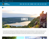
Wisconsin's 15,000 lakes. The DNR partners with the University of Wisconsin - Extension and citizens around the state to help protect and maintain these amazing natural resources while providing some of the best recreational opportunities in the nation. More than 600 lake organizations and thousands of volunteers play a leadership role in the stewardship of Wisconsin's lakes.

Find a Lake, Lake Water Quality Data, Lake Maps, Plants and Aquatic invasive Insects - are all linked to this site.

Subject:
Agriculture, Food and Natural Resources
Art and Design
Biology
Botany
Career and Technical Education
Ecology
Environmental Literacy and Sustainability
Environmental Science
Fine Arts
Forestry and Agriculture
Life Science
Zoology
Material Type:
Activity/Lab
Data Set
Diagram/Illustration
Interactive
Author:
Wisconsin Department of Natural Resources
Date Added:
04/23/2024
Wisconsin Lakes - Water Quality Data for each lake by County
Unrestricted Use
Public Domain
Rating
0.0 stars

Volunteers, DNR staff, county staff and others collect water clarity, temperature and dissolved oxygen, as well as other water quality data, on lakes across Wisconsin. Around 1,000 volunteers are currently active, and the network has been going strong since 1986. Water clarity is measured with a black and white disk called a "Secchi Disk".

Satellite images are used to retrieve water clarity data for lakes across the state. This effort began in 1999 when the University of Wisconsin-Madison Environmental Remote Sensing Center (ERSC) developed a model for the retrieval of water clarity data from satellite images and Citizen Lake Monitoring Network volunteers provided on-the-ground Secchi data to calibrate this model for each satellite image. Water clarity data was retrieved for over 8,000 lakes statewide between 1999 and 2001. The DNR continues to analyze data in this way today in its remote sensing program.

Subject:
Agriculture, Food and Natural Resources
Biology
Career and Technical Education
Ecology
Environmental Science
Forestry and Agriculture
Life Science
Marketing, Management and Entrepreneurship
Material Type:
Data Set
Diagram/Illustration
Other
Author:
Wisconsin Department of Natural Resources
Date Added:
04/24/2024
Wisconsin State Parks
Unrestricted Use
Public Domain
Rating
0.0 stars

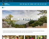
The Wisconsin State Park System provides places for outdoor recreation and for learning about nature and conservation. State parks, forests, trails and recreation areas see more than 20 million visits a year. Come and join the fun!

This site has links to all of the State Parks, Forests, Trails and recreation areas in Wisconsin.

Subject:
Agriculture, Food and Natural Resources
Art and Design
Astronomy
Atmospheric Science
Biology
Botany
Career and Technical Education
Earth and Space Science
Ecology
Education
Elementary Education
Environmental Literacy and Sustainability
Environmental Science
Fine Arts
Forestry and Agriculture
Geography
Geology
Higher Education
Life Science
Marketing, Management and Entrepreneurship
Social Studies
Material Type:
Other
Reference Material
Author:
Wisconsin Department of Natural Resources
Date Added:
04/24/2024
Wisconsin Surface Water Data Viewer
Conditional Remix & Share Permitted
CC BY-NC
Rating
0.0 stars

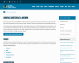
The Surface Water Data Viewer is a mapping tool for the State of Wisconsin. It provides interactive web mapping tools for a variety of datasets, including chemistry, physical, and biological data. The data managed in layers that can be turned on and off as needed. The Homepage of the Surface Water Data Viewer (SWDV) has many commonly used features labeled. Descriptions of the features are as follows:

Toolbars: There are a variety of toolbars with different themes to help complete tasks using the SWDV. The toolbars can be used to display the layers available to the map, add or remove shapes, text, or measurement features, identify points, print maps, and more!

Search Bar: Using the search bar, you can search monitoring stations by number, locations by keyword, and waterbodies by WBIC. Be careful when using the search bar, partial matches do not always appear in the results.

Navigation Pane: The navigation pane is where results will appear from searches, where you are able to select layers for the map, and features for printing. You will be able to refine the data that is shown here, if desired. You can hide the navigation pane by clicking the left-facing arrow at the top.

Coordinates and Coordinate System: The coordinates will display for any point moused-over on the map. Click the black triangle to select your preferred method for displaying lat/long (DD, DMS, DDM, Mercator). The right-most option in this pane allows you to manually manage thescale of the map. Click on the scale tool, and selected the desired scale at which you wish to view the map. Select Go to implement changes.

Scale Bar: The scale bar shows the current extent of the map.

Whole State View: This view describes what is being shown on the main map relative to the entire state. A blue rectangle will cover the region of the state being shown on the map. You can also navigate the map by moving the blue square around the state-view map. If you print a map, this whole state view will print in the corner as a reference. You can minimize this view by clicking the corner-facing arrow in the top left edge of the box.

Show/Hide Toolbar: Use this button to hide the toolbar for a larger view of the map. If you have hidden the toolbar, you can also use this button to show it again.
Subject:
Agriculture, Food and Natural Resources
American Indian Studies
Biology
Botany
Career and Technical Education
Earth and Space Science
Ecology
Education
Elementary Education
Environmental Science
Forestry and Agriculture
Geography
Geology
Higher Education
Hydrology
Life Science
Social Studies
Material Type:
Activity/Lab
Homework/Assignment
Learning Task
Lecture
Lesson
Author:
Wisconsin Department of Natural Resources
Date Added:
03/12/2024