These handouts accompany the 5th Grade Rain Garden Design Challenge Lesson Plan. …
These handouts accompany the 5th Grade Rain Garden Design Challenge Lesson Plan. The handouts give criteria for identifying areas of erosion and non-point source pollution entering waterways on school property, slope and soil suitability criteria for situating the rain garden, and data collection procedures for phosphate testing. The handouts also include guidelines and criteria for the final poster presentation design and Claim-Evidence-Reasoning, as well as rubrics for scoring and guidelines for peer feedback.
This lesson engages 5th grade students in identifying areas of erosion and …
This lesson engages 5th grade students in identifying areas of erosion and non-point source pollution entering waterways on school property, making a claim on the most suitable site to locate a rain garden by conducting field tests on slope and soil type, and testing for the presence of phosphates in waterways on school forest property. Students then compete in a rain garden design challenge using their data to create a poster presentation, including a map and claim evidence reasoning, for the best rain garden design plan, scored using a rubric.
Climate Wisconsin is an educational multimedia collection featuring stories about the impact …
Climate Wisconsin is an educational multimedia collection featuring stories about the impact of climate change in Wisconsin. LEARNING GOALS: Expand understanding of how climate change impacts life in Wisconsin. Connect personal observations to the study of climate and environmental science. Identify actions that may impact changes to our climate.
Through several activities/models as well as a class discussion, students will learn …
Through several activities/models as well as a class discussion, students will learn about volcanoes and their eruptions. They will also explore the types of rocks.
This is a laboratory course supplemented by lectures that focus on selected …
This is a laboratory course supplemented by lectures that focus on selected analytical facilities that are commonly used to determine the mineralogy, elemental abundance and isotopic ratios of Sr and Pb in rocks, soils, sediments and water.
This text set focuses on the Anishinaabe names for the Wenabozho Ominisan. …
This text set focuses on the Anishinaabe names for the Wenabozho Ominisan. Wenabozho is an important Anishinaabe figure, a trickster. Ominisan is the Anishinaabe word for islands. Wenabozho Ominisan (the islands of Wenabozho) is the Anishinaabe way to refer to what is also known as the Apostle Islands archipelago.
This text set focuses on the Anishinaabe names for the Wenabozho Ominisan. …
This text set focuses on the Anishinaabe names for the Wenabozho Ominisan. Wenabozho is an important Anishinaabe figure, a trickster. Ominisan is the Anishinaabe word for islands. Wenabozho Ominisan (the islands of Wenabozho) is the Anishinaabe way to refer to what is also known as the Apostle Islands archipelago. Some of the Anishinaabe island names and English names are literal translations. Yet, some of the Anishinaabe names describe a characteristic or use of the island in a manner different from the English names. The text set provides resources that will not only allow students to learn the Anishinaabe names but also provide insight into traditional uses and perspectives of these islands.
This site is a lecture about crystal structure from Dr. Stephen Nelson …
This site is a lecture about crystal structure from Dr. Stephen Nelson at Tulane University. Topics include axial ratios, intercepts of crystal faces (Weiss Parameters), determination of the Miller Index of a crystal, the modified notation of hexagonal systems, which is referred to as Miller-Bravais Indices, and using the Miller Index notation to designate crystal forms. Tables and illustrations accompany the text.
"This course covers the following questions. What are the predominant heat producing …
"This course covers the following questions. What are the predominant heat producing elements of the Earth? Where and how much are they? Are they present in the core of the Earth? Detection of antineutrinos generated in the Earth provides: 1) information on the sources of the terrestrial heat, 2) direct test of the Bulk Silicate Earth (BSE) model and 3) testing of non-conventional models of Earth's core. Use of antineutrinos to probe the deep interior of our planet is becoming practical due to recent fundamental advances in the antineutrino detectors."
Through spatial and graphical analysis of bird populations on a fictional island, …
Through spatial and graphical analysis of bird populations on a fictional island, students learn the meaning of biodiversity, species richness, endemism, and abundance. With the teacher acting as a facilitator, students use an interactive PDF map to explore various ways to represent and compare biodiversity across ecoregions. Students manipulate information layers to identify, describe, compare and graph bird distribution patterns in the island's different ecoregions. Rather than being given a list of vocabulary words, students grapple with the material to discover the meaning of these words and concepts. Through this experiential process, they combine the newly acquired terminology with complementary skills to evaluate and communicate their findings on bird biodiversity. This lesson prepares students for the more complex use of spatial and graphical analysis in our GIS-based Amazon unit.
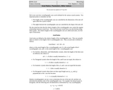
Conflict Diamonds or Blood Diamonds are stones produced in areas controlled by …
Conflict Diamonds or Blood Diamonds are stones produced in areas controlled by rebel forces that are opposed to internationally recognized governments. These rebels sell these diamonds and the money is used to purchase arms or fund their military actions.
Provided is short 8 minute video and a corresponding worksheet designed to spark discussion about the Kimberly Process.
I great way to incorporate a science and society lesson when studying gems and minerals.
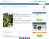
Students design and construct devices to trap insects that are present in …
Students design and construct devices to trap insects that are present in the area around the school. The objective is to ask the right design questions and conduct the right tests to determine if the traps work .
This resource is for teachers who want to teach their students about …
This resource is for teachers who want to teach their students about earthquakes and human involvement. This lesson plan is designed for older students to learn about earthquakes, hydraulic fracturing, and hydrocarbons while collecting and analyzing data to create a scientific poster of their findings based on their argument driven inquiry.
This course is organized around seven projects and a capstone assignment. Each …
This course is organized around seven projects and a capstone assignment. Each project includes readings, quizzes, and discussions about concepts and tools in cartography and visualization. Throughout the course, students complete “mile marker” assignments that are designed to help them progress toward the capstone assignment. Through the course projects, students confront realistic problem scenarios that incorporate such skills and concepts as creating symbolization schemes, coordinate systems and map projections, creating isoline and other terrain representations, interpolation, classification schemes, multivariate representation and representation of data uncertainty. Those who successfully complete the course are able to design and produce effective reference and thematic maps using GIS software and can interpret and critique maps and related information graphics.
Students consider the Earth's major types of landforms such as mountains, rivers, …
Students consider the Earth's major types of landforms such as mountains, rivers, plains, hills, canyons, oceans and plateaus. Student teams build three-dimensional models of landscapes, depicting several of these landforms. Once the models are built, they act as civil and transportation engineers to design and build roads through the landscapes they have created. The worksheet is provided in English and Spanish.
How sweet is this activity? It's an introduction to the rock cycle …
How sweet is this activity? It's an introduction to the rock cycle using chocolate! Chocolate can be ground into small particles (weathered), heated, cooled, and compressed  just like rocks. Unlike rocks, chocolate can undergo these processes safely and at reasonable temperatures. Use your chocolate to create “sedimentary,†“metamorphic,†and “igneous†chocolate. And at the end of it all, make a tasty treat!
In this Earth Science activity, students will investigate rocks in an outdoor …
In this Earth Science activity, students will investigate rocks in an outdoor field trip. Students will be divided into groups and given a Ziploc bag to collect rocks. We will then return to the classroom, and the students will put their rocks into different groups. The different groups could be the size, shape, color, and texture of the rocks. We will then talk about the Rock Cycle and the three main types of rocks. Students will record their observations in their science journals.
No restrictions on your remixing, redistributing, or making derivative works. Give credit to the author, as required.
Your remixing, redistributing, or making derivatives works comes with some restrictions, including how it is shared.
Your redistributing comes with some restrictions. Do not remix or make derivative works.
Most restrictive license type. Prohibits most uses, sharing, and any changes.
Copyrighted materials, available under Fair Use and the TEACH Act for US-based educators, or other custom arrangements. Go to the resource provider to see their individual restrictions.