Updating search results...

Search Resources

107 Results

View
Selected filters:
  • Geography
6-8 Social Studies/Civics Suggested Scope & Sequence: Based on the Wisconsin Standards for Social Studies (2018)
Rating
0.0 stars

The Wisconsin Social Studies/Civics 6-8 Suggested Scope & Sequence is divided by grade. The writing team decided this because they wanted to be able to build upon previous learning, and if the three courses were listed at any grade, educators would not be able to count on what was happening the year before. Therefore, we offer the
following order of courses:
• 6th Grade: Geography & Cultures of the World: Yesterday and Today
• 7th Grade: Civics & Our Contemporary World
• 8th Grade: Wisconsin & U.S. Studies (Thematic, 1924 – Present Day)

Civics and Social Studies are integrative by nature. Focusing on themes over dates, names, and battles can help students visualize the connections between strands of social studies better and learn to see the bigger picture while still meeting our state standards and expectations. Instead of viewing events in isolation, a thematic approach allows
students to better see connections and patterns across time. In addition, it assists teachers in helping students make connections to their own lives, identities, and current issues.

Each course is thematic, based in inquiry, has a civics lens, and is aligned to the Wisconsin Standards for Social Studies and the National Council for the Social Studies Themes of Social Studies. The courses all have the same units, focused on the strands of social studies (Inquiry, Behavioral Sciences, Economics, Geography, History, Political Science) in a thematic manner through the subject area. Every year starts with an inquiry unit to build inquiry skills and dispositions.

Each unit is further divided into planning ideas tied to middle school indicators from the Wisconsin Standards for Social Studies (2018). These planning ideas include:
• Potential Essential Questions, aligned to the standards
• NCSS theme of this unit
6-8 Social Studies/Civics: Suggested Scope and Sequence 8
• Focusing Questions for the Topic
• Recommended Inquiry Topics
• Specific Social Studies Indicators met with this unit
• Important Terms and Points to Consider
• Supporting Resource Providers to Consider

The essential and focusing questions are meant to help guide instruction and determine quality resources and lessons for use in the classroom. The recommended inquiry topics are provided to assist specific content choices for the unit.

We recognize this work is not as complete as the K-5 recommended scope & sequence. Where the K-5 team started with a framework similar to this document, the 6-8 started from scratch. We anticipate a more robust 6-8 document similar to the current released K-5 to be released by summer 2024.

Subject:
American Indian Studies
Ancient History
Civics and Government
Economics
Ethnic Studies
Gender Studies
Geography
Psychology
Religious Studies
Social Studies
Sociology and Anthropology
U.S. History
World Cultures
World History
Material Type:
Curriculum Map
Author:
Wisconsin Department of Public Instruction
Kristen McDaniel
Date Added:
01/12/2024
9 Classroom Resources on Genocide
Rating
0.0 stars

In accordance with Genocide Awareness Month, Facing History offers nine classroom resources educators can utilize to help their students think critically about the specific historical and contemporary conditions under which genocides occurred to effectively unite head, heart, and conscience.

Subject:
Civics and Government
Ethnic Studies
Geography
Religious Studies
Social Studies
Sociology and Anthropology
World Cultures
World History
Material Type:
Activity/Lab
Learning Task
Lesson Plan
Author:
Facing History and Ourselves
Kaitlin Smith
Date Added:
11/02/2023
About Climate Wisconsin – Climate Wisconsin – PBS Wisconsin Education
Only Sharing Permitted
CC BY-ND
Rating
0.0 stars

Climate Wisconsin is an educational multimedia collection featuring stories about the impact of climate change in Wisconsin.
LEARNING GOALS:
Expand understanding of how climate change impacts life in Wisconsin.
Connect personal observations to the study of climate and environmental science.
Identify actions that may impact changes to our climate.

Subject:
Agriculture, Food and Natural Resources
Art and Design
Astronomy
Atmospheric Science
Biology
Business and Information Technology
Career and Technical Education
Character Education
Composition and Rhetoric
Earth and Space Science
Ecology
Education
Elementary Education
English Language Arts
Environmental Literacy and Sustainability
Environmental Science
Family and Consumer Sciences
Fine Arts
Forestry and Agriculture
Geography
Geology
Health Education
Health Science
Higher Education
Life Science
Literature
Marketing, Management and Entrepreneurship
Media Arts
Reading Foundation Skills
Reading Informational Text
Reading Literature
Social Studies
Material Type:
Activity/Lab
Diagram/Illustration
Homework/Assignment
Interactive
Author:
PBS Wisconsin Education
Date Added:
04/21/2024
Academy for American Democracy, Part 1: Geography, From Athens to America
Unrestricted Use
Public Domain
Rating
0.0 stars

Geography is a major factor in the development of every civilization, including ancient Athens. Learn the ways in which the natural features of Athens helped...

Subject:
Civics and Government
Geography
Social Studies
World History
Material Type:
Homework/Assignment
Learning Task
Author:
Tang Academy for American Democracy
New York Historical Society
Date Added:
06/12/2023
Advanced Analytic Methods in Geospatial Intelligence
Conditional Remix & Share Permitted
CC BY-NC-SA
Rating
0.0 stars

The traditional approach to geospatial analysis is the intuitive technique. In order to improve analysis, relatively uncomplicated methods exist to help intelligence analysts structure their analysis. These structured methods, which can be applied to a broad range of problems, provide a scientific-like and demonstrable approach to analysis that can enhance the intelligence analyst objectivity. Structured methodologies do not replace the subjective insight of the intelligence analyst. Instead, the intent is to use a logical framework to illustrate and capitalize on intuition, experience, and judgment. A structured methodology provides a traceable and repeatable means to reach a conclusion. Significant for us, structured methods have significant value in that they can be taught. Structured methodologies are severely neglected in the geospatial realm. This course teaches the theory and practice behind a structured analytic method designed for geospatial intelligence, with particular emphasis given to selecting and applying appropriate analysis techniques to create and test hypotheses. Students will assess the various connotative biases and spatial fallacies that interfere with sound spatial thinking. Students also appraise basic analysis techniques including imagination, diagnostic, and challenging & reframing.

Subject:
Geography
Social Studies
Material Type:
Activity/Lab
Assessment
Diagram/Illustration
Full Course
Reading
Syllabus
Provider:
Pennsylvania State University
Provider Set:
Penn State, College of EMS
Author:
Mr. Steve Handwerk, Mr. David Jimenez, Dr. Gregory Thomas
Date Added:
11/09/2017
African American History (Teaching with Historic Places) (U.S. National Park Service)
Rating
0.0 stars

Teaching with Historic Places (TwHP) uses historic places in National Parks and in the National Park Service's National Register of Historic Places to enliven history, social studies, geography, civics, and other subjects. TwHP has created a variety of products and activities that help teachers bring historic places into the classroom.

Here you’ll find place-based educational resources relating to African American history and culture; including lesson plans and "Curiosity Kits" that are a series of articles that students can read individually or in a small group, in order to spark historical thinking.

Subject:
Geography
Social Studies
U.S. History
Material Type:
Lesson Plan
Primary Source
Author:
National Park Service
Date Added:
08/06/2023
Anishinaabe Place Names: Wenabozho Ominisan
Conditional Remix & Share Permitted
CC BY-NC-SA
Rating
0.0 stars

This text set focuses on the Anishinaabe names for the Wenabozho Ominisan. Wenabozho is an important Anishinaabe figure, a trickster. Ominisan is the Anishinaabe word for islands. Wenabozho Ominisan (the islands of Wenabozho) is the Anishinaabe way to refer to what is also known as the Apostle Islands archipelago.

Subject:
American Indian Studies
Earth and Space Science
Environmental Science
Geography
Geology
Global Education
Language Education (ESL)
World Languages
Material Type:
Diagram/Illustration
Homework/Assignment
Learning Task
Module
Teaching/Learning Strategy
Unit of Study
Author:
Rick Erickson
Sandy Benton
Date Added:
06/01/2023
Art and Ecology
Read the Fine Print
Rating
0.0 stars

Artists are often particularly keen observers and precise recorders of the physical conditions of the natural world. As a result, paintings can be good resources for learning about ecology. Teachers can use this lesson to examine with students the interrelationship of geography, natural resources, and climate and their effects on daily life. It also addresses the roles students can take in caring for the environment. Students will look at paintings that represent cool temperate, warm temperate, and tropical climates.
In this lesson students will: Identify natural resources found in particular geographic areas; Discuss ways in which climate, natural resources, and geography affect daily life; Apply critical-thinking skills to consider the various choices artists have made in their representations of the natural world; Make personal connections to the theme by discussing ways they can be environmental stewards; Identify natural resources found in particular geographic areas; Discuss ways in which climate, natural resources, and geography affect daily life; Apply critical-thinking skills to consider the various choices artists have made in their representations of the natural world; Make personal connections to the theme by discussing ways they can be environmental stewards.

Subject:
Art History
Ecology
Fine Arts
Geography
Life Science
Performing and Visual Arts
Social Studies
Material Type:
Activity/Lab
Assessment
Diagram/Illustration
Lesson Plan
Provider:
National Gallery of Art
Date Added:
10/13/2017
Assessing the Timing and Extent of Coastal Change in Western Alaska
Read the Fine Print
Educational Use
Rating
0.0 stars

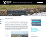
An interactive map based on four decades of satellite images helps residents, resource managers, and stewards of the land anticipate and plan for coastal change.

Subject:
Geography
Social Studies
Material Type:
Case Study
Provider:
National Oceanic and Atmospheric Administration
Provider Set:
U.S. Climate Resilience Toolkit
Date Added:
08/29/2016
British Columbia in a Global Context
Unrestricted Use
CC BY
Rating
0.0 stars

This first year Geography textbook takes a holistic approach to Geography by incorporating elements of physical, human and regional geography, as well as bringing in methods and perspectives from spatial information science.. This textbook applies a fundamental geographical approach to understanding our globally changing world by looking at local processes which are linked to larger global processes and events. For example mining and its effects are a global issue and we can see how these unfold in BC. A further example is the recent apology to First Nation peoples on the residential school treatment, as similar events occur in the US, Ireland and Australia. Processes of urbanization, a phenomenon which people all over the globe are experiencing, can be seen in Vancouver with our discussion of the city’s development. Geography students, indeed all first year students, need to be able to critically assess their own contexts and environments in order to properly engage with our continually globalizing world.

Subject:
Geography
Social Studies
Material Type:
Textbook
Provider:
BCcampus
Provider Set:
BCcampus Faculty Reviewed Open Textbooks
Author:
Arthur Green
Aviv Ettya
Britta Ricker
Cristina Tenemos
Simon Fraser
Siobhan McPhee
Date Added:
10/31/2014
Cartography and Visualization
Conditional Remix & Share Permitted
CC BY-NC-SA
Rating
0.0 stars

This course is organized around seven projects and a capstone assignment. Each project includes readings, quizzes, and discussions about concepts and tools in cartography and visualization. Throughout the course, students complete “mile marker” assignments that are designed to help them progress toward the capstone assignment. Through the course projects, students confront realistic problem scenarios that incorporate such skills and concepts as creating symbolization schemes, coordinate systems and map projections, creating isoline and other terrain representations, interpolation, classification schemes, multivariate representation and representation of data uncertainty. Those who successfully complete the course are able to design and produce effective reference and thematic maps using GIS software and can interpret and critique maps and related information graphics.

Subject:
Earth and Space Science
Geography
Geology
Social Studies
Material Type:
Activity/Lab
Assessment
Full Course
Lecture
Reading
Syllabus
Provider:
Pennsylvania State University
Provider Set:
Penn State, College of EMS
Author:
Adrienne Gruver
Date Added:
11/09/2017
Central American Population
Conditional Remix & Share Permitted
CC BY-NC-SA
Rating
0.0 stars

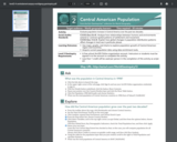
Evaluate population increase in Central America over the past two decades using a geographic information system. Students manipulate map layers and interpret thematic maps to answer questions about how the Central American population has changed. Teachers must modify the pdf for classroom use because the answers are not provide separate from the questions.

Subject:
Geography
Social Studies
Material Type:
Lecture
Lesson
Author:
Esri Geoinquiries
Date Added:
06/25/2023
The Columbian Exchange: An Interactive Lesson
Rating
0.0 stars

The lesson helps students understand the background and impact of the Columbian Exchange both now and in the past.

To read a review of standards alignment, go to: https://docs.google.com/document/d/1WFF3rHfOobKe3bBZ8o9_WDJ9FQbT6Wah/edit

Subject:
Geography
Social Studies
U.S. History
World History
Material Type:
Formative Assessment
Interactive
Learning Task
Lesson
Rubric/Scoring Guide
Author:
PBS Learning Media
Date Added:
12/21/2021
Digital Mapping and Geographic Information Systems (GIS)
Read the Fine Print
Educational Use
Rating
0.0 stars

Geographic information systems (GIS), once used predominantly by experts in cartography and computer programming, have become pervasive in everyday business and consumer use. This unit explores GIS in general as a technology about which much more can be learned, and it also explores applications of that technology. Students experience GIS technology through the use of Google Earth on the environmental topic of plastics in the ocean in an area known as the Great Pacific Garbage Patch. The use of this topic in GIS makes the unit multidisciplinary, incorporating the physics of ocean currents, the chemistry associated with pollutant degradation and chemical sorption to organic-rich plastics, and ecological impact to aquatic biota.

Subject:
Career and Technical Education
Geography
Social Studies
Technology and Engineering
Material Type:
Full Course
Unit of Study
Provider:
TeachEngineering
Provider Set:
TeachEngineering NGSS Aligned Resources
Author:
Andrey Koptelov
Nathan Howell
National Science Foundation GK-12 and Research Experience for Teachers (RET) Programs,
Date Added:
09/18/2014
Digital Public Library of America
Rating
0.0 stars

The Digital Public Library of America is a free digital collection of artifacts gathered from libraries, archives and museums.  This great collection of primary source materials will continue to grow as new items are made digital. 

Subject:
Art and Design
Civics and Government
Computer Science
Economics
Education
Environmental Science
Ethnic Studies
Fine Arts
Geography
Life Science
Performing and Visual Arts
Social Studies
Material Type:
Diagram/Illustration
Primary Source
Provider:
Digital Public Library of America
Date Added:
03/20/2018
Discovering Rainforest Locations Lesson Plan
Rating
0.0 stars

This resource aims to teach map reading skills of worldwide temperatures, percipitation, biovidsetiy, and soil nutrition levels in rainforest areas. It includes world maps, tropical rainforest maps, vocabulary, and teaching strategies.

Subject:
Agriculture, Food and Natural Resources
Career and Technical Education
Education
Elementary Education
Environmental Literacy and Sustainability
Environmental Science
Forestry and Agriculture
Geography
Global Education
Library and Information Science
Life Science
Social Studies
World Cultures
Material Type:
Activity/Lab
Diagram/Illustration
Interactive
Lesson
Lesson Plan
Author:
California Academy of Sciences
Date Added:
03/27/2024
Distorted Disturbances
Read the Fine Print
Educational Use
Rating
0.0 stars

Students pass around and distort messages written on index cards to learn how we use signals from GPS occultations to study the atmosphere. The cards represent information sent from GPS satellites being distorted as they pass through different locations in the Earth's atmosphere and reach other satellites. Analyzing GPS occultations enables better global weather forecasting, storm tracking and climate change monitoring.

Subject:
Career and Technical Education
Geography
Social Studies
Technology and Engineering
Material Type:
Activity/Lab
Provider:
TeachEngineering
Provider Set:
TeachEngineering NGSS Aligned Resources
Author:
Integrated Teaching and Learning Program,
Jonah Kisesi
Marissa H. Forbes
Penina Axelrad
Date Added:
09/18/2014
Earth Processes in the Critical Zone
Conditional Remix & Share Permitted
CC BY-NC-SA
Rating
0.0 stars

EARTH 530 will introduce you to the basic information necessary for understanding Earth surface processes in the Critical Zone through an integration of various scientific disciplines. Those who successfully complete EARTH 530 will be able to apply their knowledge of fundamental concepts of Earth surface processes to understanding outstanding fundamental questions in Critical Zone science and how their lives are intimately linked to Critical Zone health.

Subject:
Earth and Space Science
Geography
Geology
Social Studies
Material Type:
Activity/Lab
Assessment
Full Course
Homework/Assignment
Lecture Notes
Provider:
Pennsylvania State University
Provider Set:
Penn State, College of EMS
Author:
Tim White
Date Added:
11/09/2017