Essentials of Geographic Information Systems integrates key concepts behind the technology with …
Essentials of Geographic Information Systems integrates key concepts behind the technology with practical concerns and real-world applications. Recognizing that many potential GIS users are nonspecialists or may only need a few maps, this book is designed to be accessible, pragmatic, and concise. Essentials of Geographic Information Systems also illustrates how GIS is used to ask questions, inform choices, and guide policy. From the melting of the polar ice caps to privacy issues associated with mapping, this book provides a gentle, yet substantive, introduction to the use and application of digital maps, mapping, and GIS.
Geography 431 is designed to further understanding of the natural processes of …
Geography 431 is designed to further understanding of the natural processes of aquatic ecosystems, management of water resources, and threats to sustaining water quantity and quality for all types of freshwater surface, ground, rivers, lakes, wetlands for geographers, ecologists, earth scientists, engineers, planners, other environmental professionals as well as those in non-science fields. This course will develop awareness and appreciation of the multiple perspectives about water as a precious resource, commodity, and sometimes hazard. We will learn how and why water is distributed unevenly in space and time around the Earth. We will examine the ways in which resource management decisions made in human society are strongly related to the availability, quantity, and quality of water. The course examines water resources management, including issues surrounding irrigation; dams and dam removal; provision of safe potable water; threats to water quantity and quality including human and aquatic ecosystem effects; land use changes; the water economy including bottled water, privatization, and water as a free good; water laws and policy; institutions for water management at the global, national, regional, and local scale; and issues of water security and climate change.
The course provides the geospatial information system professional an overview of systems …
The course provides the geospatial information system professional an overview of systems analysis and design with emphasis the concepts behind the design process including: business use case modeling, business object modeling, requirements definition, analysis and preliminary design, and, finally, detailed design and deployment. The concepts of the geospatial software and database development process are introduced and the limitations of current modeling techniques are addressed within the spatial systems development paradigm. In a series of related activities the student applies the methods, tools and the concepts of the systems development process to document a portion of a geospatial system with Unified Modeling Language (UML), the standard graphical notation for modeling application needs. UML affords a common unifying framework that integrates database models with the rest of a system design.
Students will be able to watch this video of Hans Rosling explaining …
Students will be able to watch this video of Hans Rosling explaining data analysis of population growth and the economic impacts an increasing population can have. This video is connected to the data and format on the gapminder website.
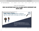
In this lesson, students will look at 3 maps to learn about …
In this lesson, students will look at 3 maps to learn about where the ancestral tribal lands of four Native nations are located. The four nations are the Iroquois Confederacy (made of 5 nations), the Cherokee Nation, the Chickasaw Nation, and the Western Abenaki nation. Students will label all four groups on three different maps and as they look at each map they will consider how the land is represented on the map and how that might impact how people understand Native land and Native sovereignty. This lesson is part of a Unit that includes the following lessons: Grade 3 Unit 2 History Mystery 1: WHAT IS NATIVE SOVEREIGNTY AND WHY IS IT IMPORTANT? Grade 3 Unit 2 History Mystery 2: WHAT CAN DIFFERENT MAPS TELL US ABOUT NATIVE SOVEREIGNTY AND NATIVE LAND? Grade 3 Unit 2 History Mystery 3: WHAT STRATEGIES TO NATIVE NATIONS USE TO PROTECT THEIR SOVEREIGNTY DURING THE AMERICAN REVOLUTION (1)? Grade 3 Unit 2 History Mystery 4: WHAT STRATEGIES TO NATIVE NATIONS USE TO PROTECT THEIR SOVEREIGNTY DURING THE AMERICAN REVOLUTION (2)?
"In this lesson, students will learn the basic vocabulary of maps and …
"In this lesson, students will learn the basic vocabulary of maps and the concepts of map projections and distortion. In exploring the Mercator and Peters' map projections, students will learn how looking at different projections can influence our thinking about the world."
Best practices and guidelines for teaching about genocide from the Holocaust Center …
Best practices and guidelines for teaching about genocide from the Holocaust Center for Humanity. These are guidelines for educators, not lesson plans.
Over the course of nine months, eleven Hmong language educators took an …
Over the course of nine months, eleven Hmong language educators took an Ethnic Studies course with Dr. Jenna Cushing-Leubner & Heritage Language/Ethnic Studies teacher Natalia Benjamin at the University of Wisconsin-Whitewater, and attended the Boston Ethnic Studies training with Katie Li and her team. Afterwards Dr. Vicky Xiong-Lor of Clovis Unified and Doua Vue of Fresno Unified lead the team through self-healing activities and created a Hmong Ethnic Studies curriculum. This is the first phase of curriculum creation with more to come.
Hmong Museum is the first museum dedicated to the preservation and education …
Hmong Museum is the first museum dedicated to the preservation and education of Hmong culture, history, experiences, and arts. We do this through the creation and collaboration of programs that:
Document Hmong history & knowledge Exhibit Hmong culture & art Share Hmong experiences & stories
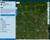
This data layer includes lines representing existing sections of the Ice Age …
This data layer includes lines representing existing sections of the Ice Age National Scenic Trail. This version of the data is hosted by Wisconsin DNR for DNR staff use and public download and is updated approximately every two months.
This layer is hosted by Wisconsin DNR, and reflects Ice Age Trail updates received from the Ice Age Trail Alliance on December 21st, 2023. This layer is typically updated approximately every two months and is primarily for the purpose of DNR staff use and public download from DNR's Open Data Portal. For more current trail data contact Tiffany Stram (tiffany@iceagetrail.org) GIS/Technology Specialist at Ice Age Trail Alliance. For the official depiction of Ice Age Trails in Wisconsin, see Ice Age Trail Alliance's Ice Age National Scenic Trail Existing Sections - Official Layer: https://www.arcgis.com/home/item.html?id=735b25ad50e74520b7396d9168f53cfc.
This data layer includes lines representing existing sections of the Ice Age National Scenic Trail. This layer is a combination of GPS and digitized data, merged to represent one complete data layer for the IAT. The data was developed by the Ice Age Trail Alliance (IATA) in cooperation with the National Park Service's Ice Age Trail Office.
This video tutorial will help you identify effective formative practices. In order …
This video tutorial will help you identify effective formative practices. In order to improve student outcomes, it is essential that educators understand what the formative assessment process is and the characteristics of effective formative assessment practices.
Developing environmentally literate citizens is the primary goal of environmental science. One …
Developing environmentally literate citizens is the primary goal of environmental science. One of the four components of environmental literacy is "connecting to nature". Culture plays a key role in the way individuals connect to their environment. Understanding culture also supports the development of a culturally responsive classroom and helps students develop an understanding of environmental justice, another key concept of environmental science. This lesson helps students explore their own culture and compare and contrast it with other cultures.
This video and resources can be used to support educators' professional development …
This video and resources can be used to support educators' professional development related to assessment literacy. Consider using the supplement to kick off your next PLC meeting to enhance your own assessment literacy.
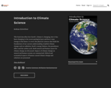
This book describes how Earth's climate is changing, how it has been …
This book describes how Earth's climate is changing, how it has been changing in the recent geological past and how it may change in the future. It covers the physical sciences that build the foundations of our current understanding of global climate change such as radiation, Earth's energy balance, the greenhouse effect and the carbon cycle. Both natural and human causes for climate change are discussed. Impacts of climate change on natural and human systems are summarized. Ethical and economical aspects of human-caused climate change and solutions are presented.
This unit will use a variety of resources to give students a …
This unit will use a variety of resources to give students a guide to understanding Treaty Rights and the importance of Treaty Rights to Indigenous peoples. It is important for all people, Indigenous and non-Indigenous, to understand Treaty Rights, how they were established, and how they apply today.
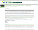
This activity is a field investigation where students will be able to …
This activity is a field investigation where students will be able to observe sinkholes located in the southeastern Minnesota area and a cave system in Forestville State Park which will assist them in defining Karst topography.
The Wisconsin Social Studies/Civics K-5 Suggested Scope & Sequence is divided by …
The Wisconsin Social Studies/Civics K-5 Suggested Scope & Sequence is divided by grade. Each grade has a theme, with K-2 having a common theme of “place” and 3-5 having a common theme of “Wisconsin and U.S. Studies”. Each grade has 4-10 topics, which could align to local units. This formatting was adapted from the 2018 History and Social Science Framework by the Massachusetts Department of Elementary and Secondary Education.
Each topic is further divided into planning ideas tied to specific grade-level indicators from the Wisconsin Standards for Social Studies (2018). These planning ideas include: • Potential Essential Questions, tied to the standards • Focusing Questions for the topic • Driving (DQ) and Guiding (GQ) Questions from the Educating for American Democracy Roadmap • Specific Social Studies Indicators met with this topic • Important Terms and Points to Consider • Supporting Resources to Consider, including lesson plans from trusted resources, and suggested additional texts such as primary sources and trade books.
The essential, focusing, driving, and guiding questions are meant to help guide instruction and determine quality resources and lessons for use in the classroom.
In this series of activities, students build their background knowledge about bats …
In this series of activities, students build their background knowledge about bats through a variety of media and texts (Activity 1), play games to learn more about how bats interact with their prey and how they use their bodies, and choose an action(s) to help make the world a better place for bats, and therefore, humans (Activity 2). My students decided to create educational posters convincing people to help bats, plant a bat garden, build a bat house, and adopt-a-bat. They also wrote persuasive letters to hang the bat house on our school, which they presented to the administration (and the project was approved - in addition to which the principal asked us to create additional educational materials to teach the school community - teachers, students, other staff - and families about the benefits of bats).
Explore the factors leading to the independence movement of Latin American colonies. …
Explore the factors leading to the independence movement of Latin American colonies. Students will manipulate thematic layers using a geographic information system. Teachers must transfer the questions and instructions to a new document because the answers are included on the pdf linked here.
No restrictions on your remixing, redistributing, or making derivative works. Give credit to the author, as required.
Your remixing, redistributing, or making derivatives works comes with some restrictions, including how it is shared.
Your redistributing comes with some restrictions. Do not remix or make derivative works.
Most restrictive license type. Prohibits most uses, sharing, and any changes.
Copyrighted materials, available under Fair Use and the TEACH Act for US-based educators, or other custom arrangements. Go to the resource provider to see their individual restrictions.