In this course you will learn about phase relations as applied to …
In this course you will learn about phase relations as applied to oil and/or gas reservoir processes, enhanced oil recovery, gas pipeline transportation, natural gas processing and liquefaction, and other problems in petroleum production. The primary objective of the course is to apply the thermodynamics of phase equilibrium to the framework for phase behavior modeling of petroleum fluids. The focus of the course will be on equilibrium thermodynamics and its relevance to phase behavior predictions and phase equilibrium data description. We will attempt to apply phase behavior principles to petroleum production processes of practical interest, especially natural gas condensate systems.
Physical Geography, also called earth science, is the study of our home …
Physical Geography, also called earth science, is the study of our home planet and all of its components: its lands, waters, atmosphere, and interior. In this book, some chapters are devoted to the processes that shape the lands and impact people. Other chapters depict the processes of the atmosphere and its relationship to the planets surface and all our living creatures. For as long as people have been on the planet, humans have had to live within Earths boundaries. Now human life is having a profound effect on the planet. Several chapters are devoted to the effect people have on the planet.The journey to better understanding Earth begins here with an exploration of how scientists learn about the natural world and introduces you to the study of physical geography and earth science.
This course introduces the potential of GIS to support all stages of …
This course introduces the potential of GIS to support all stages of emergency (crisis or disaster) management activities, the latest R&D advances that are helping to achieve this potential now, and some challenges for the future. The course focuses on requirements analysis and proposal writing targeted toward planning and implementing GIS solutions for government agencies and contractors. As a basis from which to pursue these objectives, Planning GIS for Emergency Management introduces the current and potential future roles of GIS in support of crisis (emergency) management activities at all geographic scales (local to international). These roles are considered at each of the four stages of crisis management are (mitigation, preparation, response, and recovery). Then, selected focus topics (e.g., GIS for evacuation planning and support) are considered in detail.
In this unit, students learn the very basics of navigation, including the …
In this unit, students learn the very basics of navigation, including the different kinds of navigation and their purposes. The concepts of relative and absolute location, latitude, longitude and cardinal directions are explored, as well as the use and principles of maps and a compass. Students discover the history of navigation and learn the importance of math and how it ties into navigational techniques. Understanding how trilateration can determine one's location leads to a lesson on the global positioning system and how to use a GPS receiver. The unit concludes with an overview of orbits and spacecraft trajectories from Earth to other planets.
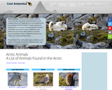
This website provides an elaborate overview of the Polar Regions; the Arctic …
This website provides an elaborate overview of the Polar Regions; the Arctic and Antarctic. Students can use this site to research polar animals, investigate the habitats-learn history, science, environment, and compare/contrast the two regions. Teachers can use this site to provide information to their students.
Students use their knowledge of scales and areas to determine the best …
Students use their knowledge of scales and areas to determine the best locations in Alabraska for the underground caverns. They cut out rectangular paper pieces to represent caverns to scale with the maps and place the cut-outs on the maps to determine feasible locations.
Students learn to use the Visual Basic for Applications (VBA) programming environment …
Students learn to use the Visual Basic for Applications (VBA) programming environment to add functionality to ArcView. No previous programming experience is assumed. Students who successfully complete the course are able to automate repetitive tasks, customize the ArcView interface, and share their customizations with others.
This course will introduce you to Remote Sensing for the Geospatial Intelligence …
This course will introduce you to Remote Sensing for the Geospatial Intelligence Professional - Students who successfully complete GEOG 883 will have a basic understanding of remote sensing systems, airborne and space borne sensors that collect optical imagery, elevation, and spectral data. They will understand the methods used to georeference and rectify these data in order to produce scaled maps and GIS-ready digital data products. The students will be introduced to the processing workflows used to convert raw data into orthophotos, digital terrain models, and image analysis products. These data products will be used in a variety of application scenarios, using commercially available software tools.
As state and local education agencies increasingly focus on serving educators with …
As state and local education agencies increasingly focus on serving educators with their data systems, a common challenge has arisen: identifying the critical knowledge and skills needed by teachers and administrators to use data effectively. Many states are creating data literacy and data use training programs for pre- and in-service educators without a common foundation on which to base the content. In addition, several state education agencies and educator preparation programs have begun communicating about how to create a stronger alignment between pre- and in-service training for educators regarding data use.
The goals of this textbook are to help students acquire the technical …
The goals of this textbook are to help students acquire the technical skills of using software and managing a database, and develop research skills of collecting data, analyzing information and presenting results. We emphasize that the need to investigate the potential and practicality of GIS technologies in a typical planning setting and evaluate its possible applications. GIS may not be necessary (or useful) for every planning application, and we anticipate these readings to provide the necessary foundation for discerning its appropriate use. Therefore, this textbook attempts to facilitate spatial thinking focusing more on open-ended planning questions, which require judgment and exploration, while developing the analytical capacity for understanding a variety of local and regional planning challenges. While this textbook provides the background for understanding the concepts in GIS as applicable to urban and regional planning, it is best when accompanied by a hands-on tutorial, which will enable readers to develop an in-depth understanding of the specific planning applications of GIS. Chapters in this text book are either composed by the editors using Creative Common materials, or linked to a book chapter scanned copy in the library reserve. In the end of each chapter, we also provided several discussion questions, together with contextual applications through some web links.
This video and resources can be used to build awareness among leaders, …
This video and resources can be used to build awareness among leaders, as well as to support educators' professional learning. Consider using this supplement to support conversations with parents/community, as well as to promote data and assessment literacy as part of ongoing professional development and PLC activities.
This video and resources can be used to support educators' professional development …
This video and resources can be used to support educators' professional development related to data and assessment literacy. Consider using this supplement to kick off your next PLC meeting to enhance your own data and assessment literacy.
Teach your students to guide their own inquiry: Facilitation Materials for Question …
Teach your students to guide their own inquiry: Facilitation Materials for Question Formulation Technique from the Right Question Institute. This resource includes a powerpoint to lead students through the steps to construct their own questions to lead their inquiry, has student handouts, and gives exmaples for how to use the Question Formulation Technique in your instructional practices.
In this lesson, students examine classic Maya art and monumental inscriptions, as …
In this lesson, students examine classic Maya art and monumental inscriptions, as well as an excerpt from an Aztec encyclopedia, to explore how the ancient Mexican city of Teotihuacan influenced other Mesoamerican societies. Students also reason about contemporary scholars' commentary on the historical sources.
This course offers an introduction to the capabilities of lidar sensors and …
This course offers an introduction to the capabilities of lidar sensors and platforms, data processing systems, and derived digital data products. Students in this course will master basic skills needed to leverage commercial lidar data sources and information products in a broad range of applications, including topographic mapping, flood inundation studies, vegetation analysis, and 3D modeling of urban infrastructure.
Students are encouraged to read at home, where parents help them track …
Students are encouraged to read at home, where parents help them track their reading minutes, then teachers record their reading minutes in portfolios where minutes turn into "miles. " They visit sixteen cities around the state to collect clues and solve eight crimes. This activity weaves facts into the crimes that students are trying to solve as they travel their reading miles.
Students will: Increase reading fluency with time spent reading at home Review addition and subtraction as they add minutes into their portfolios and then subtract them as miles when they travel in Wisconsin Use map-reading skills to trace their routes from city to city on a Wisconsin road map Apply problem-solving skills to match their collected clues to the descriptions of the criminals in their game packets
Wise management of tribal lands and natural resources is very important for …
Wise management of tribal lands and natural resources is very important for the future of American Indian communities. Tribes depend on these resources to sustain their economies and cultures long into the future. Tribal leaders know that lands and natural resources are at risk of degradation and there is a need for good management to protect and restore those resources. Each tribe has its own unique and special natural gifts. Coastal tribes have the salmon, Alaska Natives tribes have the caribou, and Great Plains tribes have the bison. In the Great Lakes region there is wild rice and maple syrup. In the Northwest, there is the whale.
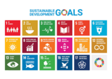
Explore what the United Nations sustainability goals are and their purpose for …
Explore what the United Nations sustainability goals are and their purpose for improving the human and environmental global community. After learning about the goals in general,s students will dig deeper into understanding how achieving Goal #6 Access to Clean Water and Sanitation looks different in every country. After learning about their other countries, students will explore how Wisconsin's own drinking water must be monitored to make sure it's safe. Students will then be asked to explore ways they can alert people to the need to test and make sure their own drinking water is safe.
Learn about urban, suburban and rural communities in this social studies lesson …
Learn about urban, suburban and rural communities in this social studies lesson for kids. We share everything your first and second grade student needs to know about urban, suburban and rural communities and areas.
No restrictions on your remixing, redistributing, or making derivative works. Give credit to the author, as required.
Your remixing, redistributing, or making derivatives works comes with some restrictions, including how it is shared.
Your redistributing comes with some restrictions. Do not remix or make derivative works.
Most restrictive license type. Prohibits most uses, sharing, and any changes.
Copyrighted materials, available under Fair Use and the TEACH Act for US-based educators, or other custom arrangements. Go to the resource provider to see their individual restrictions.