Updating search results...

Search Resources

27 Results

View
Selected filters:
  • monitoring
About Climate Wisconsin – Climate Wisconsin – PBS Wisconsin Education
Only Sharing Permitted
CC BY-ND
Rating
0.0 stars

Climate Wisconsin is an educational multimedia collection featuring stories about the impact of climate change in Wisconsin.
LEARNING GOALS:
Expand understanding of how climate change impacts life in Wisconsin.
Connect personal observations to the study of climate and environmental science.
Identify actions that may impact changes to our climate.

Subject:
Agriculture, Food and Natural Resources
Art and Design
Astronomy
Atmospheric Science
Biology
Business and Information Technology
Career and Technical Education
Character Education
Composition and Rhetoric
Earth and Space Science
Ecology
Education
Elementary Education
English Language Arts
Environmental Literacy and Sustainability
Environmental Science
Family and Consumer Sciences
Fine Arts
Forestry and Agriculture
Geography
Geology
Health Education
Health Science
Higher Education
Life Science
Literature
Marketing, Management and Entrepreneurship
Media Arts
Reading Foundation Skills
Reading Informational Text
Reading Literature
Social Studies
Material Type:
Activity/Lab
Diagram/Illustration
Homework/Assignment
Interactive
Author:
PBS Wisconsin Education
Date Added:
04/21/2024
Black bear population in Wisconsin - status and distribution
Conditional Remix & Share Permitted
CC BY-NC
Rating
0.0 stars

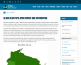
Wisconsin's occupied bear range is expanding, which means residents can expect to see black bears in areas outside of the bear's traditional range. An abundant population and suitable bear habitat have facilitated the southerly movement of occupied bear range in Wisconsin. Wisconsin's black bear population is considerably higher than it was 30 years ago.

Wisconsin's bear population was estimated to be about 9,000 bears in 1989. The most recent data indicates the bear population is currently estimated to be a little over 24,000 bears. DNR manages bear population size through regulated hunting. The number of hunting permits have steadily increased following studies showing higher numbers of bears. In the near future, opportunities will be provided to the public to comment on the desired numbers of bears in each of the state's bear management regions as the DNR prepares a new bear management plan.

Wisconsin is not alone in its expanding bear range. The results from a 2008 survey of eastern United States and Canadian Provinces that actively manage black bear populations indicated that 75% of these jurisdictions report an increase in bear range. Only Vermont reported a contracting bear range.

Subject:
Agriculture, Food and Natural Resources
Biology
Career and Technical Education
Ecology
Environmental Science
Forestry and Agriculture
Life Science
Zoology
Material Type:
Data Set
Diagram/Illustration
Interactive
Author:
Wisconsin Department of Natural Resources
Date Added:
04/21/2024
Elk in Wisconsin
Conditional Remix & Share Permitted
CC BY-NC
Rating
0.0 stars

Once widespread here and across North America, elk were eliminated from Wisconsin in the 1880s due to unregulated hunting and habitat loss. Over 130 years later, they once again live in our state's central and northern forest regions. From a population of 25 elk reintroduced in 1995, and with the help of the second reintroduction effort that started in 2015, the state's total elk population has now surpassed 400 animals.

Thanks to the support of multiple partners and the backing of Wisconsin citizens, the bugle of rutting September bulls is back and here to stay!

Elk (Cervus canadensis) is one of North America's most significant deer family members (Cervidae), second only to moose. Wisconsin's native elk (before European settlement) belonged to the Eastern elk subspecies (C. c. canadensis), believed to have gone extinct during the late 1800s. The Rocky Mountain sub-species (C. c. nelsoni) was later used in reintroduction efforts in Wisconsin and other eastern U.S. states.

Elk is one of three members of the deer family that lives in Wisconsin regularly, with the other two being white-tailed deer (Odocoileus virginianus) and moose (Alces alces). Elk are approximately three times larger than deer and about two-thirds the size of moose. Adult elk are light tan-colored with a darker mane on their neck with a distinct buff-colored rump patch and stub tail.

Elk vary in size by sex. A mature cow stands approximately four and a half feet tall at the shoulder, six and a half feet in length from nose to tail and weighs 500-650 pounds. In contrast, a mature bull may stand five feet or more at the shoulder, stretch over eight feet long and weigh 600-900 pounds. Wisconsin elk calves typically weigh between 35-40 pounds at birth. Calves are born with white spots to help them blend into their surroundings during their first few months. Elk are also a herd-associated species that have many vocalizations and unique characteristics.

Subject:
Agriculture, Food and Natural Resources
Career and Technical Education
Ecology
Environmental Literacy and Sustainability
Environmental Science
Forestry and Agriculture
Life Science
Zoology
Material Type:
Data Set
Interactive
Author:
Wisconsin Department of Natural Resources
Date Added:
04/21/2024
Fish List – Eat Wisconsin Fish
Conditional Remix & Share Permitted
CC BY-NC
Rating
0.0 stars

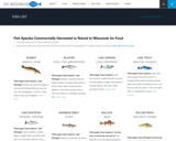
Fish Species Commercially Harvested or Raised in Wisconsin for Food
Common names for fish can be different by region.

Subject:
Agriculture, Food and Natural Resources
Art and Design
Business and Information Technology
Career and Technical Education
Early Learning
Ecology
Education
Elementary Education
Environmental Literacy and Sustainability
Family and Consumer Sciences
Fine Arts
Forestry and Agriculture
Health Science
Life Science
Marketing, Management and Entrepreneurship
Zoology
Material Type:
Data Set
Diagram/Illustration
Reference Material
Author:
NOAA
University of Wisconsin - Madison
Sea Grant of Wisconsin
Date Added:
04/21/2024
Laurentide Ice Sheet: Ice-Margin Positions in Wisconsin (2nd edition)
Unrestricted Use
CC BY
Rating
0.0 stars

Series of 43 page-size maps showing the chronology of the last glaciation's advances and retreats across Wisconsin. Includes a brief discussion about how the maps were made, how lake positions were determined, as well as a list of selected references.

Subject:
Earth and Space Science
Environmental Science
Forestry and Agriculture
Geology
Hydrology
Life Science
Material Type:
Data Set
Diagram/Illustration
Author:
D.M.; Attig
J.W.;
Mickelson
Date Added:
02/20/2024
Meteorites and Craters in Wisconsin
Conditional Remix & Share Permitted
CC BY-NC
Rating
0.0 stars

Wisconsin's Meteorites dataset collection of all of the known locations of meteorites, plus known craters formed from larger meteorites, including the Rock Elm Disturbance found in West Central Wisconsin.

Subject:
Astronomy
Earth and Space Science
Geology
Material Type:
Case Study
Data Set
Diagram/Illustration
Reading
Reference Material
Author:
Wisconsin Geological and Natural History Survey
Date Added:
03/25/2024
The Monitoring Process Lesson Module
Conditional Remix & Share Permitted
CC BY-NC-SA
Rating
0.0 stars

This lesson module demonstrate techniques for monitoring projects and taking corrective actions. This lesson module contains a student narrative, discussion guide, individual and group activities, and a posttest with descriptive key.

Subject:
Business and Information Technology
Career and Technical Education
Marketing, Management and Entrepreneurship
Material Type:
Lesson Plan
Author:
MBA Research and Curriculum Center
Date Added:
08/04/2020
The Nature of Monitoring Lesson Module
Conditional Remix & Share Permitted
CC BY-NC-SA
Rating
0.0 stars

This lesson module guides students through the nature of monitoring projects and taking corrective actions. This lesson module contains a student narrative, discussion guide, individual and group activities, and a posttest with descriptive key. 

Subject:
Business and Information Technology
Career and Technical Education
Marketing, Management and Entrepreneurship
Material Type:
Lesson Plan
Author:
MBA Research and Curriculum Center
Date Added:
08/04/2020
PFAS Interactive Data Viewer - Wisconsin Department of Natural Resources
Only Sharing Permitted
CC BY-NC-ND
Rating
0.0 stars

The PFAS Interactive Data Viewer is a mapping tool that incorporates datasets from several DNR programs to show locations throughout Wisconsin that have been impacted by PFAS.

Information included in the PFAS Interactive Data Viewer include locations with known PFAS contamination and whether clean up has been completed; results from testing municipal drinking water for PFAS; locations with PFAS-related fish and game consumption advisories; and waterbodies throughout Wisconsin sampled for PFAS during targeted or routine monitoring.

These data may not reflect current PFAS levels at specific locations.

Subject:
Agriculture, Food and Natural Resources
Anatomy/Physiology
Biology
Career and Technical Education
Chemistry
Civics and Government
Earth and Space Science
Ecology
Environmental Science
Family and Consumer Sciences
Forestry and Agriculture
Geology
Health Science
Hydrology
Life Science
Marketing, Management and Entrepreneurship
Physical Science
Social Studies
Technology and Engineering
Material Type:
Data Set
Diagram/Illustration
Interactive
Author:
Wisconsin Department of Natural Resources
Date Added:
03/12/2024
Principles of Oceanographic Instrument Systems -- Sensors and Measurements (13.998), Spring 2004
Conditional Remix & Share Permitted
CC BY-NC-SA
Rating
0.0 stars

This course introduces theoretical and practical principles of design of oceanographic sensor systems. Topics include: transducer characteristics for acoustic, current, temperature, pressure, electric, magnetic, gravity, salinity, velocity, heat flow, and optical devices; limitations on these devices imposed by ocean environments; signal conditioning and recording; noise, sensitivity, and sampling limitations; and standards. Lectures by experts cover the principles of state-of-the-art systems being used in physical oceanography, geophysics, submersibles, acoustics. For lab work, day cruises in local waters allow students to prepare, deploy and analyze observations from standard oceanographic instruments.

Subject:
Earth and Space Science
Oceanography
Material Type:
Full Course
Provider:
M.I.T.
Provider Set:
M.I.T. OpenCourseWare
Author:
Williams, Albert (Sandy), 3rd
Date Added:
01/01/2004
Protecting Wisconsin's Biodiversity
Conditional Remix & Share Permitted
CC BY-NC
Rating
0.0 stars

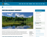
Biodiversity is a shortened form of the term "biological diversity." The entire spectrum of life forms and the many ecological processes support them. Wisconsin is blessed with abundant biodiversity. Located at the junction of the eastern deciduous forest, northern boreal forest and temperate grasslands, we have a wealth of species and natural communities.

Approximately 1,800 species of native plants and close to 700 species of native vertebrates have been identified in Wisconsin. In addition, there are thousands of species of non-vascular plants and invertebrates. These pages highlight the uncommon and rare species, natural communities, geological features and essential habitat areas throughout Wisconsin.

Subject:
Agriculture, Food and Natural Resources
Biology
Botany
Career and Technical Education
Early Learning
Ecology
Education
Elementary Education
Environmental Science
Forestry and Agriculture
Health Science
Life Science
Zoology
Material Type:
Activity/Lab
Data Set
Interactive
Author:
Wisconsin Department of Natural Resources
Date Added:
04/21/2024
Snapshot Wisconsin Data Dashboard
Conditional Remix & Share Permitted
CC BY-NC
Rating
0.0 stars

Snapshot Wisconsin is a partnership to monitor wildlife year-round, using a statewide network of trail cameras. Snapshot Wisconsin provides data needed for decision making at the Wisconsin Department of Natural Resources. It is also a unique opportunity for individuals, families, and students to get involved in monitoring the state’s valuable natural resources. This tool is designed to help visualize many aspects of Snapshot Wisconsin data.

Subject:
Agriculture, Food and Natural Resources
Art and Design
Biology
Career and Technical Education
Ecology
Environmental Science
Fine Arts
Forestry and Agriculture
Genetics
Life Science
Marketing, Management and Entrepreneurship
Zoology
Material Type:
Data Set
Interactive
Other
Reference Material
Author:
SnapShot Wisconsin
Wildlife Restoration
Wisconsin Department of Natural Resources
Date Added:
04/21/2024
Water Clarity Monitoring - Extension Lakes
Unrestricted Use
Public Domain
Rating
0.0 stars

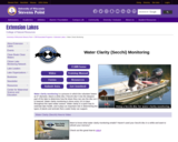
Water clarity monitoring is a process in which the volunteer lowers an 8” diameter, black & white disc (“Secchi disc”) into the deepest part of the lake to determine how far down they can see the disc as it is lowered. Water clarity monitoring is done every 10-14 days throughout the open-water season. Water clarity is a quick way to estimate lake health, and it plays an important role in determining the types of plants and animals that a water body can support.

Can also add in collected data for Water Chemistry analysis along with Secchi disc collected data.

This site includes data collection forms for individuals or groups to add their data from their own lake to this dataset.

Subject:
Agriculture, Food and Natural Resources
Biology
Career and Technical Education
Ecology
Environmental Science
Life Science
Material Type:
Activity/Lab
Homework/Assignment
Lesson
Author:
Paul Skawinski
college of Natural Resources
University of Wisconsin Stevens Point
Date Added:
04/24/2024
Water Resources of the United States—National Water Information System (NWIS) Mapper - USGS
Only Sharing Permitted
CC BY-NC-ND
Rating
0.0 stars

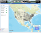
The National Water Information System (NWIS) Mapper provides access to over 1.5 million sites contained in the USGS National Water Information System (NWIS), including sites where current and historical surface-water, groundwater, springs, and atmospheric data has been collected. Users can search by site type, data type, site number, or place.

Subject:
Agriculture, Food and Natural Resources
Atmospheric Science
Business and Information Technology
Career and Technical Education
Earth and Space Science
Ecology
Education
Elementary Education
English Language Arts
Environmental Literacy and Sustainability
Environmental Science
Forestry and Agriculture
Geography
Geology
Health Education
Health Science
Higher Education
Hydrology
Life Science
Literature
Marketing, Management and Entrepreneurship
Oceanography
Social Studies
Technology and Engineering
Material Type:
Activity/Lab
Homework/Assignment
Author:
USGS (US Geological Survey)
Date Added:
03/12/2024
Wear’s the Technology?
Read the Fine Print
Educational Use
Rating
0.0 stars

Students apply their knowledge of scale and geometry to design wearables that would help people in their daily lives, perhaps for medical reasons or convenience. Like engineers, student teams follow the steps of the design process, to research the wearable technology field (watching online videos and conducting online research), brainstorm a need that supports some aspect of human life, imagine their own unique designs, and then sketch prototypes (using Paint®). They compare the drawn prototype size to its intended real-life, manufactured size, determining estimated length and width dimensions, determining the scale factor, and the resulting difference in areas. After considering real-world safety concerns relevant to wearables (news article) and getting preliminary user feedback (peer critique), they adjust their drawn designs for improvement. To conclude, they recap their work in short class presentations.

Subject:
Career and Technical Education
Mathematics
Measurement and Data
Numbers and Operations
Material Type:
Activity/Lab
Provider:
TeachEngineering
Author:
Denise W. Carlson
Evelynne Pyne
Lauchlin Blue
Robotics Engineering for Better Life and Sustainable Future RET, College of Engineering, Michigan State University
Date Added:
10/13/2017
Wisconsin Historic Climate Data
Unrestricted Use
Public Domain
Rating
0.0 stars

Wisconsin’s climate is typically continental with some modification by Lakes Michigan and Superior. The cold, snowy winters favor a variety of winter sports, and the warm summers appeal to thousands of vacationers each year. About two-thirds of the annual precipitation falls during the growing season (freeze-free period). It is normally adequate for vegetation, although drought is occasionally reported. This climate is most favorable for dairy farming; the primary crops are corn, small grains, hay, and vegetables. The rapid succession of storms moving from west to east or southwest to northeast account for the stimulating climate.

Select from Climate by Location, Division, Normals, Statewide Extremes, Longterm Annual Variability, and Daily Climate data.

Subject:
Agriculture, Food and Natural Resources
Atmospheric Science
Biology
Botany
Career and Technical Education
Earth and Space Science
Ecology
Education
Elementary Education
Environmental Science
Family and Consumer Sciences
Forestry and Agriculture
Health Science
Higher Education
Hydrology
Life Science
Marketing, Management and Entrepreneurship
Material Type:
Activity/Lab
Diagram/Illustration
Homework/Assignment
Interactive
Author:
Wisconsin State Climatology Office and Nelson Institute for Environmental Studies
Date Added:
04/28/2024
Wisconsin Lakes Data - Lake Water Quality Data - Lake Maps - Plants and Aquatic Insects
Unrestricted Use
Public Domain
Rating
0.0 stars

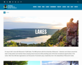
Wisconsin's 15,000 lakes. The DNR partners with the University of Wisconsin - Extension and citizens around the state to help protect and maintain these amazing natural resources while providing some of the best recreational opportunities in the nation. More than 600 lake organizations and thousands of volunteers play a leadership role in the stewardship of Wisconsin's lakes.

Find a Lake, Lake Water Quality Data, Lake Maps, Plants and Aquatic invasive Insects - are all linked to this site.

Subject:
Agriculture, Food and Natural Resources
Art and Design
Biology
Botany
Career and Technical Education
Ecology
Environmental Literacy and Sustainability
Environmental Science
Fine Arts
Forestry and Agriculture
Life Science
Zoology
Material Type:
Activity/Lab
Data Set
Diagram/Illustration
Interactive
Author:
Wisconsin Department of Natural Resources
Date Added:
04/23/2024
Wisconsin Lakes - Water Quality Data for each lake by County
Unrestricted Use
Public Domain
Rating
0.0 stars

Volunteers, DNR staff, county staff and others collect water clarity, temperature and dissolved oxygen, as well as other water quality data, on lakes across Wisconsin. Around 1,000 volunteers are currently active, and the network has been going strong since 1986. Water clarity is measured with a black and white disk called a "Secchi Disk".

Satellite images are used to retrieve water clarity data for lakes across the state. This effort began in 1999 when the University of Wisconsin-Madison Environmental Remote Sensing Center (ERSC) developed a model for the retrieval of water clarity data from satellite images and Citizen Lake Monitoring Network volunteers provided on-the-ground Secchi data to calibrate this model for each satellite image. Water clarity data was retrieved for over 8,000 lakes statewide between 1999 and 2001. The DNR continues to analyze data in this way today in its remote sensing program.

Subject:
Agriculture, Food and Natural Resources
Biology
Career and Technical Education
Ecology
Environmental Science
Forestry and Agriculture
Life Science
Marketing, Management and Entrepreneurship
Material Type:
Data Set
Diagram/Illustration
Other
Author:
Wisconsin Department of Natural Resources
Date Added:
04/24/2024
Wisconsin Surface Water Data Viewer
Conditional Remix & Share Permitted
CC BY-NC
Rating
0.0 stars

The Surface Water Data Viewer is a mapping tool for the State of Wisconsin. It provides interactive web mapping tools for a variety of datasets, including chemistry, physical, and biological data. The data managed in layers that can be turned on and off as needed. The Homepage of the Surface Water Data Viewer (SWDV) has many commonly used features labeled. Descriptions of the features are as follows:

Toolbars: There are a variety of toolbars with different themes to help complete tasks using the SWDV. The toolbars can be used to display the layers available to the map, add or remove shapes, text, or measurement features, identify points, print maps, and more!

Search Bar: Using the search bar, you can search monitoring stations by number, locations by keyword, and waterbodies by WBIC. Be careful when using the search bar, partial matches do not always appear in the results.

Navigation Pane: The navigation pane is where results will appear from searches, where you are able to select layers for the map, and features for printing. You will be able to refine the data that is shown here, if desired. You can hide the navigation pane by clicking the left-facing arrow at the top.

Coordinates and Coordinate System: The coordinates will display for any point moused-over on the map. Click the black triangle to select your preferred method for displaying lat/long (DD, DMS, DDM, Mercator). The right-most option in this pane allows you to manually manage thescale of the map. Click on the scale tool, and selected the desired scale at which you wish to view the map. Select Go to implement changes.

Scale Bar: The scale bar shows the current extent of the map.

Whole State View: This view describes what is being shown on the main map relative to the entire state. A blue rectangle will cover the region of the state being shown on the map. You can also navigate the map by moving the blue square around the state-view map. If you print a map, this whole state view will print in the corner as a reference. You can minimize this view by clicking the corner-facing arrow in the top left edge of the box.

Show/Hide Toolbar: Use this button to hide the toolbar for a larger view of the map. If you have hidden the toolbar, you can also use this button to show it again.

Subject:
Agriculture, Food and Natural Resources
American Indian Studies
Biology
Botany
Career and Technical Education
Earth and Space Science
Ecology
Education
Elementary Education
Environmental Science
Forestry and Agriculture
Geography
Geology
Higher Education
Hydrology
Life Science
Social Studies
Material Type:
Activity/Lab
Homework/Assignment
Learning Task
Lecture
Lesson
Author:
Wisconsin Department of Natural Resources
Date Added:
03/12/2024
Wisconsin Water Condition Viewer - Wisconsin DNR
Only Sharing Permitted
CC BY-NC-ND
Rating
0.0 stars

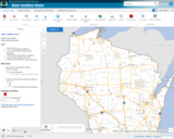
The Water Condition Viewer (WCV) is an interactive mapping tool that focuses on water condition, monitoring, assessment and management data. Data includes Clean Water Act, Monitoring Projects, Healthy Watersheds Assessments, Targeted Watershed Assessments, Wastewater Evaluation, Watershed Planning, County Land and Water Plans, Nine Key Element Plans and more. All datasets from specialized themes are available from this main, general set of layers.

Subject:
Agriculture, Food and Natural Resources
Biology
Botany
Career and Technical Education
Earth and Space Science
Ecology
Education
Elementary Education
Environmental Literacy and Sustainability
Environmental Science
Family and Consumer Sciences
Forestry and Agriculture
Geology
Health Education
Health Science
Hydrology
Life Science
Marketing, Management and Entrepreneurship
Material Type:
Activity/Lab
Homework/Assignment
Lecture
Lesson
Author:
Wisconsin Department of Natural Resources
Date Added:
03/12/2024