Updating search results...

Search Resources

66 Results

View
Selected filters:
  • ecosystem
Population Density: How Much Space Do You Have?
Read the Fine Print
Educational Use
Rating
0.0 stars

Students learn about population density within environments and ecosystems. They determine the density of a population and think about why population density and distribution information is useful to engineers for city planning and design as well as for resource allocation.

Subject:
Art and Design
Career and Technical Education
Fine Arts
Technology and Engineering
Material Type:
Activity/Lab
Provider:
TeachEngineering
Provider Set:
TeachEngineering NGSS Aligned Resources
Author:
Christopher Valenti
Denise Carlson
Integrated Teaching and Learning Program,
Malinda Schaefer Zarske
Date Added:
10/14/2015
Protecting Wisconsin's Biodiversity
Conditional Remix & Share Permitted
CC BY-NC
Rating
0.0 stars

Biodiversity is a shortened form of the term "biological diversity." The entire spectrum of life forms and the many ecological processes support them. Wisconsin is blessed with abundant biodiversity. Located at the junction of the eastern deciduous forest, northern boreal forest and temperate grasslands, we have a wealth of species and natural communities.

Approximately 1,800 species of native plants and close to 700 species of native vertebrates have been identified in Wisconsin. In addition, there are thousands of species of non-vascular plants and invertebrates. These pages highlight the uncommon and rare species, natural communities, geological features and essential habitat areas throughout Wisconsin.

Subject:
Agriculture, Food and Natural Resources
Biology
Botany
Career and Technical Education
Early Learning
Ecology
Education
Elementary Education
Environmental Science
Forestry and Agriculture
Health Science
Life Science
Zoology
Material Type:
Activity/Lab
Data Set
Interactive
Author:
Wisconsin Department of Natural Resources
Date Added:
04/21/2024
Schoolyard Stewards
Only Sharing Permitted
CC BY-NC-ND
Rating
0.0 stars

A key component of wildlife management is understanding the impact that humans have on their surrounding environment. In this activity students will begin to explore the human impacts that their school yard is experiencing from air, soil, and water pollution.

Subject:
Agriculture, Food and Natural Resources
Career and Technical Education
Ecology
Environmental Science
Life Science
Zoology
Material Type:
Lesson
Lesson Plan
Date Added:
05/08/2019
Snapshot Wisconsin Data Dashboard
Conditional Remix & Share Permitted
CC BY-NC
Rating
0.0 stars

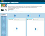
Snapshot Wisconsin is a partnership to monitor wildlife year-round, using a statewide network of trail cameras. Snapshot Wisconsin provides data needed for decision making at the Wisconsin Department of Natural Resources. It is also a unique opportunity for individuals, families, and students to get involved in monitoring the state’s valuable natural resources. This tool is designed to help visualize many aspects of Snapshot Wisconsin data.

Subject:
Agriculture, Food and Natural Resources
Art and Design
Biology
Career and Technical Education
Ecology
Environmental Science
Fine Arts
Forestry and Agriculture
Genetics
Life Science
Marketing, Management and Entrepreneurship
Zoology
Material Type:
Data Set
Interactive
Other
Reference Material
Author:
SnapShot Wisconsin
Wildlife Restoration
Wisconsin Department of Natural Resources
Date Added:
04/21/2024
Sound for Sight
Read the Fine Print
Educational Use
Rating
0.0 stars

Echolocation is the ability to orient by transmitting sound and receiving echoes from objects in the environment. As a result of a Marco-Polo type activity and subsequent lesson, students learn basic concepts of echolocation. They use these concepts to understand how dolphins use echolocation to locate prey, escape predators, navigate their environment, such as avoiding gillnets set by commercial fishing vessels. Students will also learn that dolphin sounds are vibrations created by vocal organs, and that sound is a type of wave or signal that carries energy and information especially in the dolphin's case. Students will learn that a dolphin's sense of hearing is highly enhanced and better than that of human hearing. Students will also be introduced to the concept of by-catch Students will learn what happens to animals caught through by-catch and why.

Subject:
Biology
Career and Technical Education
Life Science
Technology and Engineering
Material Type:
Activity/Lab
Lesson Plan
Provider:
TeachEngineering
Provider Set:
TeachEngineering NGSS Aligned Resources
Author:
Engineering K-PhD Program,
Tom Rose, Billyde Brown, Neera Desai, Kim Goetze, Mina Innes, Angela Jiang, Matt Nusnbaum Aruna Venkatesan, Vicki Thayer, Amy Whitt , Pratt School of Engineering and Duke Marine Laboratory
Date Added:
09/18/2014
WGNHS – Wisconsin Geological and Natural History Survey – UW–Madison
Only Sharing Permitted
CC BY-NC-ND
Rating
0.0 stars

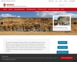
The Wisconsin Geological and Natural History Survey (WGNHS) has been serving Wisconsin for over 125 years. Part of the Division of Extension at the University of Wisconsin–Madison, WGNHS provides objective scientific information about the geology, mineral resources, and water resources of Wisconsin. We conduct research, map Wisconsin’s geology, and share information through our publications and outreach.

WGNHS has been producing geologic maps, scientific reports, and more for over 125 years. Our publications catalog offers thousands of maps, reports, datasets, and other publications—all of which are available to view and download for free.

The Wisconsin Geological and Natural History Survey (WGNHS) was created by the Wisconsin Legislature in 1897. It is the descendant of earlier state surveys in Wisconsin, which date back to 1854.

WGNHS, part of the Division of Extension at the University of Wisconsin–Madison, is an interdisciplinary organization that conducts natural resources surveys and research to produce information used for decision-making, problem-solving, planning, management, development, and education. Survey is defined to include resource inventory as well as basic and applied research and analysis. WGNHS has no specific regulatory or enforcement responsibilities.

Mission of WGNHS:
Understanding the earth • Charting its history • Sustaining its resources
The Survey conducts earth-science surveys, field studies, and research.

We provide objective scientific information about the geology, water resources, and mineral resources of Wisconsin.

We collect, interpret, disseminate, and archive natural resource information.

We communicate the results of our activities through publications, technical talks, our website, social media, and responses to inquiries from the public.

These activities support informed decision making by government, industry, business, and individual residents of Wisconsin.

Subject:
Agriculture, Food and Natural Resources
Archaeology
Biology
Botany
Career and Technical Education
Civics and Government
Earth and Space Science
Ecology
Education
Environmental Science
Forestry and Agriculture
Geography
Geology
Higher Education
Hydrology
Life Science
Social Studies
Material Type:
Activity/Lab
Diagram/Illustration
Homework/Assignment
Other
Date Added:
03/04/2024
Water Clarity Monitoring - Extension Lakes
Unrestricted Use
Public Domain
Rating
0.0 stars

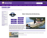
Water clarity monitoring is a process in which the volunteer lowers an 8” diameter, black & white disc (“Secchi disc”) into the deepest part of the lake to determine how far down they can see the disc as it is lowered. Water clarity monitoring is done every 10-14 days throughout the open-water season. Water clarity is a quick way to estimate lake health, and it plays an important role in determining the types of plants and animals that a water body can support.

Can also add in collected data for Water Chemistry analysis along with Secchi disc collected data.

This site includes data collection forms for individuals or groups to add their data from their own lake to this dataset.

Subject:
Agriculture, Food and Natural Resources
Biology
Career and Technical Education
Ecology
Environmental Science
Life Science
Material Type:
Activity/Lab
Homework/Assignment
Lesson
Author:
Paul Skawinski
college of Natural Resources
University of Wisconsin Stevens Point
Date Added:
04/24/2024
Water Resources of the United States—National Water Information System (NWIS) Mapper - USGS
Only Sharing Permitted
CC BY-NC-ND
Rating
0.0 stars

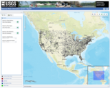
The National Water Information System (NWIS) Mapper provides access to over 1.5 million sites contained in the USGS National Water Information System (NWIS), including sites where current and historical surface-water, groundwater, springs, and atmospheric data has been collected. Users can search by site type, data type, site number, or place.

Subject:
Agriculture, Food and Natural Resources
Atmospheric Science
Business and Information Technology
Career and Technical Education
Earth and Space Science
Ecology
Education
Elementary Education
English Language Arts
Environmental Literacy and Sustainability
Environmental Science
Forestry and Agriculture
Geography
Geology
Health Education
Health Science
Higher Education
Hydrology
Life Science
Literature
Marketing, Management and Entrepreneurship
Oceanography
Social Studies
Technology and Engineering
Material Type:
Activity/Lab
Homework/Assignment
Author:
USGS (US Geological Survey)
Date Added:
03/12/2024
What Makes a Forest?
Rating
0.0 stars

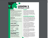
NUTSHELL: In the optional Field Enhancement portion of the lesson, the class explores the living and nonliving parts of a forest while on a hike. Students spend individual quiet time observing and drawing parts of a forest. In main portion of the lesson, students match plant species with forest ecosystems and learn that living things are influenced by the nonliving things around them. They create a song or skit to show what they have learned about living and nonliving connections. The students conclude the lesson by creating a mural of different types of Wisconsin forests.
BIG IDEAS
Forests are ecosystems characterized by a dominance of tree cover and they contain a variety of other organisms (e.g., other plants, animals).Forests differ in composition (species within a forest) and structure (layers in a forest). These are both affected by biotic (e.g., animals, plants, humans) and abiotic (e.g., soil moisture, sunlight, climate) factors. 
OBJECTIVES Upon completion of this lesson, students will be able to:
Explain how living things in a forest depend on nonliving things.Recognize that all forests do not contain the same plants and animals.
SUBJECT AREAS: Arts, Language Arts, Science
LESSON/ACTIVITY TIME
Total Lesson Time: 190 minutes (including optional Field Enhancement)Time Breakdown: Field Enhancement (optional)--50 minutes; Introduction--15 minutes; Activity 1--35 minutes; Activity 2--45 minutes; Conclusion--45 minutes
TEACHING SITE Classroom; well-forested site for optional Field Enhancement

Subject:
Biology
Environmental Science
Life Science
Material Type:
Lesson
Lesson Plan
Provider:
LEAF, Wisconsin Department of Natural Resources-Division of Forestry, and the Wisconsin Center for Environmental Education
Date Added:
01/01/2004
Why Do We Build Dams?
Read the Fine Print
Educational Use
Rating
0.0 stars

Students are introduced to the concept of a dam and its potential benefits, which include water supply, electricity generation, flood control, recreation and irrigation. This lesson begins an ongoing classroom scenario in which student engineering teams working for the Splash Engineering firm design dams for a fictitious client, Thirsty County.

Subject:
Career and Technical Education
Earth and Space Science
Hydrology
Technology and Engineering
Material Type:
Lesson Plan
Provider:
TeachEngineering
Provider Set:
TeachEngineering NGSS Aligned Resources
Author:
Denali Lander
Denise W. Carlson
Integrated Teaching and Learning Program,
Kristin Field
Lauren Cooper
Michael Bendewald
Sara Born
Timothy M. Dittrich
Date Added:
09/18/2014
Wisconsin Historic Climate Data
Unrestricted Use
Public Domain
Rating
0.0 stars

Wisconsin’s climate is typically continental with some modification by Lakes Michigan and Superior. The cold, snowy winters favor a variety of winter sports, and the warm summers appeal to thousands of vacationers each year. About two-thirds of the annual precipitation falls during the growing season (freeze-free period). It is normally adequate for vegetation, although drought is occasionally reported. This climate is most favorable for dairy farming; the primary crops are corn, small grains, hay, and vegetables. The rapid succession of storms moving from west to east or southwest to northeast account for the stimulating climate.

Select from Climate by Location, Division, Normals, Statewide Extremes, Longterm Annual Variability, and Daily Climate data.

Subject:
Agriculture, Food and Natural Resources
Atmospheric Science
Biology
Botany
Career and Technical Education
Earth and Space Science
Ecology
Education
Elementary Education
Environmental Science
Family and Consumer Sciences
Forestry and Agriculture
Health Science
Higher Education
Hydrology
Life Science
Marketing, Management and Entrepreneurship
Material Type:
Activity/Lab
Diagram/Illustration
Homework/Assignment
Interactive
Author:
Wisconsin State Climatology Office and Nelson Institute for Environmental Studies
Date Added:
04/28/2024
Wisconsin Lakes Data - Lake Water Quality Data - Lake Maps - Plants and Aquatic Insects
Unrestricted Use
Public Domain
Rating
0.0 stars

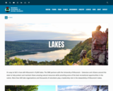
Wisconsin's 15,000 lakes. The DNR partners with the University of Wisconsin - Extension and citizens around the state to help protect and maintain these amazing natural resources while providing some of the best recreational opportunities in the nation. More than 600 lake organizations and thousands of volunteers play a leadership role in the stewardship of Wisconsin's lakes.

Find a Lake, Lake Water Quality Data, Lake Maps, Plants and Aquatic invasive Insects - are all linked to this site.

Subject:
Agriculture, Food and Natural Resources
Art and Design
Biology
Botany
Career and Technical Education
Ecology
Environmental Literacy and Sustainability
Environmental Science
Fine Arts
Forestry and Agriculture
Life Science
Zoology
Material Type:
Activity/Lab
Data Set
Diagram/Illustration
Interactive
Author:
Wisconsin Department of Natural Resources
Date Added:
04/23/2024
Wisconsin Lakes - Water Quality Data for each lake by County
Unrestricted Use
Public Domain
Rating
0.0 stars

Volunteers, DNR staff, county staff and others collect water clarity, temperature and dissolved oxygen, as well as other water quality data, on lakes across Wisconsin. Around 1,000 volunteers are currently active, and the network has been going strong since 1986. Water clarity is measured with a black and white disk called a "Secchi Disk".

Satellite images are used to retrieve water clarity data for lakes across the state. This effort began in 1999 when the University of Wisconsin-Madison Environmental Remote Sensing Center (ERSC) developed a model for the retrieval of water clarity data from satellite images and Citizen Lake Monitoring Network volunteers provided on-the-ground Secchi data to calibrate this model for each satellite image. Water clarity data was retrieved for over 8,000 lakes statewide between 1999 and 2001. The DNR continues to analyze data in this way today in its remote sensing program.

Subject:
Agriculture, Food and Natural Resources
Biology
Career and Technical Education
Ecology
Environmental Science
Forestry and Agriculture
Life Science
Marketing, Management and Entrepreneurship
Material Type:
Data Set
Diagram/Illustration
Other
Author:
Wisconsin Department of Natural Resources
Date Added:
04/24/2024
Wisconsin Rocks and Minerals - Interactive Storymap
Only Sharing Permitted
CC BY-NC-ND
Rating
0.0 stars

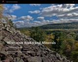
The Badger State is home to a wide variety of rocks and minerals, some of which you may find familiar and others you may not recognize. In this interactive guide, the Wisconsin Geological and Natural History Survey takes you on a journey through the state, exploring our most important rocks and minerals.

Subject:
Earth and Space Science
Ecology
Education
Elementary Education
Environmental Science
Forestry and Agriculture
Geology
Higher Education
Hydrology
Life Science
Material Type:
Activity/Lab
Homework/Assignment
Lesson
Author:
Wisconsin Geological and Natural History Survey
Date Added:
03/04/2024
Wisconsin State Parks
Unrestricted Use
Public Domain
Rating
0.0 stars

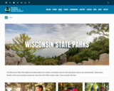
The Wisconsin State Park System provides places for outdoor recreation and for learning about nature and conservation. State parks, forests, trails and recreation areas see more than 20 million visits a year. Come and join the fun!

This site has links to all of the State Parks, Forests, Trails and recreation areas in Wisconsin.

Subject:
Agriculture, Food and Natural Resources
Art and Design
Astronomy
Atmospheric Science
Biology
Botany
Career and Technical Education
Earth and Space Science
Ecology
Education
Elementary Education
Environmental Literacy and Sustainability
Environmental Science
Fine Arts
Forestry and Agriculture
Geography
Geology
Higher Education
Life Science
Marketing, Management and Entrepreneurship
Social Studies
Material Type:
Other
Reference Material
Author:
Wisconsin Department of Natural Resources
Date Added:
04/24/2024
Wisconsin Surface Water Data Viewer
Conditional Remix & Share Permitted
CC BY-NC
Rating
0.0 stars

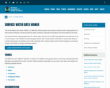
The Surface Water Data Viewer is a mapping tool for the State of Wisconsin. It provides interactive web mapping tools for a variety of datasets, including chemistry, physical, and biological data. The data managed in layers that can be turned on and off as needed. The Homepage of the Surface Water Data Viewer (SWDV) has many commonly used features labeled. Descriptions of the features are as follows:

Toolbars: There are a variety of toolbars with different themes to help complete tasks using the SWDV. The toolbars can be used to display the layers available to the map, add or remove shapes, text, or measurement features, identify points, print maps, and more!

Search Bar: Using the search bar, you can search monitoring stations by number, locations by keyword, and waterbodies by WBIC. Be careful when using the search bar, partial matches do not always appear in the results.

Navigation Pane: The navigation pane is where results will appear from searches, where you are able to select layers for the map, and features for printing. You will be able to refine the data that is shown here, if desired. You can hide the navigation pane by clicking the left-facing arrow at the top.

Coordinates and Coordinate System: The coordinates will display for any point moused-over on the map. Click the black triangle to select your preferred method for displaying lat/long (DD, DMS, DDM, Mercator). The right-most option in this pane allows you to manually manage thescale of the map. Click on the scale tool, and selected the desired scale at which you wish to view the map. Select Go to implement changes.

Scale Bar: The scale bar shows the current extent of the map.

Whole State View: This view describes what is being shown on the main map relative to the entire state. A blue rectangle will cover the region of the state being shown on the map. You can also navigate the map by moving the blue square around the state-view map. If you print a map, this whole state view will print in the corner as a reference. You can minimize this view by clicking the corner-facing arrow in the top left edge of the box.

Show/Hide Toolbar: Use this button to hide the toolbar for a larger view of the map. If you have hidden the toolbar, you can also use this button to show it again.

Subject:
Agriculture, Food and Natural Resources
American Indian Studies
Biology
Botany
Career and Technical Education
Earth and Space Science
Ecology
Education
Elementary Education
Environmental Science
Forestry and Agriculture
Geography
Geology
Higher Education
Hydrology
Life Science
Social Studies
Material Type:
Activity/Lab
Homework/Assignment
Learning Task
Lecture
Lesson
Author:
Wisconsin Department of Natural Resources
Date Added:
03/12/2024
Wisconsin Water Condition Viewer - Wisconsin DNR
Only Sharing Permitted
CC BY-NC-ND
Rating
0.0 stars

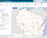
The Water Condition Viewer (WCV) is an interactive mapping tool that focuses on water condition, monitoring, assessment and management data. Data includes Clean Water Act, Monitoring Projects, Healthy Watersheds Assessments, Targeted Watershed Assessments, Wastewater Evaluation, Watershed Planning, County Land and Water Plans, Nine Key Element Plans and more. All datasets from specialized themes are available from this main, general set of layers.

Subject:
Agriculture, Food and Natural Resources
Biology
Botany
Career and Technical Education
Earth and Space Science
Ecology
Education
Elementary Education
Environmental Literacy and Sustainability
Environmental Science
Family and Consumer Sciences
Forestry and Agriculture
Geology
Health Education
Health Science
Hydrology
Life Science
Marketing, Management and Entrepreneurship
Material Type:
Activity/Lab
Homework/Assignment
Lecture
Lesson
Author:
Wisconsin Department of Natural Resources
Date Added:
03/12/2024
Wisconsin Weather and Soil Monitoring Station Interactive map Mesonet - Wisconsin State Climatology Office
Unrestricted Use
Public Domain
Rating
0.0 stars

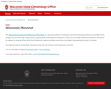
The Wisconsin Environmental Mesonet (WiscoNet) is a growing network of weather and soil monitoring stations across Wisconsin, designed to provide high quality data at high spatial and temporal resolutions. There are currently 14 Wisconet stations with plans to expand to around 90 by 2026. Each Wisconet station provides more than one dozen measurements every 5 minutes.

The stations measure temperature, dew point, wind, rain, soil moisture and temperature, and more.

You can view data through an interactive map or a list of stations.

Subject:
Agriculture, Food and Natural Resources
Career and Technical Education
Material Type:
Activity/Lab
Diagram/Illustration
Homework/Assignment
Interactive
Author:
Wisconsin State Climatology Office and Nelson Institute for Environmental Studies
Date Added:
04/28/2024
Wisconsin Wetland Inventory - Wetlands Data
Conditional Remix & Share Permitted
CC BY-NC
Rating
0.0 stars

The Wisconsin Wetland Inventory (WWI) regulatory maps show graphic representations of the type, size and location of wetlands in Wisconsin. These maps have been prepared from the analysis of high altitude imagery in conjunction with soil surveys, topographic maps, previous wetland inventories and field work. The Wisconsin Department of Natural Resources (DNR) manages the WWI.

The U.S. Fish and Wildlife Service (USFWS) began producing non-regulatory, polygonal, geospatial wetland maps for the United States via their National Wetlands Inventory (NWI) in the mid-1970s. While DNR does provide WWI data to USFWS, there can be a significant lag before those updates appear in the NWI.

STATEWIDE: Digital wetlands data are available from the Wisconsin DNR for the state. Alternatively, wetlands are available for free viewing as a layer in the DNR Surface Water Data Viewer.

Wisconsin Wetland Inventory Geodatabase – free download
App: Wisconsin DNR Surface Water Data Viewer

NATIONAL: The NWI is slightly more detailed than WWI since NWI also maps deep water systems including lakes, streams and rivers. The Wisconsin DNR provides their WWI data to the U.S. Fish and Wildlife service for integration into the NWI, but users should be cautioned that Wisconsin updates to NWI can reportedly take months, and in some cases years. Users requiring Wisconsin wetlands data are strongly encouraged to start with the Wisconsin Wetland Inventory.

National Wetlands Inventory Data

Subject:
Agriculture, Food and Natural Resources
Biology
Career and Technical Education
Earth and Space Science
Ecology
Environmental Literacy and Sustainability
Environmental Science
Forestry and Agriculture
Geology
Hydrology
Life Science
Material Type:
Data Set
Interactive
Reading
Reference Material
Author:
Wisconsin State Cartographer’s Office (SCO)
Date Added:
03/25/2024
Wisconsin's Champion Trees
Conditional Remix & Share Permitted
CC BY-NC
Rating
0.0 stars

The Champion Tree Program recognizes and celebrates the state’s largest trees. The Wisconsin Department of Natural Resources began documenting these trees in 1941 with the help of the community. People around the state discovered these trees in the Northwoods, in neighbors’ yards and along city streets. The program has endured as a result of people such as yourself. We invite you to join us in honoring and preserving Wisconsin’s natural resources heritage.

Subject:
Agriculture, Food and Natural Resources
Art and Design
Biology
Botany
Career and Technical Education
Early Learning
Ecology
Education
Elementary Education
Environmental Literacy and Sustainability
Environmental Science
Fine Arts
Forestry and Agriculture
Higher Education
Life Science
Media Arts
Material Type:
Data Set
Diagram/Illustration
Other
Reference Material
Author:
Wisconsin Department of Natural Resources
Date Added:
04/21/2024