Updating search results...

Search Resources

558 Results

View
Selected filters:
  • Biology
Wisconsin Water Condition Viewer - Wisconsin DNR
Only Sharing Permitted
CC BY-NC-ND
Rating
0.0 stars

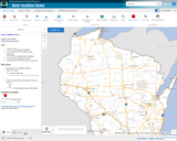
The Water Condition Viewer (WCV) is an interactive mapping tool that focuses on water condition, monitoring, assessment and management data. Data includes Clean Water Act, Monitoring Projects, Healthy Watersheds Assessments, Targeted Watershed Assessments, Wastewater Evaluation, Watershed Planning, County Land and Water Plans, Nine Key Element Plans and more. All datasets from specialized themes are available from this main, general set of layers.

Subject:
Agriculture, Food and Natural Resources
Biology
Botany
Career and Technical Education
Earth and Space Science
Ecology
Education
Elementary Education
Environmental Literacy and Sustainability
Environmental Science
Family and Consumer Sciences
Forestry and Agriculture
Geology
Health Education
Health Science
Hydrology
Life Science
Marketing, Management and Entrepreneurship
Material Type:
Activity/Lab
Homework/Assignment
Lecture
Lesson
Author:
Wisconsin Department of Natural Resources
Date Added:
03/12/2024
Wisconsin Water Quantity Data Viewer - Wisconsin DNR
Only Sharing Permitted
CC BY-NC-ND
Rating
0.0 stars

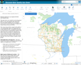
This map viewer was created for use by the general public to view water quantity data collected by Wisconsin DNR (WDNR), the US Geological Survey (UGSG) and the Wisconsin Geological and Natural History Survey (WGNHS).

This viewer also provides a means for the public to view pending high capacity well applications and recently approved wells. As required by Wisconsin law, these locations are generalized to display at the public land survey section level. Therefore, any well or surface water intake is symbolized by the section in which is located. Clicking identify on sections may return multiple records, one for each data point. This viewer contains a number of layer groups:

Well Applications and Approvals – This layer displays the locations of pending and approved high capacity well applications. It includes:
High capacity wells that have been applied for by the owner but have not yet been approved by the Department
High capacity wells approved in the last 30 days
High capacity wells approved by WDNR but that have not yet been constructed

High Capacity Withdrawal Locations – This layer show the location of high capacity wells constructed and available for use as well as currently registered high capacity surface water withdrawals. It includes:

Existing high capacity wells
Existing surface water withdrawals

USGS Water Quantity Monitoring – This layer shows the locations of groundwater level monitoring points, streamflow gages, and lake level gages monitored and recorded by USGS. It includes currently active monitoring locations as well as historical monitoring locations. Symbol sizes are scaled according to the number of measurements taken at each location.

WDNR Water Quantity Monitoring Groundwater Protection Features – This layer shows the locations of streamflow and lake level measurements maintained by WDNR. It includes a variety of measurement types taken by WDNR staff, partner organizations, county staff and volunteers.

WGNHS Spring Monitoring – This layer shows the location of springs surveyed by WGNHS staff between 2015 and 2017. Note that spring flow varies seasonally and annually. In addition, many spring locations are located on private land and not accessible by the public without landowner permission.

Groundwater Protection Features – This layer displays the locations of groundwater protection features as defined by Wisconsin Rule NR820. It includes trout streams, outstanding and exceptional water resources, and springs with a flow rate surveyed by WGNHS of 1 cubic foot per second (CFS) or greater. Note that all 1 CFS may not have been surveyed.

Guidance for how to use WDNR Geocortex viewers can be found here. For more information, please contact the water use section at 608-266-2299 or at DNRWATERUSEREGISTRATION@wisconsin.gov
Subject:
Agriculture, Food and Natural Resources
Biology
Business and Information Technology
Career and Technical Education
Earth and Space Science
Ecology
Education
Elementary Education
Environmental Science
Forestry and Agriculture
Geology
Health Science
Higher Education
Hydrology
Life Science
Marketing, Management and Entrepreneurship
Material Type:
Activity/Lab
Homework/Assignment
Lecture
Lesson
Author:
Wisconsin Department of Natural Resources
Date Added:
03/12/2024
Wisconsin Wetland Inventory Geodatabase
Conditional Remix & Share Permitted
CC BY-NC
Rating
0.0 stars

Wisconsin DNR's Wisconsin Wetland Inventory geodatabase, containing wetland polygons and points.

The principal focus of the wetland inventory is to produce wetland maps that are graphic representations of the type, size and location of wetlands in Wisconsin. Currently, there are two different datasets that have been created using different mapping methods and technologies.

The majority of the state was mapped using traditional stereo-pair, black-and-white, infrared photography. Within this context, the objective was to provide reconnaissance level information on the location, type, size of these habitats such that they are accurate at the nominal scale of the 1:24,000 (1 inch = 2000 feet) base map.

LiDAR Technology:
LiDAR has advanced the ability to see and map wetland and surface water features.

New wetland mapping is underway in areas across the state at a nominal scale of 1:2000 (1 inch = 166.7 feet). The data are being mapped according to the National Wetland Inventory standards using new methods. Please see the WWI SOP for more information.

Subject:
Agriculture, Food and Natural Resources
Biology
Botany
Career and Technical Education
Earth and Space Science
Ecology
Environmental Literacy and Sustainability
Environmental Science
Forestry and Agriculture
Hydrology
Life Science
Marketing, Management and Entrepreneurship
Technology and Engineering
Zoology
Material Type:
Data Set
Diagram/Illustration
Interactive
Other
Reference Material
Author:
Wisconsin Department of Natural Resources
Date Added:
03/25/2024
Wisconsin Wetland Inventory - Wetlands Data
Conditional Remix & Share Permitted
CC BY-NC
Rating
0.0 stars

The Wisconsin Wetland Inventory (WWI) regulatory maps show graphic representations of the type, size and location of wetlands in Wisconsin. These maps have been prepared from the analysis of high altitude imagery in conjunction with soil surveys, topographic maps, previous wetland inventories and field work. The Wisconsin Department of Natural Resources (DNR) manages the WWI.

The U.S. Fish and Wildlife Service (USFWS) began producing non-regulatory, polygonal, geospatial wetland maps for the United States via their National Wetlands Inventory (NWI) in the mid-1970s. While DNR does provide WWI data to USFWS, there can be a significant lag before those updates appear in the NWI.

STATEWIDE: Digital wetlands data are available from the Wisconsin DNR for the state. Alternatively, wetlands are available for free viewing as a layer in the DNR Surface Water Data Viewer.

Wisconsin Wetland Inventory Geodatabase – free download
App: Wisconsin DNR Surface Water Data Viewer

NATIONAL: The NWI is slightly more detailed than WWI since NWI also maps deep water systems including lakes, streams and rivers. The Wisconsin DNR provides their WWI data to the U.S. Fish and Wildlife service for integration into the NWI, but users should be cautioned that Wisconsin updates to NWI can reportedly take months, and in some cases years. Users requiring Wisconsin wetlands data are strongly encouraged to start with the Wisconsin Wetland Inventory.

National Wetlands Inventory Data

Subject:
Agriculture, Food and Natural Resources
Biology
Career and Technical Education
Earth and Space Science
Ecology
Environmental Literacy and Sustainability
Environmental Science
Forestry and Agriculture
Geology
Hydrology
Life Science
Material Type:
Data Set
Interactive
Reading
Reference Material
Author:
Wisconsin State Cartographer’s Office (SCO)
Date Added:
03/25/2024
Wisconsin's Champion Trees
Conditional Remix & Share Permitted
CC BY-NC
Rating
0.0 stars

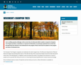
The Champion Tree Program recognizes and celebrates the state’s largest trees. The Wisconsin Department of Natural Resources began documenting these trees in 1941 with the help of the community. People around the state discovered these trees in the Northwoods, in neighbors’ yards and along city streets. The program has endured as a result of people such as yourself. We invite you to join us in honoring and preserving Wisconsin’s natural resources heritage.

Subject:
Agriculture, Food and Natural Resources
Art and Design
Biology
Botany
Career and Technical Education
Early Learning
Ecology
Education
Elementary Education
Environmental Literacy and Sustainability
Environmental Science
Fine Arts
Forestry and Agriculture
Higher Education
Life Science
Media Arts
Material Type:
Data Set
Diagram/Illustration
Other
Reference Material
Author:
Wisconsin Department of Natural Resources
Date Added:
04/21/2024
Wisconsin's Fishes
Conditional Remix & Share Permitted
CC BY-NC
Rating
0.0 stars

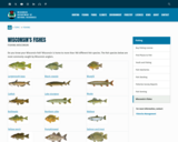
Do you know your Wisconsin fish? Wisconsin is home to more than 160 different fish species. The fish species below are most commonly caught by Wisconsin anglers.

Also links to these resources:
Wisconsin's state record fish
Hooked on Wisconsin Anglers' Club
Game fish of Wisconsin poster
Fish Wildcards - A set of 45 fish, plus games, knots, basic fish anatomy, a common fish parasite, and a handy trick to estimate your fish’s weight with a ruler! Two versions:
Match Your Catch, Low-Res Version [PDF] or
Match Your Catch, Hi-Res Version [PDF]
Fish of Wisconsin [exit DNR]
Fish identification database [exit DNR]
Burbot, bowfin and snakehead identification
Wisconsin fish species list [PDF] - a printable document with Wisconsin's fish species.

Subject:
Agriculture, Food and Natural Resources
Art and Design
Biology
Career and Technical Education
Early Learning
Ecology
Education
Elementary Education
Environmental Science
Family and Consumer Sciences
Fine Arts
Health Science
Life Science
Marketing, Management and Entrepreneurship
Media Arts
Zoology
Material Type:
Activity/Lab
Data Set
Interactive
Reference Material
Author:
Wisconsin Department of Natural Resources
Date Added:
04/21/2024
Wolves in Wisconsin
Conditional Remix & Share Permitted
CC BY-NC
Rating
0.0 stars

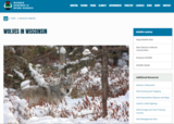
Wisconsin Department of Natural Resources dataset of current Wolf population and distribution of wolf packs found throughout Wisconsin.

Following a federal court ruling on Feb. 10, 2022, gray wolves are listed as an endangered species in the lower 48 states (excluding the northern Rocky Mountains region). As such, wolves are federally protected. Harvest and lethal depredation control are prohibited.

Wisconsin's wolf population remains healthy and secure in the state. The department will continue its robust wolf population monitoring program and the development of an updated wolf management plan.

The DNR will continue to partner with USDA-Wildlife Services to address wolf conflicts in Wisconsin. If you suspect wolves in the depredation of livestock, pets or hunting dogs, or if wolves are exhibiting threatening or dangerous behavior, contact USDA-Wildlife Services staff immediately. If in northern Wisconsin, call 1-800-228-1368 or 715-369-5221; in southern Wisconsin, call 1-800-433-0663 or 920-324-4514. While gray wolves are listed as a federally endangered species, it remains unlawful to shoot a wolf unless there is an immediate threat to human safety.

Subject:
Agriculture, Food and Natural Resources
Biology
Business and Information Technology
Career and Technical Education
Ecology
Education
Elementary Education
Environmental Literacy and Sustainability
Environmental Science
Forestry and Agriculture
Life Science
Marketing, Management and Entrepreneurship
Zoology
Material Type:
Data Set
Diagram/Illustration
Other
Reference Material
Author:
Wisconsin Department of Natural Resources
Date Added:
03/25/2024
Working With Available Space
Conditional Remix & Share Permitted
CC BY-NC-SA
Rating
0.0 stars

Despite a space with limited possibilities, Becky Smith has organized a high school biology classroom where she can work and her students can learn. A classroom profile.

Subject:
Biology
Life Science
Material Type:
Lesson Plan
Reading
Teaching/Learning Strategy
Provider:
University of North Carolina at Chapel Hill School of Education
Provider Set:
LEARN NC Articles & More
Author:
Sydney Brown
Date Added:
03/07/2005
Writing Poems from Dragonfly Facts
Conditional Remix & Share Permitted
CC BY-NC-SA
Rating
0.0 stars

This activity is a creative writing assignment in which first graders create poetry from scientific information about dragonflies.

Subject:
Biology
Life Science
Material Type:
Activity/Lab
Lesson Plan
Provider:
Science Education Resource Center (SERC) at Carleton College
Provider Set:
Pedagogy in Action
Author:
Mary Jo Taintor
Date Added:
02/10/2023
Yeast Cells Respire, Too (But Not Like Me and You)
Read the Fine Print
Educational Use
Rating
0.0 stars

Students set up a simple way to indirectly observe and quantify the amount of respiration occurring in yeast-molasses cultures. Each student adds a small amount of baking yeast to a test tube filled with diluted molasses. A second, smaller test tube is then placed upside-down inside the solution. As the yeast cells respire, the carbon dioxide they produce is trapped inside the inverted test tube, producing a growing bubble of gas that is easily observed and measured. Students are presented with the procedure for designing an effective experiment; they learn to think critically about experimental results and indirect observations of experimental events.

Subject:
Biology
Career and Technical Education
Life Science
Technology and Engineering
Material Type:
Activity/Lab
Lesson Plan
Provider:
TeachEngineering
Provider Set:
TeachEngineering NGSS Aligned Resources
Author:
Mary R. Hebrank
Date Added:
09/26/2008
Yellowstone Fires
Conditional Remix & Share Permitted
CC BY-NC-SA
Rating
0.0 stars

This Starting Point Teaching Collection page describes the Yellowstone Fires module created for NASA's Classroom of the Future. Emphasizing an integrated approach to environmental earth science through problem-based learning, the module asks students to assume the role of environmental biologist, and help several government agencies resolve the debate surrounding "let it burn" policies in national parks. The government agencies would like to know whether or not to allow naturally occurring fires in Yellowstone National Park to burn to their natural conclusion. The agencies are particularly interested in student recommendations based on an Earth System Science analysis of a fire's impact on the air, land, water, and living things. Many of the pages within the module site provide hyperlinked background resources to investigate wildland fire issues in more detail. A glossary, references, related links, and a general description of the problem-based learning model compliment the site. On this page, teachers can find learning goals, teaching notes and tips, teaching materials, assessment hints and references and resources dealing with this exercise. It also describes the context in which the module is best used.

Subject:
Atmospheric Science
Biology
Earth and Space Science
Ecology
Education
Forestry and Agriculture
Geology
Hydrology
Life Science
Material Type:
Activity/Lab
Reading
Provider:
Science Education Resource Center (SERC) at Carleton College
Provider Set:
Starting Point (SERC)
Author:
Rebecca Teed
Robert Myers
Date Added:
11/09/2017
The cell: Animal cell and plant cell comparison
Conditional Remix & Share Permitted
CC BY-NC-SA
Rating
0.0 stars

The smallest unit of life is the cell. Cells are tiny factories that work with incredible precision. All living organisms consist of one or more cells. Regardless of their shape and form, which vary greatly, in each cell we can distinguish common organelles. The two most important cell categories are animal and plant cells. In this lesson, we will talk about the similarities and differences of the organelles found in animal and plant cells as well as their functions.

Subject:
Biology
Life Science
Material Type:
Activity/Lab
Assessment
Unit of Study
Author:
ISKME.
Date Added:
11/26/2018
epaulets in red-winged black bird social system
Restricted Use
Copyright Restricted
Rating
0.0 stars

The article provides an opportunity to do close reading of scientific language related to evolution and heredity in fourth grade science. There is also a diagram which can be reproduced in overhead, discussed, and recreated in simpler forms. Of the article, I would do the close reading portion with just the methods section of the article, having students first read it with an eye for unknown vocabulary, a second time, looking at sentences and rephrasing, and a third time to get the main idea. This process would be repeated, but with an eye first to students analyzing what information they can see in the graph, and making predictions of what they will find, and then the teacher showing both a bar graph and a pie chart with the same information. The conclusion of the article and the graph reading would be done in large group, with encouragement of discussions, partner to partner talk, and students changing their models of the 'big picture'.

Subject:
Biology
Life Science
Material Type:
Primary Source
Provider:
International Society for Behavioral Ecology
Date Added:
06/30/2016
The life cycle of a butterfly
Unrestricted Use
Public Domain
Rating
0.0 stars

This video provides learners with a detailed description of the life cycle of a butterfly.  Each stage is discussed in depth with diagrams for students understandnding.  The pace of the video is very age appropriate and the terminology is used properly for thier comprehension.

Subject:
Biology
Life Science
Material Type:
Interactive
Learning Task
Provider:
unknown
Date Added:
10/28/2016
pH Scale
Unrestricted Use
CC BY
Rating
0.0 stars

Test the pH of things like coffee, spit, and soap to determine whether each is acidic, basic, or neutral. Visualize the relative number of hydroxide ions and hydronium ions in solution. Switch between logarithmic and linear scales. Investigate whether changing the volume or diluting with water affects the pH. Or you can design your own liquid!

Subject:
Biology
Career and Technical Education
Chemistry
Education
Life Science
Mathematics
Physical Science
Physics
Technology and Engineering
Material Type:
Activity/Lab
Interactive
Simulation
Provider:
PhET
Author:
Adams, Wendy
Archie Paulson
Barbera, Jack
Chris Malley
Excellence Center of Science and Mathematics Education at King Saud University
Jack Barbera
Kathy Perkins
Landgon, Laurie
Laurie Langdon
Loeblein, Patricia
Malley, Chris
National Science Foundation
O'Donnell Foundation
Patricia Loeblein
Paulson, Archie
Perkins, Kathy
PhET
PhET Interactive Simulations
The William and Flora Hewlett Foundation
Wendy Adams
Date Added:
07/01/2008
simple interactive game about heredity in dogs
Restricted Use
Copyright Restricted
Rating
0.0 stars

Students investigate one trait in heredity, using models and quick results with a computer-generated game. Students have practice in predicting and creating solutions to specific heredity questions. The game becomes increasingly more challenging as it progresses.

Subject:
Biology
Life Science
Material Type:
Activity/Lab
Diagram/Illustration
Game
Learning Task
Simulation
Provider:
pbskids.org
Date Added:
06/30/2016
virtual labs - photosynthesis
Conditional Remix & Share Permitted
CC BY-NC
Rating
0.0 stars

This is a virtual lab of photosynthesis that can be used for elementary through high school levels. The pdfattachment is intended for a late elementary audience but can be modified for olders students. The independent variable is light color and type of plant. There is a chart and video and journal that students can use on line. The video gives some background on the fact that white light is made up of many different colors of light. There is a ruler that can be dragged to measure the height of each plant.

Subject:
Biology
Life Science
Physical Science
Physics
Material Type:
Activity/Lab
Interactive
Provider:
Glencoe
Date Added:
06/16/2015