Only Sharing Permitted
CC BY-NC-ND
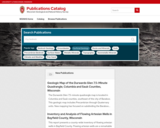
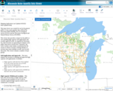
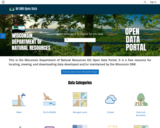
This is the Wisconsin Department of Natural Resources GIS Open Data Portal. It is a free resource for locating, viewing, and downloading data developed and/or maintained by the Wisconsin DNR.
This site also has categories of: Water, Fish and Wildlife, Managed Lands, Cimate, Parks and Recreation, Forestry, Transportation, Indexess and PLSS, Boundaries and Land Cover and Vegetation.
The site also has Applications that include: PFAS in Wisconsin Data Viewer, Western Coulee and Ridges Regional Master Plan, North Central Forest Regional Master Plan, Wildfires Dashboard App, Report Invasive Species, CWD reporting, etc
- Subject:
- Agriculture, Food and Natural Resources
- Biology
- Botany
- Career and Technical Education
- Civics and Government
- Earth and Space Science
- Ecology
- Education
- Elementary Education
- Environmental Literacy and Sustainability
- Environmental Science
- Forestry and Agriculture
- Geography
- Geology
- Health Education
- Health Science
- Higher Education
- Hydrology
- Life Science
- Social Studies
- Zoology
- Material Type:
- Activity/Lab
- Homework/Assignment
- Learning Task
- Lecture
- Lesson
- Lesson Plan
- Author:
- Wisconsin Department of Natural Resources
- Date Added:
- 03/12/2024