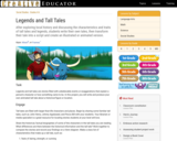
Legends and tall tales are stories filled with unbelievable events or exaggerations …
Legends and tall tales are stories filled with unbelievable events or exaggerations that explain a person’s character or how something came to be. In this project, students will write and produce their own animated tall tale about a historical figure or location.
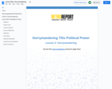
Every decade, after each United States census, states engage in redistricting, the …
Every decade, after each United States census, states engage in redistricting, the redrawing of congressional and state legislative boundaries. This process often becomes politicized, with district lines drawn to create partisan advantages and disadvantages – a tactic known as gerrymandering. What’s at stake now: control of the House of Representatives. Which criteria should matter most when drawing district lines? What are the electoral consequences when politicians draw lines based on political or racial demographics? Examine interactive resources to explore how changing district lines can affect the balance of partisan power, and evaluate criteria for drawing district lines.
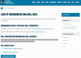
Wisconsin DNR link to look up most private or public wells. Can …
Wisconsin DNR link to look up most private or public wells. Can use Map View or by unique Well ID number. Well construction information, including geology, construction method, well depth, water depth, well yield and other information about the well.
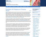
This course is a friendly introduction to Geographic Information Science and related …
This course is a friendly introduction to Geographic Information Science and related Technologies, reflecting current state-of-the-art and practice. GIScience is the intersection of professions, institutions, and technologies that produce geographic data and render information from it. It is a rapidly growing and evolving field. Learning is a way of life for everyone who is successful in todays every changing world. With this in mind, we hope that this text may contribute to your lifelong exploration of how geographic information and related technologies that generate it can be used to improve the quality of life--yours and your neighbors', locally and globally, now and in the future.
This project is addressing the needs of a consistent standards-based curriculum for …
This project is addressing the needs of a consistent standards-based curriculum for our middle school. The new Wisconsin Social Studies Standards have altered what needs to be taught at all levels and our current middle school social studies curriculum does not address these standards. We are also in a situation that several teachers teach social studies along with other subjects and this curriculum will address the need for consistency and providing these teachers with exact objectives and standards for their classrooms. The project's intended audience is middle school teachers and students. Grades 6-8. The anticipated impact is that students taught under this curriculum will have a solid base of knowledge in all areas of the social sciences. This will impact their ability to be successful in future social studies classes- specifically high school classes that are more specific and will build off the knowledge learned in middle school. It will also impact the teachers that will be teaching the curriculum as it will provide a well-laid out plan and expectations that will hopefully make their planning easier and more consistent. This will also in term alleviate some of the issues the high school teachers are currently seeing with students coming in with a weak knowledge base.
The teacher will set up a skype session with a classroom from …
The teacher will set up a skype session with a classroom from around the world and will not tell the students where the classroom is from. The students will then participate in the skype session in which they will ask yes/no questions. The goal is to be the first class to guess where the other students are from. After the game is finished the students can share about their school and/or culture.
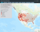
Interactive Risk Map that shows the amount of risk associated with different …
Interactive Risk Map that shows the amount of risk associated with different Natural Hazards for each area of the United States. These natural hazards include: Fires, Floods, Earthquakes, Thunderstorms / Tornadoes, Droughts, Hurricanes, Winter Weather events, Extreme heat.
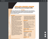
NUTSHELL:Â In this lesson, students work in teams and use primary data …
NUTSHELL: In this lesson, students work in teams and use primary data sources, such as weather data and an emergency radio traffic log, to investigate the Cottonville Fire. Using primary documents such as newspaper articles, students study how the fire was suppressed and evaluate successes and limitations to fighting the fire. To conclude, teams are given post-fire landowner dilemmas to discuss.  BIG IDEAS In Wisconsin, there are two main types of wildland fire – wildfire and prescribed fire. Wildfires start without the intent of the landowner or land manager and are uncontrolled and unwanted. Prescribed fires are contained and are planned to meet the goals of a landowner or land manager.The ignition of wildland fire can be caused by human activity (e.g., debris burning and other outdoor burning, machine sparks, children playing with matches, power lines, fireworks) or natural sources (e.g., lightning, spontaneous combustion). Human activity is responsible for most wildland fires in Wisconsin.Fire requires oxygen, heat, and fuel to exist. Collectively these elements are known as the fire triangle. Under most conditions, the three elements can be manipulated to slow or stop the spread of fire.Fire behavior is influenced by topography, weather, and fuel characteristics. The fire season is determined by seasonal changes in weather and fuel.Wildland fire management has direct and indirect costs and benefits for the economy. Effective wildland fire management requires both financial and human resources.The wildland/urban interface is an area where human structures exist among wildland fuels. As people move into fire prone areas, the potential for ignition of wildland fire increases, and buildings and other human-made objects become a possible fuel source. OBJECTIVES Upon completion of this lesson, students will be able to: Explore the ecologic, economic, and social affects of wildfire.Examine multiple data sources to make predictions and draw conclusions about a natural phenomenon.Discuss how wildfire behaves and the factors that influence this behavior.Analyze wildfire suppression efforts and evaluate challenges in each. SUBJECT AREAS Geography, Mathematics, Science, Social Studies LESSON/ACTIVITY TIME Total Lesson Time: 235 minutesTime Breakdown: Introduction--5 minutes; Activity 1--60 minutes; Activity 2--90 minutes; Activity 3 --40 minutes; Conclusion--40 minutes
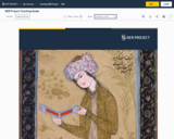
The book collects together and republishes a set of essays by Frank …
The book collects together and republishes a set of essays by Frank G. Speck that were originally issued as separate articles in The Southern Workman. The papers, which were written early in Speck's career, during the period 1907-1911, draw upon his first-hand observations in the Indian and Oklahoma Territories on the eve of Oklahoma statehood. In contrast to his more dispassionate ethnographic writings, which were published in venues read primarily by professional anthropologists and folklorists, these essays were published for a popular audience in the journal of the Hampton Normal and Agricultural Institute, an important college serving African American and Native American students. Reflecting the sensibilities of Speck and his anthropological circle at the time, these brief essays are accessible, provocative and sometimes biting in tone and represent the work of a young scholar seeking to develop a public, progressive, critical and engaged stance relative to the social problems faced by the peoples--particularly Native American and African American peoples--of Oklahoma and of the United States more broadly. For modern readers, the essays are little utilized sources for the study of Oklahoma, Freedmen, and Muscogee (Creek) Indian cultural history. They also deepen historical understandings of Speck and his work and enrich scholarly knowledge of early efforts at developing anthropology as a means of cultural critique. Under U.S. copyright law, these essays are now in the public domain and is being republished on this basis.
This is designed to have the students think critically about the immigration …
This is designed to have the students think critically about the immigration debate in the United States. This lesson allows the teacher to guide student driven discussion without coloring the debate with their personal opinion. This very difficult topic becomes easy to talk about with these students using this method.
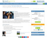
Celestial navigation is the art and science of finding one's geographic position …
Celestial navigation is the art and science of finding one's geographic position by means of astronomical observations, particularly by measuring altitudes of celestial objects sun, moon, planets or stars. This activity starts with a basic, but very important and useful, celestial measurement: measuring the altitude of Polaris (the North Star) or measuring the latitude.
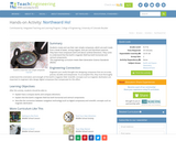
Students create and use their own simple compasses, which are each made …
Students create and use their own simple compasses, which are each made from a bowl of water, strong magnet, stick pin and Styrofoam peanuts. They learn how compasses work and about cardinal directions. They come to understand that the Earth's magnetic field has both horizontal and vertical components.
This teaching guide from the OER Project outlines their courses, PD, and …
This teaching guide from the OER Project outlines their courses, PD, and other resources.
The OER Project is a coalition of educators and historians committed to boosting student engagement and achievement through transformational social studies programs. By empowering classroom teachers with better curricula, content, and a vibrant community, we deliver more compelling, impactful, and usable histories. “OER” stands for open educational resources. When you grab a free worksheet off Pinterest for your tenth graders, that’s an OER resource. We recognize the value of OER resources, but want to go beyond the typical content repository approach—we aim to improve OER by providing coherency, support, and community.
Currently, the OER Project offers two courses—Big History Project (BHP) and World History Project (WHP)—both of which are completely free, online, and adaptable to different standards and classroom needs. Unlike textbooks, lesson websites, and other commercial products, everything has been purposely built to truly empower teachers and leave traditional history courses in—sorry for the pun—the past. We also offer short, standalone courses for those who want to try the OER Project approach, but aren’t yet ready to take on a full history course. Our current standalone options include Project X, a course that uses data to explore historical trends to help make predictions about the future; Project Score, a course that uses writing tools and the use of Score, a free, online essay-scoring service to help support student writing; and Climate Project, an evidence-based overview of the global carbon problem that culminates in students developing a plan of action they can implement locally
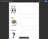
The "Observe, Think, Wonder" sheet was written (along with other resources) from …
The "Observe, Think, Wonder" sheet was written (along with other resources) from a grant from the Library of Congress. It is based off their 6-12 analysis of primary sources documents. This is geared more towards elementary primary source analysis.
A K-5 student can analyze appropriate primary sources such as photographs and maps. Using the "Observe, Think, Wonder", students can walk through age-appropriate analysis by taking some time to look closely at the source (observe) and write down what they see; then dig a little deeper into what they think is happening in the photo or reading (think) before finally writing down any questions they might have about the source (wonder). This is great practice for further analysis and evaluation as they get older.
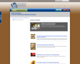
Explore the Society's online exhibits to uncover unique facets of Wisconsin history. …
Explore the Society's online exhibits to uncover unique facets of Wisconsin history. Exhibits are based on past gallery exhibits at the Wisconsin Historical Museum and include curated images, trivia and brief historical essays.
Note that the viewing of the resource does not meet social studies standards. Teachers are encouraged to consider the use of primary source analysis documents such as those from the Library of Congress and the National Archives in order to help students access social studies curricular objectives.
This course involves the design, development, and deployment of interactive mapping tools …
This course involves the design, development, and deployment of interactive mapping tools distributed via the World Wide Web and using “open” (non-proprietary, community-developed) standards and software code. It will also prepare students to design, develop, and implement custom web mapping applications using open standards and open source software. On completion of the course, students will be able to build and deploy a complete web mapping solution including selecting the spatial data, the server and client software. Students will be able to determine which type of mapping server is required for their needs and to explain why choosing an open standard based solution is better than a proprietary solution. The course will cover a variety of open source software packages for web mapping and will provide pointers to commercial solutions where appropriate.
The Wisconsin Veterans Museum Oral History Collection contains personal stories and military …
The Wisconsin Veterans Museum Oral History Collection contains personal stories and military experiences of Wisconsin veterans of the Spanish-American War through present-day. The more than 2,800 interviews complement the archive and object collections to build a complete description of military service.
Alone, these primary sources do not meet any social studies standards. However, the use of analysis and inquiry will allow students to gain insight into multiple curricular objectives. Teachers are encouraged to use analysis documents such as those from the Library of Congress or the National Archives.
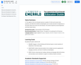
In The Legend of the Lost Emerald, learners in grades 4-6 will …
In The Legend of the Lost Emerald, learners in grades 4-6 will use the same tools, practices, and skills that maritime archaeologists use to locate and dive for shipwrecks on the Great Lakes and uncover the real treasure—the stories inspired by actual shipwrecks and Great Lakes history.
No restrictions on your remixing, redistributing, or making derivative works. Give credit to the author, as required.
Your remixing, redistributing, or making derivatives works comes with some restrictions, including how it is shared.
Your redistributing comes with some restrictions. Do not remix or make derivative works.
Most restrictive license type. Prohibits most uses, sharing, and any changes.
Copyrighted materials, available under Fair Use and the TEACH Act for US-based educators, or other custom arrangements. Go to the resource provider to see their individual restrictions.