Updating search results...

Search Resources

303 Results

View
Selected filters:
  • Homework/Assignment
We the People: how was the Constitution Used to Organize the Government?
Unrestricted Use
CC BY
Rating
0.0 stars

This lesson explains the steps taken by the First Congress to name a president and vice president, to provide funding for the new government, to draft a bill of rights, and to organize the executive and judicial branches. When you complete this lesson, you should be able to explain how the Constitution provides an outline of the federal government’s organization and that details are added by the government itself. You should also be able to explain how the First Congress used the Constitution to name a president and vice president and raise revenue to fund the new government. You should be able to describe how Congress has organized the executive branch and how it has expanded. In addition, you should be able to describe how the Judiciary Act established the federal court system.

Subject:
Civics and Government
Social Studies
Material Type:
Homework/Assignment
Lesson
Lesson Plan
Author:
Ashley Nowak
Date Added:
06/09/2023
What Responsibilities Accompany Our Rights?
Rating
0.0 stars

We the People: The Citizen and the Constitution
In this lesson you will discuss some important questions about the responsibilities of citizens. You must develop your own answers to these questions. We hope this lesson will help you develop good answers.

Subject:
Civics and Government
Social Studies
Material Type:
Curriculum Map
Formative Assessment
Homework/Assignment
Lesson
Lesson Plan
Author:
Center for Civic Education
Center Staff
Date Added:
06/09/2023
What is the future of Earth's climate?
Rating
0.0 stars

What is the future for Earth’s climate? Explore data from NASA showing temperature changes over the past 120 years and data from the Vostok ice core to look at climate trends over different time scales. Evaluate what information the data provides and consider the limitations of conclusions that can be drawn from the data.

Subject:
Atmospheric Science
Earth and Space Science
Material Type:
Activity/Lab
Homework/Assignment
Author:
National Geographic
National Science Foundation
University of California Santa Cruz
High-Adventure Science
Date Added:
02/19/2023
When I Walk: It's About Access
Rating
0.0 stars

In this lesson, students explore issues of accessibility as they step into their immediate communities to determine a range of physical barriers to those living with disabilities and conceptualize ways to remove some of those obstacles. The video clips provided with this lesson are from When I Walk, a film by and featuring Jason DaSilva, who has been diagnosed with multiple sclerosis (MS). The documentary chronicles Jason's struggle to adapt to the realities of living with MS while holding on to his personal and creative life. With Jason's body growing weaker, his spirits, and his film, get a boost from his mother's tough love and the support of Alice Cook, who becomes his wife and filmmaking partner. POV offers a lending library of DVDs that you can borrow anytime during the school year — FOR FREE! Get started by joining our Community Network.

Subject:
Education
English Language Arts
Global Education
Special Education
Material Type:
Activity/Lab
Homework/Assignment
Lesson Plan
Author:
PBS Learning Media
Date Added:
08/11/2023
Why Government?: Hobbes and Locke Lesson Plan
Rating
0.0 stars

Website Explanation:
Students take a look at two political thinkers that spent a lot of time trying to answer the question, "Why Government?" - Thomas Hobbes and John Locke. This lesson combines our Influence Library entries on Hobbes and Locke and adds activities that ask students to compare and contrast Hobbes and Locke and to think about how these philosophers influenced those that followed in their footsteps.

Subject:
Civics and Government
Economics
Social Studies
U.S. History
World History
Material Type:
Homework/Assignment
Lesson Plan
Author:
iCivics
Date Added:
06/13/2023
Why the Bill of Rights Matters to You
Rating
0.0 stars

This lesson will allow students to use primary sources, the Bill of Rights, and Supreme Court
cases in conjunction with the game “That’s Your Right” and the Annenberg Guide to the
Constitution. Students will be able to understand the meaning and importance of the Bill of
Rights as well as how it safeguards freedoms and protects citizens from government intrusion in
everyday life. Students will focus on primary sources, the Bill of Rights and real-life scenarios to
prepare them to play the game “That’s Your Right.” Afterward, students can extend learning by
exploring real Supreme Court cases that affect students in schools.

Subject:
Civics and Government
Social Studies
U.S. History
Material Type:
Activity/Lab
Game
Homework/Assignment
Lesson Plan
Author:
Annenberg Classroom
Date Added:
05/18/2023
Wisconsin DNR Open Data Portal
Only Sharing Permitted
CC BY-NC-ND
Rating
0.0 stars

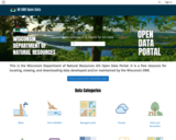
This is the Wisconsin Department of Natural Resources GIS Open Data Portal. It is a free resource for locating, viewing, and downloading data developed and/or maintained by the Wisconsin DNR.

This site also has categories of: Water, Fish and Wildlife, Managed Lands, Cimate, Parks and Recreation, Forestry, Transportation, Indexess and PLSS, Boundaries and Land Cover and Vegetation.

The site also has Applications that include: PFAS in Wisconsin Data Viewer, Western Coulee and Ridges Regional Master Plan, North Central Forest Regional Master Plan, Wildfires Dashboard App, Report Invasive Species, CWD reporting, etc

Subject:
Agriculture, Food and Natural Resources
Biology
Botany
Career and Technical Education
Civics and Government
Earth and Space Science
Ecology
Education
Elementary Education
Environmental Literacy and Sustainability
Environmental Science
Forestry and Agriculture
Geography
Geology
Health Education
Health Science
Higher Education
Hydrology
Life Science
Social Studies
Zoology
Material Type:
Activity/Lab
Homework/Assignment
Learning Task
Lecture
Lesson
Lesson Plan
Author:
Wisconsin Department of Natural Resources
Date Added:
03/12/2024
Wisconsin Historic Climate Data
Unrestricted Use
Public Domain
Rating
0.0 stars

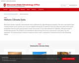
Wisconsin’s climate is typically continental with some modification by Lakes Michigan and Superior. The cold, snowy winters favor a variety of winter sports, and the warm summers appeal to thousands of vacationers each year. About two-thirds of the annual precipitation falls during the growing season (freeze-free period). It is normally adequate for vegetation, although drought is occasionally reported. This climate is most favorable for dairy farming; the primary crops are corn, small grains, hay, and vegetables. The rapid succession of storms moving from west to east or southwest to northeast account for the stimulating climate.

Select from Climate by Location, Division, Normals, Statewide Extremes, Longterm Annual Variability, and Daily Climate data.

Subject:
Agriculture, Food and Natural Resources
Atmospheric Science
Biology
Botany
Career and Technical Education
Earth and Space Science
Ecology
Education
Elementary Education
Environmental Science
Family and Consumer Sciences
Forestry and Agriculture
Health Science
Higher Education
Hydrology
Life Science
Marketing, Management and Entrepreneurship
Material Type:
Activity/Lab
Diagram/Illustration
Homework/Assignment
Interactive
Author:
Wisconsin State Climatology Office and Nelson Institute for Environmental Studies
Date Added:
04/28/2024
Wisconsin Rocks and Minerals - Interactive Storymap
Only Sharing Permitted
CC BY-NC-ND
Rating
0.0 stars

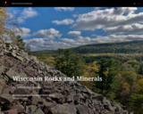
The Badger State is home to a wide variety of rocks and minerals, some of which you may find familiar and others you may not recognize. In this interactive guide, the Wisconsin Geological and Natural History Survey takes you on a journey through the state, exploring our most important rocks and minerals.

Subject:
Earth and Space Science
Ecology
Education
Elementary Education
Environmental Science
Forestry and Agriculture
Geology
Higher Education
Hydrology
Life Science
Material Type:
Activity/Lab
Homework/Assignment
Lesson
Author:
Wisconsin Geological and Natural History Survey
Date Added:
03/04/2024
Wisconsin Surface Water Data Viewer
Conditional Remix & Share Permitted
CC BY-NC
Rating
0.0 stars

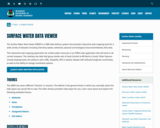
The Surface Water Data Viewer is a mapping tool for the State of Wisconsin. It provides interactive web mapping tools for a variety of datasets, including chemistry, physical, and biological data. The data managed in layers that can be turned on and off as needed. The Homepage of the Surface Water Data Viewer (SWDV) has many commonly used features labeled. Descriptions of the features are as follows:

Toolbars: There are a variety of toolbars with different themes to help complete tasks using the SWDV. The toolbars can be used to display the layers available to the map, add or remove shapes, text, or measurement features, identify points, print maps, and more!

Search Bar: Using the search bar, you can search monitoring stations by number, locations by keyword, and waterbodies by WBIC. Be careful when using the search bar, partial matches do not always appear in the results.

Navigation Pane: The navigation pane is where results will appear from searches, where you are able to select layers for the map, and features for printing. You will be able to refine the data that is shown here, if desired. You can hide the navigation pane by clicking the left-facing arrow at the top.

Coordinates and Coordinate System: The coordinates will display for any point moused-over on the map. Click the black triangle to select your preferred method for displaying lat/long (DD, DMS, DDM, Mercator). The right-most option in this pane allows you to manually manage thescale of the map. Click on the scale tool, and selected the desired scale at which you wish to view the map. Select Go to implement changes.

Scale Bar: The scale bar shows the current extent of the map.

Whole State View: This view describes what is being shown on the main map relative to the entire state. A blue rectangle will cover the region of the state being shown on the map. You can also navigate the map by moving the blue square around the state-view map. If you print a map, this whole state view will print in the corner as a reference. You can minimize this view by clicking the corner-facing arrow in the top left edge of the box.

Show/Hide Toolbar: Use this button to hide the toolbar for a larger view of the map. If you have hidden the toolbar, you can also use this button to show it again.

Subject:
Agriculture, Food and Natural Resources
American Indian Studies
Biology
Botany
Career and Technical Education
Earth and Space Science
Ecology
Education
Elementary Education
Environmental Science
Forestry and Agriculture
Geography
Geology
Higher Education
Hydrology
Life Science
Social Studies
Material Type:
Activity/Lab
Homework/Assignment
Learning Task
Lecture
Lesson
Author:
Wisconsin Department of Natural Resources
Date Added:
03/12/2024
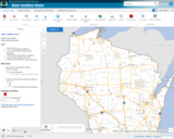
Wisconsin Water Condition Viewer - Wisconsin DNR
Only Sharing Permitted
CC BY-NC-ND
Rating
0.0 stars

The Water Condition Viewer (WCV) is an interactive mapping tool that focuses on water condition, monitoring, assessment and management data. Data includes Clean Water Act, Monitoring Projects, Healthy Watersheds Assessments, Targeted Watershed Assessments, Wastewater Evaluation, Watershed Planning, County Land and Water Plans, Nine Key Element Plans and more. All datasets from specialized themes are available from this main, general set of layers.

Subject:
Agriculture, Food and Natural Resources
Biology
Botany
Career and Technical Education
Earth and Space Science
Ecology
Education
Elementary Education
Environmental Literacy and Sustainability
Environmental Science
Family and Consumer Sciences
Forestry and Agriculture
Geology
Health Education
Health Science
Hydrology
Life Science
Marketing, Management and Entrepreneurship
Material Type:
Activity/Lab
Homework/Assignment
Lecture
Lesson
Author:
Wisconsin Department of Natural Resources
Date Added:
03/12/2024
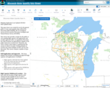
Wisconsin Water Quantity Data Viewer - Wisconsin DNR
Only Sharing Permitted
CC BY-NC-ND
Rating
0.0 stars

This map viewer was created for use by the general public to view water quantity data collected by Wisconsin DNR (WDNR), the US Geological Survey (UGSG) and the Wisconsin Geological and Natural History Survey (WGNHS).

This viewer also provides a means for the public to view pending high capacity well applications and recently approved wells. As required by Wisconsin law, these locations are generalized to display at the public land survey section level. Therefore, any well or surface water intake is symbolized by the section in which is located. Clicking identify on sections may return multiple records, one for each data point. This viewer contains a number of layer groups:

Well Applications and Approvals – This layer displays the locations of pending and approved high capacity well applications. It includes:
High capacity wells that have been applied for by the owner but have not yet been approved by the Department
High capacity wells approved in the last 30 days
High capacity wells approved by WDNR but that have not yet been constructed

High Capacity Withdrawal Locations – This layer show the location of high capacity wells constructed and available for use as well as currently registered high capacity surface water withdrawals. It includes:

Existing high capacity wells
Existing surface water withdrawals

USGS Water Quantity Monitoring – This layer shows the locations of groundwater level monitoring points, streamflow gages, and lake level gages monitored and recorded by USGS. It includes currently active monitoring locations as well as historical monitoring locations. Symbol sizes are scaled according to the number of measurements taken at each location.

WDNR Water Quantity Monitoring Groundwater Protection Features – This layer shows the locations of streamflow and lake level measurements maintained by WDNR. It includes a variety of measurement types taken by WDNR staff, partner organizations, county staff and volunteers.

WGNHS Spring Monitoring – This layer shows the location of springs surveyed by WGNHS staff between 2015 and 2017. Note that spring flow varies seasonally and annually. In addition, many spring locations are located on private land and not accessible by the public without landowner permission.

Groundwater Protection Features – This layer displays the locations of groundwater protection features as defined by Wisconsin Rule NR820. It includes trout streams, outstanding and exceptional water resources, and springs with a flow rate surveyed by WGNHS of 1 cubic foot per second (CFS) or greater. Note that all 1 CFS may not have been surveyed.

Guidance for how to use WDNR Geocortex viewers can be found here. For more information, please contact the water use section at 608-266-2299 or at DNRWATERUSEREGISTRATION@wisconsin.gov

Subject:
Agriculture, Food and Natural Resources
Biology
Business and Information Technology
Career and Technical Education
Earth and Space Science
Ecology
Education
Elementary Education
Environmental Science
Forestry and Agriculture
Geology
Health Science
Higher Education
Hydrology
Life Science
Marketing, Management and Entrepreneurship
Material Type:
Activity/Lab
Homework/Assignment
Lecture
Lesson
Author:
Wisconsin Department of Natural Resources
Date Added:
03/12/2024
Wisconsin Weather and Soil Monitoring Station Interactive map Mesonet - Wisconsin State Climatology Office
Unrestricted Use
Public Domain
Rating
0.0 stars

The Wisconsin Environmental Mesonet (WiscoNet) is a growing network of weather and soil monitoring stations across Wisconsin, designed to provide high quality data at high spatial and temporal resolutions. There are currently 14 Wisconet stations with plans to expand to around 90 by 2026. Each Wisconet station provides more than one dozen measurements every 5 minutes.

The stations measure temperature, dew point, wind, rain, soil moisture and temperature, and more.

You can view data through an interactive map or a list of stations.

Subject:
Agriculture, Food and Natural Resources
Career and Technical Education
Material Type:
Activity/Lab
Diagram/Illustration
Homework/Assignment
Interactive
Author:
Wisconsin State Climatology Office and Nelson Institute for Environmental Studies
Date Added:
04/28/2024
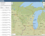
Wisconsin's historical Earthquakes - Latest Earthquakes in World - USGS
Only Sharing Permitted
CC BY-NC-ND
Rating
0.0 stars

This is a map showing the location and severity of each of the Earthquakes which have occurred in Wisconsin in recorded history. This site is also where one can find recent or historic earthquakes, lists, information on selected significant earthquakes, earthquake resources by state, or find webservices.

Subject:
Earth and Space Science
Education
Elementary Education
Forestry and Agriculture
Geography
Geology
Life Science
Social Studies
Material Type:
Activity/Lab
Diagram/Illustration
Homework/Assignment
Lecture
Author:
USGS (US Geological Survey)
Date Added:
03/12/2024
Women in the Modern Civil Rights Movement
Unrestricted Use
CC BY
Rating
0.0 stars

Who comes to mind when considering the Modern Civil Rights Movement (MCRM) during 1954 - 1965? Is it one of the big three personalities: Martin Luther King Jr., Malcolm X, or Rosa Parks? Or perhaps it is John Lewis, Stokely Carmichael, James Baldwin, Thurgood Marshall, Ralph Abernathy, or Medgar Evers. What about the names of Septima Poinsette Clark, Ella Baker, Diane Nash, Daisy Bates, Fannie Lou Hamer, Ruby Bridges, or Claudette Colvin? What makes the two groups different? Why might the first group be more familiar than the latter? A brief look at one of the most visible events during the MCRM, the March on Washington, can help shed light on this question.Students will be able to conduct an inquiry into the following research questions through this source:Who were some of the women leaders of the Modern Civil Rights Movement in your local town, city, or state? What were the expected gender roles in 1950s - 1960s America?Did these roles vary in different racial and ethnic communities?How would these gender roles affect the MCRM?Who were the "Big Six" of the MCRM?What were their individual views toward women in the movement?How were the ideas of gender similar or different from the MCRM and the later Black Power Movement?How did African American women in the MCRM relate to women in other women movements of the era (ex. Chicano, LGBT, or American Indian Movement)? 

Subject:
Gender Studies
U.S. History
Material Type:
Activity/Lab
Homework/Assignment
Primary Source
Reading
Author:
Jen Wachowski
Date Added:
09/29/2023
Women’s History in the United States
Rating
0.0 stars

This Women's History Teacher's Guide provides compelling questions, lesson activities, resources for teaching about the intersection of place and history, and multimedia resources to integrate women's perspectives and experiences throughout the school year.

Subject:
Civics and Government
Gender Studies
Social Studies
U.S. History
Material Type:
Activity/Lab
Assessment
Homework/Assignment
Author:
National Endowment for the Humanities
Date Added:
06/05/2023
Women & the American Story
Rating
0.0 stars

The events of the American Revolution took place just when political cartoons became very popular in England. People gathered every day at print shops all over London to learn the news and see the latest cartoons mocking the events of the day. Politicians quickly learned the power of a good cartoon. There is even evidence that some English politicians hired artists to mock their enemies and improve their own standing.
Students will be able to examine and analyze various political cartoons on the empowerment of colonial women and how through political cartoons, their actions were displayed and perceived by individuals of the period. Students will be able to use historical thinking skills to understand how images play a vital role in spreading information and sentiments.

Subject:
Gender Studies
Social Studies
U.S. History
Material Type:
Activity/Lab
Homework/Assignment
Lesson Plan
Author:
Lee Boomer
Date Added:
09/28/2023
Writing prompt for push  and pull distribution strategies
Conditional Remix & Share Permitted
CC BY-NC-SA
Rating
0.0 stars

This writing prompt gets students to think about how they would use a push or pull strategy to get products through the channels the distribution using an example they can all relate to.

Subject:
Career and Technical Education
Marketing, Management and Entrepreneurship
Material Type:
Activity/Lab
Homework/Assignment
Date Added:
06/12/2019