The Digital Public Library of America is a free digital collection of artifacts gathered from libraries, archives and museums. This great collection of primary source materials will continue to grow as new items are made digital.
The Digital Public Library of America is a free digital collection of artifacts gathered from libraries, archives and museums. This great collection of primary source materials will continue to grow as new items are made digital.

This resource aims to teach map reading skills of worldwide temperatures, percipitation, biovidsetiy, and soil nutrition levels in rainforest areas. It includes world maps, tropical rainforest maps, vocabulary, and teaching strategies.
Students pass around and distort messages written on index cards to learn how we use signals from GPS occultations to study the atmosphere. The cards represent information sent from GPS satellites being distorted as they pass through different locations in the Earth's atmosphere and reach other satellites. Analyzing GPS occultations enables better global weather forecasting, storm tracking and climate change monitoring.
EARTH 530 will introduce you to the basic information necessary for understanding Earth surface processes in the Critical Zone through an integration of various scientific disciplines. Those who successfully complete EARTH 530 will be able to apply their knowledge of fundamental concepts of Earth surface processes to understanding outstanding fundamental questions in Critical Zone science and how their lives are intimately linked to Critical Zone health.
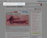
Interdisciplinary lesson plan on the ebola outbreak for middle and high school students.
This short lesson was designed in collaboration with a 7th grade Life Science teacher (Paul Jeffery). The idea behind the lesson is to help students better understand ecological and geographical classifications by teaching them at the same time in their Life Science class and their Geography class. Teaching the two classifications together will help reinforce the idea of classification. While this lesson would best be taught outdoors it can also be adapted to the indoors.
Description: Introduction to the science of Earth's climate system, the consequences of future climate on Earth, strategies for how to minimize the effects of and adapt to a changing climate.
A learning activity for the "Do You Know That Clouds Have Names?" book in the Elementary GLOBE series. Students will explore the difference between the three types of contrails, make observations of contrails outside, and record their observations. Fifteen minutes later they will make follow-up observations to see how the contrails they observed have changed. The purpose of the activity is to help students identify contrails and learn to distinguish between the three types of contrails and to understand that contrails are human-made and some contrails become clouds in the sky. Students will be able to (1) identify the three types of contrails; (2) understand that contrails are created by jet airplanes; and (3) understand that some contrails become clouds.
This course will covers a basic understanding and appreciation of energy efficiency and environmental concepts, basic operating principles of day-to-day energy conversion devices, various options to increase energy efficiency, ways to save energy and money, and ways to save the environment.
This workshop will assist organizations by helping them understand their operational choices in terms of energy supply and market pricing. Be prepared to take take advantage of new pricing options and efficient technologies, obtain financial incentives and focus budget dollars on core operations.
Bread has been an important part of the human diet since early times. Loaves baked over 5,000 years ago have been found in ancient Egyptian tombs. Wheat has been discovered in pits where human settlements existed 8,000 years ago. In the Stone Age, solid cakes were made from crushed wheat. Bread provided ancient civilizations with a reliable food source.
Students identify the parts of a wheat plant and wheat kernel and investigate the process of milling wheat kernels into flour.
Essentials of Geographic Information Systems integrates key concepts behind the technology with practical concerns and real-world applications. Recognizing that many potential GIS users are nonspecialists or may only need a few maps, this book is designed to be accessible, pragmatic, and concise. Essentials of Geographic Information Systems also illustrates how GIS is used to ask questions, inform choices, and guide policy. From the melting of the polar ice caps to privacy issues associated with mapping, this book provides a gentle, yet substantive, introduction to the use and application of digital maps, mapping, and GIS.
Estuarine Geography utilizes an ecological approach to understanding physical and biological parameters to estuarine evolution.. Superimposed upon that spatial site and situation are social, human, cultural and political activities. Humans role in estuarine evolution is discussed at length.
This video is a good resource to keep the student's attention and give an overview of Wisconsin facts that are leaned in 4th grade to meet the standards.
Explore the ethnic diversity of U.S. states and neighborhoods. Book: The House on Mango Street by Sandra Cisneros.
*Students will explain how scale (the granularity of information) changes our understanding of a place.
*Students will identify how the ethnically diverse neighborhoods of suburban Chicago influenced Cisneros’ childhood and her writing.
Educators use formative assessment to continually reflect and improve their skills related to these practices. The Formative Assessment video is a resource that can be used to support educators' professional development related to assessment literacy. Use the Video Supplement & Resource Guide to enhance your facilitation of this professional development opportunity.
METEO 469 is a required course for the Bachelor of Arts in Energy Sustainability and Policy on-line degree program, geared towards students who are able to study only part-time and at a distance. This course provides an introduction to global warming and climate change, covering the basic science, projected impacts, and approaches to mitigation. Watch this introduction video by the course author, Michael Mann:
This course cultivates a working knowledge of how geospatial professionals can develop web mapping applications that bring together data from multiple sources. GEOG 863 will provide students with an understanding of the technology that makes building mashups possible and teaches them how to build their own mashups.
This course cultivates a working knowledge of current and future capabilities of GPS and the emerging Global Navigation Satellite System.
GeoGuessr is a web-based geographic discovery game designed by Anton Wallén, a Swedish consultant, released on 9 May 9, 20. The game uses a semi-randomized Google Street View location and requires players to guess their location in the world using only the clues visible. The website received hundreds of thousands of unique visitors per day within a week of being released.