Updating search results...

Search Resources

173 Results

View
Selected filters:
  • Hydrology
Wisconsin Geological and Natural History Survey - Publications Catalog
Only Sharing Permitted
CC BY-NC-ND
Rating
0.0 stars

The Wisconsin Geological and Natural History Survey (WGNHS) has been serving Wisconsin for over 125 years. Part of the Division of Extension at the University of Wisconsin–Madison, WGNHS provides objective scientific information about the geology, mineral resources, and water resources of Wisconsin. We conduct research, map Wisconsin’s geology, and share information through our publications and outreach.

This is the link to the Publications Catalog that includes Wisconsin Data sets and maps for: Bedrock Geology, Groundwater, Surficial Geology, Rocks and Minerals, Soils, Precambrian Bedrock, Surface Water, Metallic Minerals, Topography, Nonmetallic Minerals, Climate and Weather, and Frac Sand.

Subject:
Biology
Career and Technical Education
Earth and Space Science
Ecology
Education
Elementary Education
Environmental Science
Family and Consumer Sciences
Forestry and Agriculture
Geology
Health Science
Higher Education
Hydrology
Life Science
Marketing, Management and Entrepreneurship
Material Type:
Activity/Lab
Diagram/Illustration
Interactive
Lecture
Author:
Wisconsin Geological and Natural History Survey
Date Added:
03/12/2024
Wisconsin Historic Climate Data
Unrestricted Use
Public Domain
Rating
0.0 stars

Wisconsin’s climate is typically continental with some modification by Lakes Michigan and Superior. The cold, snowy winters favor a variety of winter sports, and the warm summers appeal to thousands of vacationers each year. About two-thirds of the annual precipitation falls during the growing season (freeze-free period). It is normally adequate for vegetation, although drought is occasionally reported. This climate is most favorable for dairy farming; the primary crops are corn, small grains, hay, and vegetables. The rapid succession of storms moving from west to east or southwest to northeast account for the stimulating climate.

Select from Climate by Location, Division, Normals, Statewide Extremes, Longterm Annual Variability, and Daily Climate data.

Subject:
Agriculture, Food and Natural Resources
Atmospheric Science
Biology
Botany
Career and Technical Education
Earth and Space Science
Ecology
Education
Elementary Education
Environmental Science
Family and Consumer Sciences
Forestry and Agriculture
Health Science
Higher Education
Hydrology
Life Science
Marketing, Management and Entrepreneurship
Material Type:
Activity/Lab
Diagram/Illustration
Homework/Assignment
Interactive
Author:
Wisconsin State Climatology Office and Nelson Institute for Environmental Studies
Date Added:
04/28/2024
Wisconsin Rocks and Minerals - Interactive Storymap
Only Sharing Permitted
CC BY-NC-ND
Rating
0.0 stars

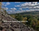
The Badger State is home to a wide variety of rocks and minerals, some of which you may find familiar and others you may not recognize. In this interactive guide, the Wisconsin Geological and Natural History Survey takes you on a journey through the state, exploring our most important rocks and minerals.

Subject:
Earth and Space Science
Ecology
Education
Elementary Education
Environmental Science
Forestry and Agriculture
Geology
Higher Education
Hydrology
Life Science
Material Type:
Activity/Lab
Homework/Assignment
Lesson
Author:
Wisconsin Geological and Natural History Survey
Date Added:
03/04/2024
Wisconsin Surface Water Data Viewer
Conditional Remix & Share Permitted
CC BY-NC
Rating
0.0 stars

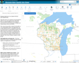
The Surface Water Data Viewer is a mapping tool for the State of Wisconsin. It provides interactive web mapping tools for a variety of datasets, including chemistry, physical, and biological data. The data managed in layers that can be turned on and off as needed. The Homepage of the Surface Water Data Viewer (SWDV) has many commonly used features labeled. Descriptions of the features are as follows:

Toolbars: There are a variety of toolbars with different themes to help complete tasks using the SWDV. The toolbars can be used to display the layers available to the map, add or remove shapes, text, or measurement features, identify points, print maps, and more!

Search Bar: Using the search bar, you can search monitoring stations by number, locations by keyword, and waterbodies by WBIC. Be careful when using the search bar, partial matches do not always appear in the results.

Navigation Pane: The navigation pane is where results will appear from searches, where you are able to select layers for the map, and features for printing. You will be able to refine the data that is shown here, if desired. You can hide the navigation pane by clicking the left-facing arrow at the top.

Coordinates and Coordinate System: The coordinates will display for any point moused-over on the map. Click the black triangle to select your preferred method for displaying lat/long (DD, DMS, DDM, Mercator). The right-most option in this pane allows you to manually manage thescale of the map. Click on the scale tool, and selected the desired scale at which you wish to view the map. Select Go to implement changes.

Scale Bar: The scale bar shows the current extent of the map.

Whole State View: This view describes what is being shown on the main map relative to the entire state. A blue rectangle will cover the region of the state being shown on the map. You can also navigate the map by moving the blue square around the state-view map. If you print a map, this whole state view will print in the corner as a reference. You can minimize this view by clicking the corner-facing arrow in the top left edge of the box.

Show/Hide Toolbar: Use this button to hide the toolbar for a larger view of the map. If you have hidden the toolbar, you can also use this button to show it again.

Subject:
Agriculture, Food and Natural Resources
American Indian Studies
Biology
Botany
Career and Technical Education
Earth and Space Science
Ecology
Education
Elementary Education
Environmental Science
Forestry and Agriculture
Geography
Geology
Higher Education
Hydrology
Life Science
Social Studies
Material Type:
Activity/Lab
Homework/Assignment
Learning Task
Lecture
Lesson
Author:
Wisconsin Department of Natural Resources
Date Added:
03/12/2024
Wisconsin Water Condition Viewer - Wisconsin DNR
Only Sharing Permitted
CC BY-NC-ND
Rating
0.0 stars

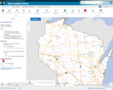
The Water Condition Viewer (WCV) is an interactive mapping tool that focuses on water condition, monitoring, assessment and management data. Data includes Clean Water Act, Monitoring Projects, Healthy Watersheds Assessments, Targeted Watershed Assessments, Wastewater Evaluation, Watershed Planning, County Land and Water Plans, Nine Key Element Plans and more. All datasets from specialized themes are available from this main, general set of layers.

Subject:
Agriculture, Food and Natural Resources
Biology
Botany
Career and Technical Education
Earth and Space Science
Ecology
Education
Elementary Education
Environmental Literacy and Sustainability
Environmental Science
Family and Consumer Sciences
Forestry and Agriculture
Geology
Health Education
Health Science
Hydrology
Life Science
Marketing, Management and Entrepreneurship
Material Type:
Activity/Lab
Homework/Assignment
Lecture
Lesson
Author:
Wisconsin Department of Natural Resources
Date Added:
03/12/2024
Wisconsin Water Quantity Data Viewer - Wisconsin DNR
Only Sharing Permitted
CC BY-NC-ND
Rating
0.0 stars

This map viewer was created for use by the general public to view water quantity data collected by Wisconsin DNR (WDNR), the US Geological Survey (UGSG) and the Wisconsin Geological and Natural History Survey (WGNHS).

This viewer also provides a means for the public to view pending high capacity well applications and recently approved wells. As required by Wisconsin law, these locations are generalized to display at the public land survey section level. Therefore, any well or surface water intake is symbolized by the section in which is located. Clicking identify on sections may return multiple records, one for each data point. This viewer contains a number of layer groups:

Well Applications and Approvals – This layer displays the locations of pending and approved high capacity well applications. It includes:
High capacity wells that have been applied for by the owner but have not yet been approved by the Department
High capacity wells approved in the last 30 days
High capacity wells approved by WDNR but that have not yet been constructed

High Capacity Withdrawal Locations – This layer show the location of high capacity wells constructed and available for use as well as currently registered high capacity surface water withdrawals. It includes:

Existing high capacity wells
Existing surface water withdrawals

USGS Water Quantity Monitoring – This layer shows the locations of groundwater level monitoring points, streamflow gages, and lake level gages monitored and recorded by USGS. It includes currently active monitoring locations as well as historical monitoring locations. Symbol sizes are scaled according to the number of measurements taken at each location.

WDNR Water Quantity Monitoring Groundwater Protection Features – This layer shows the locations of streamflow and lake level measurements maintained by WDNR. It includes a variety of measurement types taken by WDNR staff, partner organizations, county staff and volunteers.

WGNHS Spring Monitoring – This layer shows the location of springs surveyed by WGNHS staff between 2015 and 2017. Note that spring flow varies seasonally and annually. In addition, many spring locations are located on private land and not accessible by the public without landowner permission.

Groundwater Protection Features – This layer displays the locations of groundwater protection features as defined by Wisconsin Rule NR820. It includes trout streams, outstanding and exceptional water resources, and springs with a flow rate surveyed by WGNHS of 1 cubic foot per second (CFS) or greater. Note that all 1 CFS may not have been surveyed.

Guidance for how to use WDNR Geocortex viewers can be found here. For more information, please contact the water use section at 608-266-2299 or at DNRWATERUSEREGISTRATION@wisconsin.gov

Subject:
Agriculture, Food and Natural Resources
Biology
Business and Information Technology
Career and Technical Education
Earth and Space Science
Ecology
Education
Elementary Education
Environmental Science
Forestry and Agriculture
Geology
Health Science
Higher Education
Hydrology
Life Science
Marketing, Management and Entrepreneurship
Material Type:
Activity/Lab
Homework/Assignment
Lecture
Lesson
Author:
Wisconsin Department of Natural Resources
Date Added:
03/12/2024
Wisconsin Wetland Inventory Geodatabase
Conditional Remix & Share Permitted
CC BY-NC
Rating
0.0 stars

Wisconsin DNR's Wisconsin Wetland Inventory geodatabase, containing wetland polygons and points.

The principal focus of the wetland inventory is to produce wetland maps that are graphic representations of the type, size and location of wetlands in Wisconsin. Currently, there are two different datasets that have been created using different mapping methods and technologies.

The majority of the state was mapped using traditional stereo-pair, black-and-white, infrared photography. Within this context, the objective was to provide reconnaissance level information on the location, type, size of these habitats such that they are accurate at the nominal scale of the 1:24,000 (1 inch = 2000 feet) base map.

LiDAR Technology:
LiDAR has advanced the ability to see and map wetland and surface water features.

New wetland mapping is underway in areas across the state at a nominal scale of 1:2000 (1 inch = 166.7 feet). The data are being mapped according to the National Wetland Inventory standards using new methods. Please see the WWI SOP for more information.

Subject:
Agriculture, Food and Natural Resources
Biology
Botany
Career and Technical Education
Earth and Space Science
Ecology
Environmental Literacy and Sustainability
Environmental Science
Forestry and Agriculture
Hydrology
Life Science
Marketing, Management and Entrepreneurship
Technology and Engineering
Zoology
Material Type:
Data Set
Diagram/Illustration
Interactive
Other
Reference Material
Author:
Wisconsin Department of Natural Resources
Date Added:
03/25/2024
Wisconsin Wetland Inventory - Wetlands Data
Conditional Remix & Share Permitted
CC BY-NC
Rating
0.0 stars

The Wisconsin Wetland Inventory (WWI) regulatory maps show graphic representations of the type, size and location of wetlands in Wisconsin. These maps have been prepared from the analysis of high altitude imagery in conjunction with soil surveys, topographic maps, previous wetland inventories and field work. The Wisconsin Department of Natural Resources (DNR) manages the WWI.

The U.S. Fish and Wildlife Service (USFWS) began producing non-regulatory, polygonal, geospatial wetland maps for the United States via their National Wetlands Inventory (NWI) in the mid-1970s. While DNR does provide WWI data to USFWS, there can be a significant lag before those updates appear in the NWI.

STATEWIDE: Digital wetlands data are available from the Wisconsin DNR for the state. Alternatively, wetlands are available for free viewing as a layer in the DNR Surface Water Data Viewer.

Wisconsin Wetland Inventory Geodatabase – free download
App: Wisconsin DNR Surface Water Data Viewer

NATIONAL: The NWI is slightly more detailed than WWI since NWI also maps deep water systems including lakes, streams and rivers. The Wisconsin DNR provides their WWI data to the U.S. Fish and Wildlife service for integration into the NWI, but users should be cautioned that Wisconsin updates to NWI can reportedly take months, and in some cases years. Users requiring Wisconsin wetlands data are strongly encouraged to start with the Wisconsin Wetland Inventory.

National Wetlands Inventory Data

Subject:
Agriculture, Food and Natural Resources
Biology
Career and Technical Education
Earth and Space Science
Ecology
Environmental Literacy and Sustainability
Environmental Science
Forestry and Agriculture
Geology
Hydrology
Life Science
Material Type:
Data Set
Interactive
Reading
Reference Material
Author:
Wisconsin State Cartographer’s Office (SCO)
Date Added:
03/25/2024
Witnessing Evaporation
Read the Fine Print
Educational Use
Rating
0.0 stars

The engineers at Splash Engineering (the students) have been commissioned by Thirsty County to conduct a study of evaporation and transpiration in their region. During one week, students observe and measure (by weight) the ongoing evaporation of water in pans set up with different variables, and then assess what factors may affect evaporation. Variables include adding to the water an amount of soil and an amount of soil with growing plants.

Subject:
Career and Technical Education
Earth and Space Science
Hydrology
Technology and Engineering
Material Type:
Activity/Lab
Provider:
TeachEngineering
Provider Set:
TeachEngineering NGSS Aligned Resources
Author:
Denise W. Carlson
Integrated Teaching and Learning Program,
Jeff Lyng
Kristin Field
Megan Podlogar
Date Added:
09/18/2014
The Wonderful World of Water
Rating
0.0 stars

This lesson provides resources and instructions for teaching the water cycle and three states of water to early elementary grades. Includes multiple lessons and activities that could be used as a full unit.

Subject:
Earth and Space Science
Education
Elementary Education
Hydrology
Physical Science
Material Type:
Activity/Lab
Lesson
Unit of Study
Author:
Utah Education Network
Date Added:
03/30/2024
Yellowstone Fires
Conditional Remix & Share Permitted
CC BY-NC-SA
Rating
0.0 stars

This Starting Point Teaching Collection page describes the Yellowstone Fires module created for NASA's Classroom of the Future. Emphasizing an integrated approach to environmental earth science through problem-based learning, the module asks students to assume the role of environmental biologist, and help several government agencies resolve the debate surrounding "let it burn" policies in national parks. The government agencies would like to know whether or not to allow naturally occurring fires in Yellowstone National Park to burn to their natural conclusion. The agencies are particularly interested in student recommendations based on an Earth System Science analysis of a fire's impact on the air, land, water, and living things. Many of the pages within the module site provide hyperlinked background resources to investigate wildland fire issues in more detail. A glossary, references, related links, and a general description of the problem-based learning model compliment the site. On this page, teachers can find learning goals, teaching notes and tips, teaching materials, assessment hints and references and resources dealing with this exercise. It also describes the context in which the module is best used.

Subject:
Atmospheric Science
Biology
Earth and Space Science
Ecology
Education
Forestry and Agriculture
Geology
Hydrology
Life Science
Material Type:
Activity/Lab
Reading
Provider:
Science Education Resource Center (SERC) at Carleton College
Provider Set:
Starting Point (SERC)
Author:
Rebecca Teed
Robert Myers
Date Added:
11/09/2017
You Are What You Drink!
Read the Fine Print
Educational Use
Rating
0.0 stars

Contamination in drinking water sources or watersheds can negatively affect the organisms that come in contact with it. The affects can be severe causing illness or, in some cases, even death. It is important for people to understand how they can contribute to the contaminants in drinking water and what treatment can be done to counter these harmful effects. Students will learn about the various methods developed by environmental engineers for treating drinking water in the United States.

Subject:
Career and Technical Education
Earth and Space Science
Hydrology
Technology and Engineering
Material Type:
Activity/Lab
Lesson Plan
Provider:
TeachEngineering
Provider Set:
TeachEngineering NGSS Aligned Resources
Author:
Ben Heavner
Integrated Teaching and Learning Program,
Janet Yowell
Malinda Schaefer Zarske
Sharon D. Perez-Suarez
Date Added:
09/18/2014
Your River's Health
Read the Fine Print
Educational Use
Rating
0.0 stars

Students perform a macroinvertebrate survey to gauge the health of a local river. They collect water samples and count macroinvertebrates to learn how the health of a river's ecosystem can be determined by its river insect population.

Subject:
Career and Technical Education
Earth and Space Science
Hydrology
Technology and Engineering
Material Type:
Activity/Lab
Provider:
TeachEngineering
Provider Set:
TeachEngineering NGSS Aligned Resources
Author:
Denali Lander
Denise W. Carlson
Integrated Teaching and Learning Program and Laboratory,
Kristin Field
Megan Podlogar
Sara Born
Date Added:
09/18/2014