Updating search results...

Search Resources

108 Results

View
Selected filters:
  • Geography
Wisconsin Life on Apple Podcasts
Rating
0.0 stars

Wisconsin Life celebrates the people, places, history and culture of the state. Come with us as we kayak the Mississippi River, interview musicians in Milwaukee, and bake pasties in Rhinelander. We connect you with diverse people and ideas through short stories updated twice a week.

This resource is informational; the podcast alone will not meet any social studies standards.

Subject:
American Indian Studies
Archaeology
Civics and Government
Economics
Ethnic Studies
Gender Studies
Geography
Psychology
Social Studies
Sociology and Anthropology
U.S. History
World Cultures
World History
Material Type:
Reference Material
Author:
Wisconsin Public Radio
Date Added:
03/22/2024
Wisconsin State Parks
Unrestricted Use
Public Domain
Rating
0.0 stars

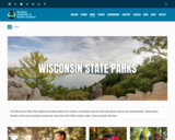
The Wisconsin State Park System provides places for outdoor recreation and for learning about nature and conservation. State parks, forests, trails and recreation areas see more than 20 million visits a year. Come and join the fun!

This site has links to all of the State Parks, Forests, Trails and recreation areas in Wisconsin.

Subject:
Agriculture, Food and Natural Resources
Art and Design
Astronomy
Atmospheric Science
Biology
Botany
Career and Technical Education
Earth and Space Science
Ecology
Education
Elementary Education
Environmental Literacy and Sustainability
Environmental Science
Fine Arts
Forestry and Agriculture
Geography
Geology
Higher Education
Life Science
Marketing, Management and Entrepreneurship
Social Studies
Material Type:
Other
Reference Material
Author:
Wisconsin Department of Natural Resources
Date Added:
04/24/2024
Wisconsin Surface Water Data Viewer
Conditional Remix & Share Permitted
CC BY-NC
Rating
0.0 stars

The Surface Water Data Viewer is a mapping tool for the State of Wisconsin. It provides interactive web mapping tools for a variety of datasets, including chemistry, physical, and biological data. The data managed in layers that can be turned on and off as needed. The Homepage of the Surface Water Data Viewer (SWDV) has many commonly used features labeled. Descriptions of the features are as follows:

Toolbars: There are a variety of toolbars with different themes to help complete tasks using the SWDV. The toolbars can be used to display the layers available to the map, add or remove shapes, text, or measurement features, identify points, print maps, and more!

Search Bar: Using the search bar, you can search monitoring stations by number, locations by keyword, and waterbodies by WBIC. Be careful when using the search bar, partial matches do not always appear in the results.

Navigation Pane: The navigation pane is where results will appear from searches, where you are able to select layers for the map, and features for printing. You will be able to refine the data that is shown here, if desired. You can hide the navigation pane by clicking the left-facing arrow at the top.

Coordinates and Coordinate System: The coordinates will display for any point moused-over on the map. Click the black triangle to select your preferred method for displaying lat/long (DD, DMS, DDM, Mercator). The right-most option in this pane allows you to manually manage thescale of the map. Click on the scale tool, and selected the desired scale at which you wish to view the map. Select Go to implement changes.

Scale Bar: The scale bar shows the current extent of the map.

Whole State View: This view describes what is being shown on the main map relative to the entire state. A blue rectangle will cover the region of the state being shown on the map. You can also navigate the map by moving the blue square around the state-view map. If you print a map, this whole state view will print in the corner as a reference. You can minimize this view by clicking the corner-facing arrow in the top left edge of the box.

Show/Hide Toolbar: Use this button to hide the toolbar for a larger view of the map. If you have hidden the toolbar, you can also use this button to show it again.

Subject:
Agriculture, Food and Natural Resources
American Indian Studies
Biology
Botany
Career and Technical Education
Earth and Space Science
Ecology
Education
Elementary Education
Environmental Science
Forestry and Agriculture
Geography
Geology
Higher Education
Hydrology
Life Science
Social Studies
Material Type:
Activity/Lab
Homework/Assignment
Learning Task
Lecture
Lesson
Author:
Wisconsin Department of Natural Resources
Date Added:
03/12/2024
Wisconsin's historical Earthquakes - Latest Earthquakes in World - USGS
Only Sharing Permitted
CC BY-NC-ND
Rating
0.0 stars

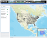
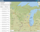
This is a map showing the location and severity of each of the Earthquakes which have occurred in Wisconsin in recorded history. This site is also where one can find recent or historic earthquakes, lists, information on selected significant earthquakes, earthquake resources by state, or find webservices.

Subject:
Earth and Space Science
Education
Elementary Education
Forestry and Agriculture
Geography
Geology
Life Science
Social Studies
Material Type:
Activity/Lab
Diagram/Illustration
Homework/Assignment
Lecture
Author:
USGS (US Geological Survey)
Date Added:
03/12/2024
A Workshop on Geographic Information Systems, Fall 2005
Conditional Remix & Share Permitted
CC BY-NC-SA
Rating
0.0 stars

This class uses lab exercises and a workshop setting to help students develop a solid understanding of the planning and public management uses of geographic information systems (GIS). The goals are to help students: acquire technical skills in the use of GIS software; acquire qualitative methods skills in data and document gathering, analyzing information, and presenting results; and investigate the potential and practicality of GIS technologies in a typical planning setting and evaluate possible applications. The workshop teaches GIS techniques and basic database management at a level that extends somewhat beyond the basic thematic mapping and data manipulation skills included in the MCP core classes (viz. 11.204 and 11.220). Instead of focusing on one thematic map of a single variable, students will concentrate on more open-ended planning questions that invite spatial analysis but will require judgment and exploration to select relevant data and mapping techniques; involve mixing and matching new, local data with extracts from official records (such as census data, parcel data and regional employment and population forecasts); utilize spatial analysis techniques such as buffering, address matching, overlays; use other modeling and visualization techniques beyond thematic mapping; and raise questions about the skills, strategy, and organizational support needed to sustain such analytic capability within a variety of local and regional planning settings. Students seeking graduate credit should enroll in the subject 11.520; undergraduates should enroll in the subject 11.188. The subjects meet together and have nearly identical content. ArcGIS/ArcMap/ArcInfo Graphical User Interface is the intellectual property of ESRI and is used herein with permission. Copyright ĺŠ ESRI. All rights reserved.

Subject:
Geography
Social Studies
Material Type:
Full Course
Provider:
M.I.T.
Provider Set:
M.I.T. OpenCourseWare
Author:
Ferreira, Joseph, Jr.
Date Added:
01/01/2005
World Geography Investigation 5 – Why is water access unequal in and around Mexico City?
Conditional Remix & Share Permitted
CC BY-NC
Rating
0.0 stars

This unit from the Read.Inquire.Write project out of the University of Michigan examines an important geographical and socio-economic political question. Students investigate five unique sources to practice important disciplinary literacy skills within the context of a topic that has significant real world implications. The unit also features an authentic summative assessment task.

Read a review of standards alignment: https://docs.google.com/document/d/1TmEjnt7iYYDhYphhwyX_zcJT9cQST1tYG7ByOaPlVM8/edit#

Subject:
Civics and Government
Geography
Social Studies
Material Type:
Activity/Lab
Assessment
Case Study
Lesson Plan
Primary Source
Rubric/Scoring Guide
Teaching/Learning Strategy
Unit of Study
Author:
Read.Inquire.Write
Date Added:
12/21/2021
A World of Weather: Fundamentals of Meteorology, Chapter 17
Conditional Remix & Share Permitted
CC BY-NC-SA
Rating
0.0 stars

This series of Web pages contains the material in Chapter 17: Numerical Weather Prediction, which is part of the fifth edition of the textbook / laboratory manual, A World of Weather: Fundamentals of Meteorology

Subject:
Earth and Space Science
Geography
Geology
Social Studies
Material Type:
Activity/Lab
Full Course
Textbook
Provider:
Pennsylvania State University
Provider Set:
Penn State, College of EMS
Author:
Lee Grenci and Jon Nese
Date Added:
11/09/2017