Updating search results...

Search Resources

32 Results

View
Selected filters:
  • groundwater
WGNHS – Wisconsin Geological and Natural History Survey – UW–Madison
Only Sharing Permitted
CC BY-NC-ND
Rating
0.0 stars

The Wisconsin Geological and Natural History Survey (WGNHS) has been serving Wisconsin for over 125 years. Part of the Division of Extension at the University of Wisconsin–Madison, WGNHS provides objective scientific information about the geology, mineral resources, and water resources of Wisconsin. We conduct research, map Wisconsin’s geology, and share information through our publications and outreach.

WGNHS has been producing geologic maps, scientific reports, and more for over 125 years. Our publications catalog offers thousands of maps, reports, datasets, and other publications—all of which are available to view and download for free.

The Wisconsin Geological and Natural History Survey (WGNHS) was created by the Wisconsin Legislature in 1897. It is the descendant of earlier state surveys in Wisconsin, which date back to 1854.

WGNHS, part of the Division of Extension at the University of Wisconsin–Madison, is an interdisciplinary organization that conducts natural resources surveys and research to produce information used for decision-making, problem-solving, planning, management, development, and education. Survey is defined to include resource inventory as well as basic and applied research and analysis. WGNHS has no specific regulatory or enforcement responsibilities.

Mission of WGNHS:
Understanding the earth • Charting its history • Sustaining its resources
The Survey conducts earth-science surveys, field studies, and research.

We provide objective scientific information about the geology, water resources, and mineral resources of Wisconsin.

We collect, interpret, disseminate, and archive natural resource information.

We communicate the results of our activities through publications, technical talks, our website, social media, and responses to inquiries from the public.

These activities support informed decision making by government, industry, business, and individual residents of Wisconsin.

Subject:
Agriculture, Food and Natural Resources
Archaeology
Biology
Botany
Career and Technical Education
Civics and Government
Earth and Space Science
Ecology
Education
Environmental Science
Forestry and Agriculture
Geography
Geology
Higher Education
Hydrology
Life Science
Social Studies
Material Type:
Activity/Lab
Diagram/Illustration
Homework/Assignment
Other
Date Added:
03/04/2024
WI Well Water Viewer - Private Well Data for Wisconsin - Center for Watershed Science and Education at UW-Stevens Point
Unrestricted Use
CC BY
Rating
0.0 stars

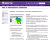
The WI Well Water Quality Interactive Viewer was created as an educational tool to help people better understand Wisconsin's groundwater resources. Communities or individuals have used it to:

See what is known about general well water quality in Wisconsin.
Compare water quality in different areas.
Raise awareness of local groundwater quality issues.
Promote testing and outreach efforts.
Encourage well testing in areas where little data exists.
The viewer relies on voluntarily submitted well water samples from homeowners and other well water data collected by state agencies over the past 25 years. This includes private well water quality data from the Center for Watershed Science and Education, the WI Dept. of Ag, Trade and Consumer Protection, and the WI Department of Natural Resources Groundwater Retrieval Network, Eau Claire County Health Dept and La Crosse County Health Dept.

The WI Well Water Viewer does not represent well water quality information for all known private wells. This information is not intended to be a substitute for well water testing and the viewer does not provide site specific information for an individual well or property. The Center for Watershed Science and Education is not responsible for misuse or misinterpretation of the data.

The compilation of data was assisted by a grant through the Environmental Public Health Tracking Program through the WI Department of Health Services.

Subject:
Career and Technical Education
Earth and Space Science
Environmental Science
Family and Consumer Sciences
Geology
Health Science
Hydrology
Life Science
Nutrition Education
Material Type:
Data Set
Interactive
Author:
David Mechenich
Center for Watershed Science and Education
Date Added:
02/20/2024
Water Remediation Lab
Read the Fine Print
Educational Use
Rating
0.0 stars

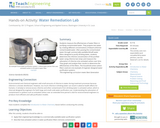
Students measure the effectiveness of water filters in purifying contaminated water. They prepare test water by creating different concentrations of bleach (chlorine-contaminated) water. After passing the contaminated water through commercially available Brita® water filters designed to purify drinking water, students determine the chlorine concentration of the purified water using chlorine test strips and measure the adsorption of chlorine onto activated carbon over time. They graph and analyze their results to determine the effectiveness of the filters. The household active carbon filters used are one example of engineer-designed water purification systems.

Subject:
Career and Technical Education
Chemistry
Physical Science
Technology and Engineering
Material Type:
Activity/Lab
Provider:
TeachEngineering
Provider Set:
TeachEngineering NGSS Aligned Resources
Author:
Barry Williams
Carleigh Samson
GK-12 Program,
Jessica Ray
Phyllis Balcerzak
Date Added:
09/18/2014
Watershed Balance
Read the Fine Print
Educational Use
Rating
0.0 stars

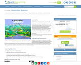
Students learn about the water cycle and its key components. First, they learn about the concept of a watershed and why it is important in the context of engineering hydrology. Then they learn how we can use the theory of conservation of mass to estimate the amount of water that enters a watershed (precipitation, groundwater flowing in) and exits a watershed (evaporation, runoff, groundwater out). Finally, students learn about runoff and how we visualize runoff in the form of hydrographs.

Subject:
Career and Technical Education
Earth and Space Science
Hydrology
Technology and Engineering
Material Type:
Lesson Plan
Provider:
TeachEngineering
Provider Set:
TeachEngineering NGSS Aligned Resources
Author:
Emily Gill, Malinda Schaefer Zarske
Integrated Teaching and Learning Program,
Date Added:
09/18/2014
What's Down the Well?
Read the Fine Print
Educational Use
Rating
0.0 stars

Students learn about physical models of groundwater and how environmental engineers determine possible sites for drinking water wells. During the activity, students create their own groundwater well models using coffee cans and wire screening. They add red food coloring to their models to see how pollutants can migrate through the groundwater into a drinking water resource.

Subject:
Career and Technical Education
Earth and Space Science
Hydrology
Technology and Engineering
Material Type:
Activity/Lab
Provider:
TeachEngineering
Provider Set:
TeachEngineering NGSS Aligned Resources
Author:
Integrated Teaching and Learning Program,
Janet Yowell
Malinda Schaefer Zarske
Melissa Straten
Date Added:
10/14/2015
Where Does All the Water Go?
Read the Fine Print
Educational Use
Rating
0.0 stars

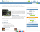
The best way for students to understand how groundwater flows is to actually see it. In this activity, students will learn the vocabulary associated with groundwater and see a demonstration of groundwater flow. Students will learn about the measurements that environmental engineers need when creating a groundwater model of a chemical plume.

Subject:
Career and Technical Education
Earth and Space Science
Hydrology
Technology and Engineering
Material Type:
Activity/Lab
Provider:
TeachEngineering
Provider Set:
TeachEngineering NGSS Aligned Resources
Author:
Integrated Teaching and Learning Program,
Date Added:
10/14/2015
Where Has All the Water Gone?
Read the Fine Print
Educational Use
Rating
0.0 stars

Students learn about the Earth's water cycle, especially about evaporation. Once a dam is constructed, its reservoir becomes a part of the region's natural hydrologic cycle by receiving precipitation, storing runoff water and evaporating water. Although almost impossible to see, and not as familiar to most people as precipitation, evaporation plays a critical role in the hydrologic cycle, and is especially of interest to engineers designing new dams and reservoirs, such as those that Splash Engineering is designing for Thirsty County.

Subject:
Career and Technical Education
Earth and Space Science
Hydrology
Technology and Engineering
Material Type:
Lesson Plan
Provider:
TeachEngineering
Provider Set:
TeachEngineering NGSS Aligned Resources
Author:
Denise W. Carlson
Integrated Teaching and Learning Program,
Jeff Lyng
Kristin Field
Date Added:
09/18/2014
Who's Down the Well?
Read the Fine Print
Educational Use
Rating
0.0 stars

Drinking water comes from many different sources, including surface water and groundwater. Environmental engineers analyze the physical properties of groundwater to predict how and where surface contaminants will travel. In this lesson, students will learn about several possible scenarios of contamination to drinking water. They will analyze the movement of example contaminants through groundwater such as environmental engineers must do (i.e., engineers identify and analyze existing contamination of water sources in order to produce high quality drinking water for consumers).

Subject:
Career and Technical Education
Earth and Space Science
Hydrology
Technology and Engineering
Material Type:
Activity/Lab
Lesson Plan
Provider:
TeachEngineering
Provider Set:
TeachEngineering NGSS Aligned Resources
Author:
Integrated Teaching and Learning Program,
Janet Yowell
Malinda Schaefer Zarske
Melissa Straten
Date Added:
09/18/2014
Wisconsin Geological and Natural History Survey - Publications Catalog
Only Sharing Permitted
CC BY-NC-ND
Rating
0.0 stars

The Wisconsin Geological and Natural History Survey (WGNHS) has been serving Wisconsin for over 125 years. Part of the Division of Extension at the University of Wisconsin–Madison, WGNHS provides objective scientific information about the geology, mineral resources, and water resources of Wisconsin. We conduct research, map Wisconsin’s geology, and share information through our publications and outreach.

This is the link to the Publications Catalog that includes Wisconsin Data sets and maps for: Bedrock Geology, Groundwater, Surficial Geology, Rocks and Minerals, Soils, Precambrian Bedrock, Surface Water, Metallic Minerals, Topography, Nonmetallic Minerals, Climate and Weather, and Frac Sand.

Subject:
Biology
Career and Technical Education
Earth and Space Science
Ecology
Education
Elementary Education
Environmental Science
Family and Consumer Sciences
Forestry and Agriculture
Geology
Health Science
Higher Education
Hydrology
Life Science
Marketing, Management and Entrepreneurship
Material Type:
Activity/Lab
Diagram/Illustration
Interactive
Lecture
Author:
Wisconsin Geological and Natural History Survey
Date Added:
03/12/2024
Wisconsin Water Condition Viewer - Wisconsin DNR
Only Sharing Permitted
CC BY-NC-ND
Rating
0.0 stars

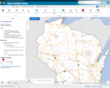
The Water Condition Viewer (WCV) is an interactive mapping tool that focuses on water condition, monitoring, assessment and management data. Data includes Clean Water Act, Monitoring Projects, Healthy Watersheds Assessments, Targeted Watershed Assessments, Wastewater Evaluation, Watershed Planning, County Land and Water Plans, Nine Key Element Plans and more. All datasets from specialized themes are available from this main, general set of layers.

Subject:
Agriculture, Food and Natural Resources
Biology
Botany
Career and Technical Education
Earth and Space Science
Ecology
Education
Elementary Education
Environmental Literacy and Sustainability
Environmental Science
Family and Consumer Sciences
Forestry and Agriculture
Geology
Health Education
Health Science
Hydrology
Life Science
Marketing, Management and Entrepreneurship
Material Type:
Activity/Lab
Homework/Assignment
Lecture
Lesson
Author:
Wisconsin Department of Natural Resources
Date Added:
03/12/2024
Wisconsin Water Quantity Data Viewer - Wisconsin DNR
Only Sharing Permitted
CC BY-NC-ND
Rating
0.0 stars

This map viewer was created for use by the general public to view water quantity data collected by Wisconsin DNR (WDNR), the US Geological Survey (UGSG) and the Wisconsin Geological and Natural History Survey (WGNHS).

This viewer also provides a means for the public to view pending high capacity well applications and recently approved wells. As required by Wisconsin law, these locations are generalized to display at the public land survey section level. Therefore, any well or surface water intake is symbolized by the section in which is located. Clicking identify on sections may return multiple records, one for each data point. This viewer contains a number of layer groups:

Well Applications and Approvals – This layer displays the locations of pending and approved high capacity well applications. It includes:
High capacity wells that have been applied for by the owner but have not yet been approved by the Department
High capacity wells approved in the last 30 days
High capacity wells approved by WDNR but that have not yet been constructed

High Capacity Withdrawal Locations – This layer show the location of high capacity wells constructed and available for use as well as currently registered high capacity surface water withdrawals. It includes:

Existing high capacity wells
Existing surface water withdrawals

USGS Water Quantity Monitoring – This layer shows the locations of groundwater level monitoring points, streamflow gages, and lake level gages monitored and recorded by USGS. It includes currently active monitoring locations as well as historical monitoring locations. Symbol sizes are scaled according to the number of measurements taken at each location.

WDNR Water Quantity Monitoring Groundwater Protection Features – This layer shows the locations of streamflow and lake level measurements maintained by WDNR. It includes a variety of measurement types taken by WDNR staff, partner organizations, county staff and volunteers.

WGNHS Spring Monitoring – This layer shows the location of springs surveyed by WGNHS staff between 2015 and 2017. Note that spring flow varies seasonally and annually. In addition, many spring locations are located on private land and not accessible by the public without landowner permission.

Groundwater Protection Features – This layer displays the locations of groundwater protection features as defined by Wisconsin Rule NR820. It includes trout streams, outstanding and exceptional water resources, and springs with a flow rate surveyed by WGNHS of 1 cubic foot per second (CFS) or greater. Note that all 1 CFS may not have been surveyed.

Guidance for how to use WDNR Geocortex viewers can be found here. For more information, please contact the water use section at 608-266-2299 or at DNRWATERUSEREGISTRATION@wisconsin.gov

Subject:
Agriculture, Food and Natural Resources
Biology
Business and Information Technology
Career and Technical Education
Earth and Space Science
Ecology
Education
Elementary Education
Environmental Science
Forestry and Agriculture
Geology
Health Science
Higher Education
Hydrology
Life Science
Marketing, Management and Entrepreneurship
Material Type:
Activity/Lab
Homework/Assignment
Lecture
Lesson
Author:
Wisconsin Department of Natural Resources
Date Added:
03/12/2024