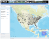
The National Water Information System (NWIS) Mapper provides access to over 1.5 …
The National Water Information System (NWIS) Mapper provides access to over 1.5 million sites contained in the USGS National Water Information System (NWIS), including sites where current and historical surface-water, groundwater, springs, and atmospheric data has been collected. Users can search by site type, data type, site number, or place.
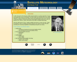
In this interactive, online module, students learn about satellite orbits (geostationary and …
In this interactive, online module, students learn about satellite orbits (geostationary and polar), remote-sensing satellite instruments (radiometers and sounders), satellite images, and the math and physics behind satellite technology. The module is part of an online course for grades 7-12 in satellite meteorology, which includes 10 interactive modules. The site also includes lesson plans developed by teachers and links to related resources. Each module is designed to serve as a stand-alone lesson, however, a sequential approach is recommended. Designed to challenge students through the end of 12th grade, middle school teachers and students may choose to skim or skip a few sections.
In this problem-based learning (PBL) scenario, students prepare a presentation for investors …
In this problem-based learning (PBL) scenario, students prepare a presentation for investors showing how their fishing company has a significant advantage because it locates upwelling zones and fishing areas using TRMM (Tropical Rainfall Measuring Mission) and other satellite data. Prior to launching the PBL, students learn about wind: the topics of air pressure, coriolis effect, upwelling and the role of differential heating on the atmosphere are explored in classroom demonstrations. Materials required include a beaker, coffee grounds, drinking straw, balloon, flashlight, and turntable. The resource includes teacher background information, glossary, assessment rubric, and an appendix introducing problem-based learning.
No restrictions on your remixing, redistributing, or making derivative works. Give credit to the author, as required.
Your remixing, redistributing, or making derivatives works comes with some restrictions, including how it is shared.
Your redistributing comes with some restrictions. Do not remix or make derivative works.
Most restrictive license type. Prohibits most uses, sharing, and any changes.
Copyrighted materials, available under Fair Use and the TEACH Act for US-based educators, or other custom arrangements. Go to the resource provider to see their individual restrictions.