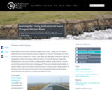
An interactive map based on four decades of satellite images helps residents, …
An interactive map based on four decades of satellite images helps residents, resource managers, and stewards of the land anticipate and plan for coastal change.
In this lesson, students learn that navigational techniques change when people travel …
In this lesson, students learn that navigational techniques change when people travel to different places land, sea, air and in space. For example, an explorer traveling by land uses different methods of navigation than a sailor or an astronaut.
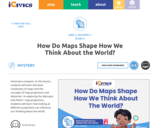
"In this lesson, students will learn the basic vocabulary of maps and …
"In this lesson, students will learn the basic vocabulary of maps and the concepts of map projections and distortion. In exploring the Mercator and Peters' map projections, students will learn how looking at different projections can influence our thinking about the world."
Geology is a core science, along with physics, chemistry, and biology. It …
Geology is a core science, along with physics, chemistry, and biology. It uses rigorous methods of inquiry that illuminate the history of the earth and its present-day geological activity. Geology allows us to discover how earthŰŞs history and activity determine the state of the planet and its life forms. The study of geology also shows us how human behavior affects the earth. Topics we will cover include plate tectonics, earthquakes, volcanoes, rocks, minerals, geologic time, glaciers, rivers, geologic structures, layers of the earth, and reading maps. This course includes laboratory work and lab credit.Login: guest_oclPassword: ocl
This is a collection of three lessons that can be added to …
This is a collection of three lessons that can be added to the lessons about energy for fourth graders after the students have created a model of the concept of transfer of energy, before or after they have discussed renewable energy as an option. Skills could be reading a map or a graph and gathering useful information, discussing it and coming up with what the information meant. Intelligence was another pursuit. Intelligence meant more than knowing things. It meant knowing things and being able to apply it to the real world as useful information and action. As you learn something, you are also aware of yourself and those around you. Knowledge is intelligence when it can be used for good in the community. It can be useful for everyone and your job is to help apply it and share it with others with this in mind. Write these two pursuits on the board and a quick definition or a student created definition.
In this task students figure out how to draw the longest line …
In this task students figure out how to draw the longest line on a map of the United States without hitting a border. They use color and line plots to keep track of their results.
Museum of Modern Art Learning Resources. Tools and strategies for engaging with …
Museum of Modern Art Learning Resources. Tools and strategies for engaging with modern and cotemporary art. Download and customize slideshows, worksheets and other resources for use in the classroom or for independent study. Has follow-up questions, hands- on activities and other opportunities for enrichment beyond the traditional classroom setting. Utilizes Video, pdf, blogs, E-News, Twitter, FB, Google+ Flickr You can browse by Themes or by Artists. they have an Advanced Placement Art History Exam, Abstract Expressionism, Cubism, Dada, Design, Investigating Identy, and much more.
This course is a friendly introduction to Geographic Information Science and related …
This course is a friendly introduction to Geographic Information Science and related Technologies, reflecting current state-of-the-art and practice. GIScience is the intersection of professions, institutions, and technologies that produce geographic data and render information from it. It is a rapidly growing and evolving field. Learning is a way of life for everyone who is successful in todays every changing world. With this in mind, we hope that this text may contribute to your lifelong exploration of how geographic information and related technologies that generate it can be used to improve the quality of life--yours and your neighbors', locally and globally, now and in the future.
This earth systems field lab begins with an in-class guided inquiry experience …
This earth systems field lab begins with an in-class guided inquiry experience which uses Minnesota Geological Survey 3-D maps of the upper Midwest to determine where they believe glaciers may have had an influence. They will determine this by looking at landscapes and compiling their own evidence from the maps. They will also offer evidence for a hypothesis they generate which involves the direction that the glacier was traveling.
This course brings together core concepts in cartography, geographic information systems, and …
This course brings together core concepts in cartography, geographic information systems, and spatial thinking with real-world examples to provide the fundamentals necessary to engage with Geography beyond the surface-level. We will explore what makes spatial information special, how spatial data is created, how spatial analysis is conducted, and how to design maps so that theyre effective at telling the stories we wish to share. To gain experience using this knowledge, we will work with the latest mapping and analysis software to explore geographic problems.
In this activity, students explore the importance of charts to navigation on …
In this activity, students explore the importance of charts to navigation on bodies of water. Using one worksheet, students learn to read the major map features found on a real nautical chart. Using another worksheet, students draw their own nautical chart using the symbols and identifying information learned.
Our Open Web Mapping course (GEOG 585) teaches students how to publish …
Our Open Web Mapping course (GEOG 585) teaches students how to publish geographic data and maps through the use of open-source web mapping standards and software. Such a solution is best suited for situations that involve the sharing of large datasets (particularly those with line or polygon geometry) or that require a relatively advanced interface. This course teaches how to build mapping applications using two APIs (specifically, the Google Maps API and Esri's JavaScript API). Such applications are often referred to as mashups, because they bring together data from multiple sources to produce a new product. The advantages of building a map application via this route are that background layers are provided by the company who wrote the API and that the learning curve for using the APIs is less steep than learning how to build comparable applications with open web mapping software. By the end of this course, you will be able to build a fairly sophisticated mapping application that would require a lot more effort and cost to replicate through other means.
This course provides students with the opportunity to develop a map of …
This course provides students with the opportunity to develop a map of contemporary architectural practice and discourse. The seminar examines six themes in terms of their recent history: city and global economy, urban plan and map of operations, program and performance, drawing and scripting, image and surface, and utopia and projection. Students will study buildings and read relevant texts in order to place recent architectural projects in disciplinary and cultural context.
In this activity, students will review and evaluate the ways land is …
In this activity, students will review and evaluate the ways land is covered and used in their local community. They will also consider the environmental effects of the different types of land use. Students will act as community planning engineers to determine where to place a new structure that will have the least effect on the environment.
The main aims of this seminar will be to go over the …
The main aims of this seminar will be to go over the classification of surfaces (Enriques-Castelnuovo for characteristic zero, Bombieri-Mumford for characteristic p), while working out plenty of examples, and treating their geometry and arithmetic as far as possible.
This website has video clips, maps, and images of the U.S. Antartartic …
This website has video clips, maps, and images of the U.S. Antartartic areas. There are 3 live webcams of the current U.S. antarctic stations, various video clips, podcasts, maps and images of Antarctica.
No restrictions on your remixing, redistributing, or making derivative works. Give credit to the author, as required.
Your remixing, redistributing, or making derivatives works comes with some restrictions, including how it is shared.
Your redistributing comes with some restrictions. Do not remix or make derivative works.
Most restrictive license type. Prohibits most uses, sharing, and any changes.
Copyrighted materials, available under Fair Use and the TEACH Act for US-based educators, or other custom arrangements. Go to the resource provider to see their individual restrictions.