These handouts accompany the 5th Grade Rain Garden Design Challenge Lesson Plan. …
These handouts accompany the 5th Grade Rain Garden Design Challenge Lesson Plan. The handouts give criteria for identifying areas of erosion and non-point source pollution entering waterways on school property, slope and soil suitability criteria for situating the rain garden, and data collection procedures for phosphate testing. The handouts also include guidelines and criteria for the final poster presentation design and Claim-Evidence-Reasoning, as well as rubrics for scoring and guidelines for peer feedback.
This lesson engages 5th grade students in identifying areas of erosion and …
This lesson engages 5th grade students in identifying areas of erosion and non-point source pollution entering waterways on school property, making a claim on the most suitable site to locate a rain garden by conducting field tests on slope and soil type, and testing for the presence of phosphates in waterways on school forest property. Students then compete in a rain garden design challenge using their data to create a poster presentation, including a map and claim evidence reasoning, for the best rain garden design plan, scored using a rubric.
Finding themselves in the middle of the Amazon rainforest after a plane …
Finding themselves in the middle of the Amazon rainforest after a plane crash, students use map scales, keys, and longitude and latitude coordinates to figure out where they are. Then they work in groups to generate ideas and make plans. They decide where they should go to be rescued, the distance to that location, the route to take, and make calculations to estimate walking travel time.
In this lesson, students learn that navigational techniques change when people travel …
In this lesson, students learn that navigational techniques change when people travel to different places land, sea, air and in space. For example, an explorer traveling by land uses different methods of navigation than a sailor or an astronaut.
In this lesson, students find their location on a map using Latitude …
In this lesson, students find their location on a map using Latitude and Longitudinal coordinates. They determine where they should go to be rescued and how best to get there.
Geographic information systems (GIS), once used predominantly by experts in cartography and …
Geographic information systems (GIS), once used predominantly by experts in cartography and computer programming, have become pervasive in everyday business and consumer use. This unit explores GIS in general as a technology about which much more can be learned, and it also explores applications of that technology. Students experience GIS technology through the use of Google Earth on the environmental topic of plastics in the ocean in an area known as the Great Pacific Garbage Patch. The use of this topic in GIS makes the unit multidisciplinary, incorporating the physics of ocean currents, the chemistry associated with pollutant degradation and chemical sorption to organic-rich plastics, and ecological impact to aquatic biota.
Explores the changing map of the public and the private in pre-industrial …
Explores the changing map of the public and the private in pre-industrial and modern societies and examines how that map affected men's and women's production and consumption of goods and leisure. The reproductive strategies of women, either in conjunction with or in opposition to their families, is another major theme. How did an ideal of the "domestic" arise in the early modern west, and to what extent did it limit the economic position of women? How has it been challenged, and with what success, in the post-industrial period? Focuses on western Europe since the Middle Ages and on the United States, but some attention to how these issues have played themselves out in non-Western cultures. This course will explore the relation of women and men in both pre-industrial and modern societies to the changing map of public and private (household) work spaces, examining how that map affected their opportunities for both productive activity and the consumption of goods and leisure. The reproductive strategies of women, either in conjunction with or in opposition to their families, will be the third major theme of the course. We will consider how a place and an ideal of the "domestic" arose in the early modern west, to what extent it was effective in limiting the economic position of women, and how it has been challenged, and with what success, in the post-industrial period. Finally, we will consider some of the policy implications for contemporary societies as they respond to changes in the composition of the paid work force, as well as to radical changes in their national demographic profiles. Although most of the material for the course will focus on western Europe since the Middle Ages and on the United States, we will also consider how these issues have played themselves out in non-western cultures.
Once widespread here and across North America, elk were eliminated from Wisconsin …
Once widespread here and across North America, elk were eliminated from Wisconsin in the 1880s due to unregulated hunting and habitat loss. Over 130 years later, they once again live in our state's central and northern forest regions. From a population of 25 elk reintroduced in 1995, and with the help of the second reintroduction effort that started in 2015, the state's total elk population has now surpassed 400 animals.
Thanks to the support of multiple partners and the backing of Wisconsin citizens, the bugle of rutting September bulls is back and here to stay!
Elk (Cervus canadensis) is one of North America's most significant deer family members (Cervidae), second only to moose. Wisconsin's native elk (before European settlement) belonged to the Eastern elk subspecies (C. c. canadensis), believed to have gone extinct during the late 1800s. The Rocky Mountain sub-species (C. c. nelsoni) was later used in reintroduction efforts in Wisconsin and other eastern U.S. states.
Elk is one of three members of the deer family that lives in Wisconsin regularly, with the other two being white-tailed deer (Odocoileus virginianus) and moose (Alces alces). Elk are approximately three times larger than deer and about two-thirds the size of moose. Adult elk are light tan-colored with a darker mane on their neck with a distinct buff-colored rump patch and stub tail.
Elk vary in size by sex. A mature cow stands approximately four and a half feet tall at the shoulder, six and a half feet in length from nose to tail and weighs 500-650 pounds. In contrast, a mature bull may stand five feet or more at the shoulder, stretch over eight feet long and weigh 600-900 pounds. Wisconsin elk calves typically weigh between 35-40 pounds at birth. Calves are born with white spots to help them blend into their surroundings during their first few months. Elk are also a herd-associated species that have many vocalizations and unique characteristics.
In this lesson, students learn how to determine location by triangulation. We …
In this lesson, students learn how to determine location by triangulation. We describe the process of triangulation and practice finding your location on a worksheet, in the classroom, and outdoors.
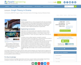
Students use graph theory to create social graphs for their own social …
Students use graph theory to create social graphs for their own social networks and apply what learn to create a graph representing the social dynamics found in a dramatic text. Students then derive meaning based on what they know about the text from the graphs they created. Students learn graph theory vocabulary, as well as engineering applications of graph theory.
Students analyze their social networks using graph theory. They gather data on …
Students analyze their social networks using graph theory. They gather data on their own social relationships, either from Facebook interactions or the interactions they have throughout the course of a day, recording it in Microsoft Excel and using Cytoscape (a free, downloadable application) to generate social network graphs that visually illustrate the key persons (nodes) and connections between them (edges). The nodes in the Cytoscape graphs are color-coded and sized according to the importance of the node (in this activity, nodes are people in students' social networks). After the analysis, the graphs are further examined to see what can be learned from the visual representation. Students gain practice with graph theory vocabulary, including node, edge, betweeness centrality and degree on interaction, and learn about a range of engineering applications of graph theory.
The marine environment is unique and requires technologies that can use sound …
The marine environment is unique and requires technologies that can use sound to gather information since there is little light underwater. The sea-floor is characterized using underwater sound and acoustical systems. Current technological innovations are allowing scientists to further understand and apply information about animal locations and habitat. Remote sensing and exploration with underwater vehicles allows scientists to map and understand the sea floor, and in some cases, the water column. In this lesson, the students will be shown benthic habitat images produced by GIS. These imaged will lead to a class discussion on why habitat mapping is useful and how current technology works to make bathymetry mapping possible. The teacher will then ask inquiry-based questions to have students brainstorm about the importance of bathymetry mapping.
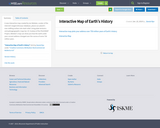
A new interactive map created by Ian Webster, curator of the internet's …
A new interactive map created by Ian Webster, curator of the internet's largest dinosaur database, places our planet's ever-shifting surface into stark relief. Using plate tectonics and paleogeographic maps by C.R. Scotese of the PALEOMAP Project, Webster's map can show you how the earth under your current address changed over the course of some 750 million years.
Historically, seafloor mapping occurred with a simple data collection method: soundings. Soundings …
Historically, seafloor mapping occurred with a simple data collection method: soundings. Soundings are taken by dropping a weight with a pre-measured rope off the side of a boat and noting the measurement on the rope when the weight hits the bottom. In this activity, student teams replicate the creation of seafloor bathymetry by taking a simplified form of soundings of an unseen seafloor model inside a shoebox and translating their collected data into a visualization of the topography, enabling them to better understand and appreciate modern remote sensing.
Students are introduced to the concept of tracking and spatial movements of …
Students are introduced to the concept of tracking and spatial movements of animals in relation to the environments in which they live. Students improve their understanding of animal tracking and how technology is used in this process.
The marine environment is unique and because little light penetrates under water, …
The marine environment is unique and because little light penetrates under water, technologies that use sound are required to gather information. The seafloor is characterized using underwater sound and acoustical systems. Current technological innovations enable scientists to further understand and apply information about animal locations and habitat. Remote sensing and exploration with underwater vehicles enables researchers to map and understand the sea floor. Similar technologies also aid in animal tracking, a method used within science and commercial industries. Through inquiry-based learning techniques, students learn the importance of habitat mapping and animal tracking.
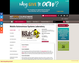
MASLab (Mobile Autonomous System Laboratory) is a robotics contest. The contest takes …
MASLab (Mobile Autonomous System Laboratory) is a robotics contest. The contest takes place during MIT's Independent Activities Period and participants earn 6 units of P/F credit and 6 Engineering Design Points. Teams of three to four students have less than a month to build and program sophisticated robots which must explore an unknown playing field and perform a series of tasks. MASLab provides a significantly more difficult robotics problem than many other university-level robotics contests. Although students know the general size, shape, and color of the floors and walls, the students do not know the exact layout of the playing field. In addition, MASLab robots are completely autonomous, or in other words, the robots operate, calculate, and plan without human intervention. Finally, MASLab is one of the few robotics contests in the country to use a vision based robotics problem.
Normally we find things using landmark navigation. When you move to a …
Normally we find things using landmark navigation. When you move to a new place, it may take you awhile to explore the new streets and buildings, but eventually you recognize enough landmarks and remember where they are in relation to each other. However, another accurate method for locating places and things is using grids and coordinates. In this activity, students will come up with their own system of a grid and coordinates for their classroom and understand why it is important to have one common method of map-making.
In this unit, students learn the very basics of navigation, including the …
In this unit, students learn the very basics of navigation, including the different kinds of navigation and their purposes. The concepts of relative and absolute location, latitude, longitude and cardinal directions are explored, as well as the use and principles of maps and a compass. Students discover the history of navigation and learn the importance of math and how it ties into navigational techniques. Understanding how trilateration can determine one's location leads to a lesson on the global positioning system and how to use a GPS receiver. The unit concludes with an overview of orbits and spacecraft trajectories from Earth to other planets.
Students use their knowledge of scales and areas to determine the best …
Students use their knowledge of scales and areas to determine the best locations in Alabraska for the underground caverns. They cut out rectangular paper pieces to represent caverns to scale with the maps and place the cut-outs on the maps to determine feasible locations.
No restrictions on your remixing, redistributing, or making derivative works. Give credit to the author, as required.
Your remixing, redistributing, or making derivatives works comes with some restrictions, including how it is shared.
Your redistributing comes with some restrictions. Do not remix or make derivative works.
Most restrictive license type. Prohibits most uses, sharing, and any changes.
Copyrighted materials, available under Fair Use and the TEACH Act for US-based educators, or other custom arrangements. Go to the resource provider to see their individual restrictions.