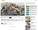
Geography is a major factor in the development of every civilization, including …
Geography is a major factor in the development of every civilization, including ancient Athens. Learn the ways in which the natural features of Athens helped...
Teaching with Historic Places (TwHP) uses historic places in National Parks and …
Teaching with Historic Places (TwHP) uses historic places in National Parks and in the National Park Service's National Register of Historic Places to enliven history, social studies, geography, civics, and other subjects. TwHP has created a variety of products and activities that help teachers bring historic places into the classroom.
Here you’ll find place-based educational resources relating to African American history and culture; including lesson plans and "Curiosity Kits" that are a series of articles that students can read individually or in a small group, in order to spark historical thinking.
This first year Geography textbook takes a holistic approach to Geography by …
This first year Geography textbook takes a holistic approach to Geography by incorporating elements of physical, human and regional geography, as well as bringing in methods and perspectives from spatial information science.. This textbook applies a fundamental geographical approach to understanding our globally changing world by looking at local processes which are linked to larger global processes and events. For example mining and its effects are a global issue and we can see how these unfold in BC. A further example is the recent apology to First Nation peoples on the residential school treatment, as similar events occur in the US, Ireland and Australia. Processes of urbanization, a phenomenon which people all over the globe are experiencing, can be seen in Vancouver with our discussion of the citys development. Geography students, indeed all first year students, need to be able to critically assess their own contexts and environments in order to properly engage with our continually globalizing world.
This is an activity about classifying planetary characteristics. Learners will analyze the …
This is an activity about classifying planetary characteristics. Learners will analyze the provided information about each planet in order to make graphs and Venn diagrams. Then, using both, learners will identify similarities and differences of the planets in the Solar System. This is Activity C-11 as part of The Universe At Your Fingertips curriculum, available for purchase.
This course is organized around seven projects and a capstone assignment. Each …
This course is organized around seven projects and a capstone assignment. Each project includes readings, quizzes, and discussions about concepts and tools in cartography and visualization. Throughout the course, students complete “mile marker” assignments that are designed to help them progress toward the capstone assignment. Through the course projects, students confront realistic problem scenarios that incorporate such skills and concepts as creating symbolization schemes, coordinate systems and map projections, creating isoline and other terrain representations, interpolation, classification schemes, multivariate representation and representation of data uncertainty. Those who successfully complete the course are able to design and produce effective reference and thematic maps using GIS software and can interpret and critique maps and related information graphics.
Geographic information systems (GIS), once used predominantly by experts in cartography and …
Geographic information systems (GIS), once used predominantly by experts in cartography and computer programming, have become pervasive in everyday business and consumer use. This unit explores GIS in general as a technology about which much more can be learned, and it also explores applications of that technology. Students experience GIS technology through the use of Google Earth on the environmental topic of plastics in the ocean in an area known as the Great Pacific Garbage Patch. The use of this topic in GIS makes the unit multidisciplinary, incorporating the physics of ocean currents, the chemistry associated with pollutant degradation and chemical sorption to organic-rich plastics, and ecological impact to aquatic biota.
This short lesson was designed in collaboration with a 7th grade Life …
This short lesson was designed in collaboration with a 7th grade Life Science teacher (Paul Jeffery). The idea behind the lesson is to help students better understand ecological and geographical classifications by teaching them at the same time in their Life Science class and their Geography class. Teaching the two classifications together will help reinforce the idea of classification. While this lesson would best be taught outdoors it can also be adapted to the indoors.
In this lesson, students will be introduced to one of the main …
In this lesson, students will be introduced to one of the main ways that the Great Lakes impact the economy of the region—shipping. Countless ships carry myriad cargo throughout the Great Lakes waterways to various destinations, making the transportation of goods accessible, reliable, and effective. Without the Great Lakes to transport various goods, which are typically shipped in the waterways, many commonly accessible materials would not be available in the ways they are today. This lesson will afford students the chance to see some of that technology in action, as well as see the direct impact that shipping has on the regional commercial industry.
A learning activity for the "Do You Know That Clouds Have Names?" …
A learning activity for the "Do You Know That Clouds Have Names?" book in the Elementary GLOBE series. Students will explore the difference between the three types of contrails, make observations of contrails outside, and record their observations. Fifteen minutes later they will make follow-up observations to see how the contrails they observed have changed. The purpose of the activity is to help students identify contrails and learn to distinguish between the three types of contrails and to understand that contrails are human-made and some contrails become clouds in the sky. Students will be able to (1) identify the three types of contrails; (2) understand that contrails are created by jet airplanes; and (3) understand that some contrails become clouds.
TED Studies, created in collaboration with Wiley, are curated video collections — …
TED Studies, created in collaboration with Wiley, are curated video collections — supplemented by rich educational materials — for students, educators and self-guided learners. In Climate Change, speakers give talks that boldly illuminate the nature and scale of current-day climate science, policy and ethics. They explore the economics and psychology of individual and collective action — or inaction — on climate change in order to assess the costs of our choices and opportunities for change. Relevant areas of interest, study and coursework include: ecology, atmospheric science, oceanography, glaciology, energy development, environmental policy, science in the media, political science, ethics, sociology, behavioral psychology and cultural studies.
This site offers geography and history activities showing how two years in …
This site offers geography and history activities showing how two years in history had an indelible impact on American politics and culture. Students interpret historical maps, identify territories acquired by the U.S., identify states later formed from these territories, examine the territorial status of Texas, and identify political, social, and economic issues related to the expansion of the U.S. in the 1840s.
This lesson is a presentation of famous scientist throughout history where the …
This lesson is a presentation of famous scientist throughout history where the students will learn and take notes about the contributions and discoveries made in science.
Students explore the impact of changing river volumes and different floodplain terrain …
Students explore the impact of changing river volumes and different floodplain terrain in experimental trials with table top-sized riverbed models. The models are made using modeling clay in aluminum baking pans placed on a slight incline. Water added "upstream" at different flow rates and to different riverbed configurations simulates different potential flood conditions. Students study flood dynamics as they modify the riverbed with blockages or levees to simulate real-world scenarios.
This course cultivates a working knowledge of how geospatial professionals can develop …
This course cultivates a working knowledge of how geospatial professionals can develop web mapping applications that bring together data from multiple sources. GEOG 863 will provide students with an understanding of the technology that makes building mashups possible and teaches them how to build their own mashups.
No restrictions on your remixing, redistributing, or making derivative works. Give credit to the author, as required.
Your remixing, redistributing, or making derivatives works comes with some restrictions, including how it is shared.
Your redistributing comes with some restrictions. Do not remix or make derivative works.
Most restrictive license type. Prohibits most uses, sharing, and any changes.
Copyrighted materials, available under Fair Use and the TEACH Act for US-based educators, or other custom arrangements. Go to the resource provider to see their individual restrictions.