These handouts accompany the 5th Grade Rain Garden Design Challenge Lesson Plan. …
These handouts accompany the 5th Grade Rain Garden Design Challenge Lesson Plan. The handouts give criteria for identifying areas of erosion and non-point source pollution entering waterways on school property, slope and soil suitability criteria for situating the rain garden, and data collection procedures for phosphate testing. The handouts also include guidelines and criteria for the final poster presentation design and Claim-Evidence-Reasoning, as well as rubrics for scoring and guidelines for peer feedback.
This lesson engages 5th grade students in identifying areas of erosion and …
This lesson engages 5th grade students in identifying areas of erosion and non-point source pollution entering waterways on school property, making a claim on the most suitable site to locate a rain garden by conducting field tests on slope and soil type, and testing for the presence of phosphates in waterways on school forest property. Students then compete in a rain garden design challenge using their data to create a poster presentation, including a map and claim evidence reasoning, for the best rain garden design plan, scored using a rubric.
In this activity, students explore the effect of chemical erosion on statues …
In this activity, students explore the effect of chemical erosion on statues and monuments. They use chalk to see what happens when limestone is placed in liquids with different pH values. They also learn several things that engineers are doing to reduce the effects of acid rain.
Students learn about the differences between types of water (surface and ground), …
Students learn about the differences between types of water (surface and ground), as well as the differences between streams, rivers and lakes. Then, they learn about dissolved organic matter (DOM), and the role it plays in identifying drinking water sources. Finally, students are introduced to conventional drinking water treatment processes.
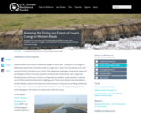
An interactive map based on four decades of satellite images helps residents, …
An interactive map based on four decades of satellite images helps residents, resource managers, and stewards of the land anticipate and plan for coastal change.
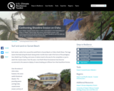
Each winter, massive waves attract surfers and visitors to the North Shore …
Each winter, massive waves attract surfers and visitors to the North Shore of Oahu in Hawaii. Some years, the waves cause severe erosion, and continuing sea level rise will accelerate this issue. Residents and the state are taking steps to preserve homes and beaches.
Students learn about using renewable energy from the Sun for heating and …
Students learn about using renewable energy from the Sun for heating and cooking as they build and compare the performance of four solar cooker designs. They explore the concepts of insulation, reflection, absorption, conduction and convection.
Students are briefly introduced to Maxwell's equations and their significance to phenomena …
Students are briefly introduced to Maxwell's equations and their significance to phenomena associated with electricity and magnetism. Basic concepts such as current, electricity and field lines are covered and reinforced. Through multiple topics and activities, students see how electricity and magnetism are interrelated.
This activity is a field investigation where students find real-life examples of …
This activity is a field investigation where students find real-life examples of erosion in their school surroundings. Students will extend what they learned during stream table lessons about erosion, deposition, deltas, meandering streams, and dams.
Students learn about water erosion through an experimental process in which small-scale …
Students learn about water erosion through an experimental process in which small-scale buildings are placed along a simulated riverbank to experience a range of flooding conditions. They learn how soil conditions are important to the stability or failure of civil engineering projects and how a river's turns and bends (curvature, sinuosity) make a difference in the likelihood of erosion. They make model buildings either with a 3D printer or with LEGO® pieces and then see how their designs and riverbank placements are impacted by slow (laminar) and fast (turbulent) water flow over the soil. Students make predictions, observations and conclusions about the stability of their model houses, and develop ideas for how to mitigate damage in civil engineering projects.
This hands-on activity explores five different forms of erosion (chemical, water, wind, …
This hands-on activity explores five different forms of erosion (chemical, water, wind, glacier and temperature). Students rotate through stations and model each type of erosion on rocks, soils and minerals. The students record their observations and discuss the effects of erosion on the Earth's landscape. Students learn about how engineers are involved in the protection of landscapes and structures from erosion. Math problems are included to help students think about the effects of erosion in real-world scenarios.
This text is provided to you as an Open Educational Resource which …
This text is provided to you as an Open Educational Resource which you access online. It is designed to give you a comprehensive introduction to Geology at no or very nominal cost. It contains both written and graphic text material, intra-text links to other internal material which may aid in understanding topics and concepts, intra-text links to the appendices and glossary for tables and definitions of words, and extra-text links to videos and web material that clarifies and augments topics and concepts. Like any new or scientific subject, Geology has its own vocabulary for geological concepts. For you to converse effectively with this text and colleagues in this earth science course, you will use the language of geology, so comprehending these terms is important. Use the intra-text links to the Glossary and other related material freely to gain familiarity with this language.
Students learn about landslides, discovering that there are different types of landslides …
Students learn about landslides, discovering that there are different types of landslides that occur at different speeds from very slow to very quick. All landslides are the result of gravity, friction and the materials involved. Both natural and human-made factors contribute to landslides. Students learn what makes landslides dangerous and what engineers are doing to prevent and avoid landslides.
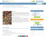
Students learn the components of the rock cycle and how rocks can …
Students learn the components of the rock cycle and how rocks can change over time under the influence of weathering, erosion, pressure and heat. They learn about geotechnical engineering and the role these engineers play in the development of an area of land, the design and placement of new structures, and detection of natural disasters.
Students explore Mercury and Venus, the first and second planets nearest the …
Students explore Mercury and Venus, the first and second planets nearest the Sun. They learn about the planets' characteristics, including their differences from Earth. Students also learn how engineers are involved in the study of planets by designing equipment and spacecraft to go where it is too dangerous for humans.
This activity is a guided inquiry investigation where students gather data on …
This activity is a guided inquiry investigation where students gather data on rate of water falling on erosion. Student will interpret their data, and develop a conclusion from the data. The data will lead to further questions, which can be developed by the students.
Rising seas and coastal erosion are eating away at the barrier island …
Rising seas and coastal erosion are eating away at the barrier island on which the Alaska Native Village of Kivalina rests. Residents and others are making concerted efforts to move the community to safety.
No restrictions on your remixing, redistributing, or making derivative works. Give credit to the author, as required.
Your remixing, redistributing, or making derivatives works comes with some restrictions, including how it is shared.
Your redistributing comes with some restrictions. Do not remix or make derivative works.
Most restrictive license type. Prohibits most uses, sharing, and any changes.
Copyrighted materials, available under Fair Use and the TEACH Act for US-based educators, or other custom arrangements. Go to the resource provider to see their individual restrictions.