Updating search results...

Search Resources

4 Results

View
Selected filters:
Earth's Albedo and Global Warming
Unrestricted Use
CC BY
Rating
0.0 stars

This interactive visualization adapted from NASA and the U.S. Geological Survey illustrates the concept of albedo, which is the measure of how much solar radiation is reflected from Earth's surface.

Subject:
Physical Science
Material Type:
Simulation
Provider:
CLEAN: Climate Literacy and Energy Awareness Network
Provider Set:
CLEAN: Climate Literacy and Energy Awareness Network
Author:
NASA Goddard Space Flight Center Scientific Visualization Studio
NSIDC (National Snow and Ice Data Center)
USGS (US Geological Survey)
Date Added:
01/22/2018
Natural Hazard Risk Map - ArcGIS
Conditional Remix & Share Permitted
CC BY-NC
Rating
0.0 stars

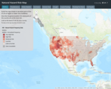
Interactive Risk Map that shows the amount of risk associated with different Natural Hazards for each area of the United States. These natural hazards include: Fires, Floods, Earthquakes, Thunderstorms / Tornadoes, Droughts, Hurricanes, Winter Weather events, Extreme heat.

Subject:
Agriculture, Food and Natural Resources
Atmospheric Science
Business and Information Technology
Career and Technical Education
Civics and Government
Earth and Space Science
Ecology
Education
Elementary Education
Environmental Science
Family and Consumer Sciences
Forestry and Agriculture
Geography
Geology
Higher Education
Hydrology
Life Science
Marketing, Management and Entrepreneurship
Oceanography
Social Studies
Technology and Engineering
Material Type:
Activity/Lab
Diagram/Illustration
Homework/Assignment
Interactive
Author:
FAO
Garmin
HERE
NOAA
USGS (US Geological Survey)
ESRI
Date Added:
04/21/2024
Water Resources of the United States—National Water Information System (NWIS) Mapper - USGS
Only Sharing Permitted
CC BY-NC-ND
Rating
0.0 stars

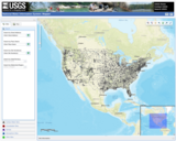
The National Water Information System (NWIS) Mapper provides access to over 1.5 million sites contained in the USGS National Water Information System (NWIS), including sites where current and historical surface-water, groundwater, springs, and atmospheric data has been collected. Users can search by site type, data type, site number, or place.

Subject:
Agriculture, Food and Natural Resources
Atmospheric Science
Business and Information Technology
Career and Technical Education
Earth and Space Science
Ecology
Education
Elementary Education
English Language Arts
Environmental Literacy and Sustainability
Environmental Science
Forestry and Agriculture
Geography
Geology
Health Education
Health Science
Higher Education
Hydrology
Life Science
Literature
Marketing, Management and Entrepreneurship
Oceanography
Social Studies
Technology and Engineering
Material Type:
Activity/Lab
Homework/Assignment
Author:
USGS (US Geological Survey)
Date Added:
03/12/2024
Wisconsin's historical Earthquakes - Latest Earthquakes in World - USGS
Only Sharing Permitted
CC BY-NC-ND
Rating
0.0 stars

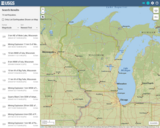
This is a map showing the location and severity of each of the Earthquakes which have occurred in Wisconsin in recorded history. This site is also where one can find recent or historic earthquakes, lists, information on selected significant earthquakes, earthquake resources by state, or find webservices.

Subject:
Earth and Space Science
Education
Elementary Education
Forestry and Agriculture
Geography
Geology
Life Science
Social Studies
Material Type:
Activity/Lab
Diagram/Illustration
Homework/Assignment
Lecture
Author:
USGS (US Geological Survey)
Date Added:
03/12/2024