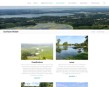
Dane County's abundant surface water resources are monitored and assessed primarily by the Wisconsin Department of Natural Resources (WDNR). Major streams and lakes are classified into categories based on the aquatic organisms present. These classifications provide an indication of water quality and fishery conditions.
Agricultural and urban land uses contribute to nutrient rich runoff reaching surface waters. Impervious surfaces and removal of wetlands also increases the flow of stormwater to local waterways. Explore issues facing our surface water and see maps of degraded water resources.
Effective water quality planning depends on long-term assessment and monitoring. The Capital Area Regional Planning Commission uses long-term datasets to evaluate regional trends.
Learn about practices meant to protect the region's streams, shorelands, and lakes.
Dane County
Land and Water Resources Viewer: An interactive county map showing watershed boundaries, thermally sensitive areas, cold water communities and more.
- Subject:
- Agriculture, Food and Natural Resources
- Biology
- Botany
- Career and Technical Education
- Civics and Government
- Earth and Space Science
- Ecology
- Education
- Elementary Education
- Environmental Literacy and Sustainability
- Environmental Science
- Family and Consumer Sciences
- Forestry and Agriculture
- Geology
- Health Education
- Health Science
- Higher Education
- Hydrology
- Life Science
- Social Studies
- Material Type:
- Activity/Lab
- Homework/Assignment
- Learning Task
- Author:
- The Capital Regional Planning Commission
- Date Added:
- 03/12/2024