This is designed to have the students think critically about the immigration …
This is designed to have the students think critically about the immigration debate in the United States. This lesson allows the teacher to guide student driven discussion without coloring the debate with their personal opinion. This very difficult topic becomes easy to talk about with these students using this method.
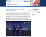
This course involves the design, development, and deployment of interactive mapping tools …
This course involves the design, development, and deployment of interactive mapping tools distributed via the World Wide Web and using “open” (non-proprietary, community-developed) standards and software code. It will also prepare students to design, develop, and implement custom web mapping applications using open standards and open source software. On completion of the course, students will be able to build and deploy a complete web mapping solution including selecting the spatial data, the server and client software. Students will be able to determine which type of mapping server is required for their needs and to explain why choosing an open standard based solution is better than a proprietary solution. The course will cover a variety of open source software packages for web mapping and will provide pointers to commercial solutions where appropriate.
In The Legend of the Lost Emerald, learners in grades 4-6 will …
In The Legend of the Lost Emerald, learners in grades 4-6 will use the same tools, practices, and skills that maritime archaeologists use to locate and dive for shipwrecks on the Great Lakes and uncover the real treasure—the stories inspired by actual shipwrecks and Great Lakes history.
Physical Geography, also called earth science, is the study of our home …
Physical Geography, also called earth science, is the study of our home planet and all of its components: its lands, waters, atmosphere, and interior. In this book, some chapters are devoted to the processes that shape the lands and impact people. Other chapters depict the processes of the atmosphere and its relationship to the planets surface and all our living creatures. For as long as people have been on the planet, humans have had to live within Earths boundaries. Now human life is having a profound effect on the planet. Several chapters are devoted to the effect people have on the planet.The journey to better understanding Earth begins here with an exploration of how scientists learn about the natural world and introduces you to the study of physical geography and earth science.
This course introduces the potential of GIS to support all stages of …
This course introduces the potential of GIS to support all stages of emergency (crisis or disaster) management activities, the latest R&D advances that are helping to achieve this potential now, and some challenges for the future. The course focuses on requirements analysis and proposal writing targeted toward planning and implementing GIS solutions for government agencies and contractors. As a basis from which to pursue these objectives, Planning GIS for Emergency Management introduces the current and potential future roles of GIS in support of crisis (emergency) management activities at all geographic scales (local to international). These roles are considered at each of the four stages of crisis management are (mitigation, preparation, response, and recovery). Then, selected focus topics (e.g., GIS for evacuation planning and support) are considered in detail.
Engage middle school students in a meaningful study of the lives of …
Engage middle school students in a meaningful study of the lives of students from across the globe through the use of contemporary nonfiction and fiction. Students create personal autobiographies, sequence story events, and prepare well-crafted summaries while learning to use higher-level comprehension strategies such as Question-Answer Relationships and the Bio-Cube. Additionally, students conduct a critical study of the NCSS Notable Tradebook Nasreen̍s Secret School: A True Story From Afghanistan by Jeanette Winter, comparing and contrasting their own lives to Nasreen̍s and expanding their geographical knowledge of the Middle East.
Students learn to use the Visual Basic for Applications (VBA) programming environment …
Students learn to use the Visual Basic for Applications (VBA) programming environment to add functionality to ArcView. No previous programming experience is assumed. Students who successfully complete the course are able to automate repetitive tasks, customize the ArcView interface, and share their customizations with others.
This course will introduce you to Remote Sensing for the Geospatial Intelligence …
This course will introduce you to Remote Sensing for the Geospatial Intelligence Professional - Students who successfully complete GEOG 883 will have a basic understanding of remote sensing systems, airborne and space borne sensors that collect optical imagery, elevation, and spectral data. They will understand the methods used to georeference and rectify these data in order to produce scaled maps and GIS-ready digital data products. The students will be introduced to the processing workflows used to convert raw data into orthophotos, digital terrain models, and image analysis products. These data products will be used in a variety of application scenarios, using commercially available software tools.
European history from the fourteenth through the sixteenth century. Consideration of political, …
European history from the fourteenth through the sixteenth century. Consideration of political, social, artistic, and scientific developments during this period of transition to the modern world. Examines the connections between Renaissance Humanism and the Protestant and Catholic reform movements of the sixteenth century. Studies works by Petrarch, Machiavelli, Brunelleschi, Leonardo, Erasmus, More, Luther, and Montaigne. The "Renaissance" as a phenomenon in European history is best understood as a series of social, political, and cultural responses to an intellectual trend which began in Italy in the fourteenth century. This intellectual tendency, known as humanism, or the studia humanitatis, was at the heart of developments in literature, the arts, the sciences, religion, and government for almost three hundred years. In this class, we will highlight the history of humanism, but we will also study religious reformations, high politics, the agrarian world, and European conquest and expansion abroad in the period.
This unit focuses on the geography of South America. The unit incorporates …
This unit focuses on the geography of South America. The unit incorporates technology by using resources like Google Earth and the CIA World Factbook website. The unit includes links to 5 individual lessons. All lessons include links to necessary materials. Everything for the lesson is created on the Google Platform (docs, slides) and can be easily adapted to Regions other than South America.
In this video adapted from Earth Island Institute, meet a high school …
In this video adapted from Earth Island Institute, meet a high school student who educated her community about how a coal-burning power plant was contributing to asthma and other health problems there.
The concept of globalization fosters the understanding of the interconnectedness of cultures …
The concept of globalization fosters the understanding of the interconnectedness of cultures and societies geographically wide apart; America, Europe, Asia, and Africa. Subject scans existing debates over globalization in four continents. Explores how globalization impacts everyday life in the First and Third World; how globalization leads to a common cosmopolitan culture; the emergence of a global youth culture; and religious, social, and political movements that challenge globalization. Materials examined include pop music, advertisements, film posters, and political cartoons. Topic for Spring 2003: Popular Culture in Japan. Taught in English.
This course offers an introduction to the capabilities of lidar sensors and …
This course offers an introduction to the capabilities of lidar sensors and platforms, data processing systems, and derived digital data products. Students in this course will master basic skills needed to leverage commercial lidar data sources and information products in a broad range of applications, including topographic mapping, flood inundation studies, vegetation analysis, and 3D modeling of urban infrastructure.
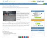
Students learn about floods, discovering that different types of floods occur from …
Students learn about floods, discovering that different types of floods occur from different water sources, but primarily from heavy rainfall. While floods occur naturally and have benefits such as creating fertile farmland, students learn that with the increase in human population in flood-prone areas, floods are become increasingly problematic. Both natural and manmade factors contribute to floods. Students learn what makes floods dangerous and what engineers design to predict, control and survive floods.
No restrictions on your remixing, redistributing, or making derivative works. Give credit to the author, as required.
Your remixing, redistributing, or making derivatives works comes with some restrictions, including how it is shared.
Your redistributing comes with some restrictions. Do not remix or make derivative works.
Most restrictive license type. Prohibits most uses, sharing, and any changes.
Copyrighted materials, available under Fair Use and the TEACH Act for US-based educators, or other custom arrangements. Go to the resource provider to see their individual restrictions.