This graduate seminar is taught in a lecture and lab exercise format. …
This graduate seminar is taught in a lecture and lab exercise format. The subject matter is tailored to introduce Environmental Engineering students to the use and potential of Geographic Information Systems in their discipline. Lectures will cover the general concepts of GIS use and introduce the material in the exercises, and exercises will introduce students to the practical application of GIS.
This site offers geography and history activities showing how two years in …
This site offers geography and history activities showing how two years in history had an indelible impact on American politics and culture. Students interpret historical maps, identify territories acquired by the U.S., identify states later formed from these territories, examine the territorial status of Texas, and identify political, social, and economic issues related to the expansion of the U.S. in the 1840s.
Geospatial intelligence (GEOINT) leverages geographic information science and technology (including cartography, geographic …
Geospatial intelligence (GEOINT) leverages geographic information science and technology (including cartography, geographic information systems, remote sensing, and global positioning systems) with intelligence tradecraft to develop intelligence products that support national security, disaster response, and international relief efforts. GEOG 882 is designed to challenge current and aspiring GEOINT professionals to be more than technicians. Students who successfully complete GEOG 882 will appreciate that while geospatial technologies are useful in revealing "what, who, where, and to some extent how" events are taking place, it is less useful in explaining "why" events occur, or what response is most appropriate. Students will learn that the political, cultural, historical, and economic perspectives of human geography are needed to put GEOINT analyses in context. The course will also challenge students to approach analyses critically, to consider alternative viewpoints and explanations, and to question their own assumptions.
Global exploration in the eighteenth and nineteenth centuries radically changed Western science, …
Global exploration in the eighteenth and nineteenth centuries radically changed Western science, orienting philosophies of natural history to more focused fields like comparative anatomy, botany, and geology. In the United States, European scientific advances and home-grown ventures like the Wilkes Exploring Expedition to Antarctica and the Pacific inspired new endeavors in cartography, ethnography, zoology, and evolutionary theory, replacing rigid models of thought and classification with more fluid and active systems. They inspired literary authors as well. This class will examine some of the most remarkable of these authors--Herman Melville (Moby-Dick and "The Encantadas"), Henry David Thoreau (Walden), Sarah Orne Jewett (Country of the Pointed Firs), Edith Wharton (House of Mirth), Toni Morrison (A Mercy), among others--in terms of the subjects and methods they adopted, imaginatively and often critically, from the natural sciences.
This course brings together core concepts in cartography, geographic information systems, and …
This course brings together core concepts in cartography, geographic information systems, and spatial thinking with real-world examples to provide the fundamentals necessary to engage with Geography beyond the surface-level. We will explore what makes spatial information special, how spatial data is created, how spatial analysis is conducted, and how to design maps so that theyre effective at telling the stories we wish to share. To gain experience using this knowledge, we will work with the latest mapping and analysis software to explore geographic problems.
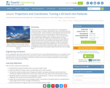
Projections and coordinates are key advancements in the geographic sciences that allow …
Projections and coordinates are key advancements in the geographic sciences that allow us to better understand the nature of the Earth and how to describe location. These innovations in describing the Earth are the basis for everything that is done in a GIS framework. Shape of the Earth is a critical starting point because in fact the Earth is not round but rather a more complex shape called a geoid. Coordinate systems are often referenced to a particular model shape of the Earth, but many different formats exist because not all coordinates work equally well in all areas. While projections and coordinates are abstract concepts in themselves, students eventually find them interesting because 1) it causes them to challenge their current ideas of the Earth's shape and 2) it is much easier to visualize these ideas for learning through interactive GIS such as Google Earth.
The following six OERS for grades K-5 are designed for teachers to use …
The following six OERS for grades K-5 are designed for teachers to use the outdoor spaces around their schools for learning with the goals of connecting students with their sense of place and well-being. Together, the six experiences comprise a school-wide mini-unit in which each grade level explore an Investigative Question. Collectively, each Investigative Question leads the entire student body in considering the Essential Question of the mini-unit. A school leadership team identified the Wisconsin Standards for Environmental Literacy and Sustainability (ELS) to be addressed at every grade level and developed an Essential Question to be explored.FIELD Edventures educators provided teachers with an introduction to outdoor, place-based inquiry learning, unpacked ELS, and met with grade level teams to co-create inquiry questions (called Investigative Questions in the lessons that follow) for their students to investigate outside each quarter. These OERs were co-taught with teachers and FIELD educators and were refined during co-reflection.
The discipline of structural geology studies the architecture of the solid Earth …
The discipline of structural geology studies the architecture of the solid Earth and other planets. Rock deformation patterns are exciting features beacause of their aesthetic beauty and their economic interest to man. Knowledge of the subsurface structure is vital for the success of a variety of engineering and mineral exploration pograms. A thorough understanding of rock structures is essential for strategic planning in the petroleum and mining industry, in construction operations, in waste disposal surveys and for water exploration. Deformation structures in the country rock are important further for locallizing hazard zones, such as potential rockslide masses, ground subsidence, and seismic faults. Research activities concentrate on rock defomation structures in he shallow continental crust.
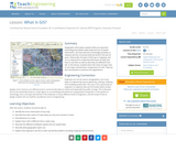
Geographic information systems (GIS) are important technology that allows rapid study and …
Geographic information systems (GIS) are important technology that allows rapid study and use of spatial information. GIS have become increasingly prevalent in industry and the consumer/internet world in the last 20 years. Historically, the basis of GIS was in mapping, and so it is important to understand the basis of maps and how to use them as well as why they are different from GIS. In this lesson, students learn the value of maps, how to use maps, and the basic components of a GIS. They are also introduced to numerous GIS applications.
No restrictions on your remixing, redistributing, or making derivative works. Give credit to the author, as required.
Your remixing, redistributing, or making derivatives works comes with some restrictions, including how it is shared.
Your redistributing comes with some restrictions. Do not remix or make derivative works.
Most restrictive license type. Prohibits most uses, sharing, and any changes.
Copyrighted materials, available under Fair Use and the TEACH Act for US-based educators, or other custom arrangements. Go to the resource provider to see their individual restrictions.