Updating search results...

Search Resources

4 Results

View
Selected filters:
  • capacity
Air Traffic Control, Fall 2006
Conditional Remix & Share Permitted
CC BY-NC-SA
Rating
0.0 stars

Introduces the various aspects of present and future Air Traffic Control systems. Descriptions of the present system: systems-analysis approach to problems of capacity and safety; surveillance, including NAS and ARTS; navigation subsystem technology; aircraft guidance and control; communications; collision avoidance systems; sequencing and spacing in terminal areas; future directions and development; critical discussion of past proposals and of probable future problem areas.

Subject:
Career and Technical Education
Material Type:
Full Course
Provider:
M.I.T.
Provider Set:
M.I.T. OpenCourseWare
Author:
Hansman, John
Date Added:
01/01/2006
Bears in a Boat
Read the Fine Print
Rating
0.0 stars

In this math activity, learners are challenged to create aluminum foil boats that will hold plastic bears until the boats sink. The lesson serves as a fun, hands-on way to collect data. Data from two attempts is collected and used to make two class box-and-whisker plots with some surprising results. This lesson guide includes questions for learners, assessment options, extensions, and reflection questions.

Subject:
Geometry
Mathematics
Material Type:
Interactive
Lesson Plan
Provider:
National Council of Teachers of Mathematics
Provider Set:
Illuminations
Author:
Jim Rubillo
NCTM Illuminations
Thinkfinity/Verizon Foundation
Date Added:
11/09/2012
Evaluation (Hexagon) Tool Activity
Unrestricted Use
CC BY
Rating
0.0 stars

  Purpose:This tool guides teams in evaluating and evidenced-based improvement strategies (EBIS)prior to implementation.Description:As a tool to evaluate readiness for implementation, this resource is designed to systematically lead teams in a thorough examination of the EBIS before it’s implemented in a sc During this study, the team answers questions about their current evidence for the “Program Indicators” of Evidence, Supports, and Usability as well as the “ Implementing Site Indicators” of Need, Fit and Capacity.

Subject:
Education
Material Type:
Other
Author:
Lauren Zellmer
Date Added:
10/21/2022
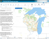
Wisconsin Water Quantity Data Viewer - Wisconsin DNR
Only Sharing Permitted
CC BY-NC-ND
Rating
0.0 stars

This map viewer was created for use by the general public to view water quantity data collected by Wisconsin DNR (WDNR), the US Geological Survey (UGSG) and the Wisconsin Geological and Natural History Survey (WGNHS).

This viewer also provides a means for the public to view pending high capacity well applications and recently approved wells. As required by Wisconsin law, these locations are generalized to display at the public land survey section level. Therefore, any well or surface water intake is symbolized by the section in which is located. Clicking identify on sections may return multiple records, one for each data point. This viewer contains a number of layer groups:

Well Applications and Approvals – This layer displays the locations of pending and approved high capacity well applications. It includes:
High capacity wells that have been applied for by the owner but have not yet been approved by the Department
High capacity wells approved in the last 30 days
High capacity wells approved by WDNR but that have not yet been constructed

High Capacity Withdrawal Locations – This layer show the location of high capacity wells constructed and available for use as well as currently registered high capacity surface water withdrawals. It includes:

Existing high capacity wells
Existing surface water withdrawals

USGS Water Quantity Monitoring – This layer shows the locations of groundwater level monitoring points, streamflow gages, and lake level gages monitored and recorded by USGS. It includes currently active monitoring locations as well as historical monitoring locations. Symbol sizes are scaled according to the number of measurements taken at each location.

WDNR Water Quantity Monitoring Groundwater Protection Features – This layer shows the locations of streamflow and lake level measurements maintained by WDNR. It includes a variety of measurement types taken by WDNR staff, partner organizations, county staff and volunteers.

WGNHS Spring Monitoring – This layer shows the location of springs surveyed by WGNHS staff between 2015 and 2017. Note that spring flow varies seasonally and annually. In addition, many spring locations are located on private land and not accessible by the public without landowner permission.

Groundwater Protection Features – This layer displays the locations of groundwater protection features as defined by Wisconsin Rule NR820. It includes trout streams, outstanding and exceptional water resources, and springs with a flow rate surveyed by WGNHS of 1 cubic foot per second (CFS) or greater. Note that all 1 CFS may not have been surveyed.

Guidance for how to use WDNR Geocortex viewers can be found here. For more information, please contact the water use section at 608-266-2299 or at DNRWATERUSEREGISTRATION@wisconsin.gov

Subject:
Agriculture, Food and Natural Resources
Biology
Business and Information Technology
Career and Technical Education
Earth and Space Science
Ecology
Education
Elementary Education
Environmental Science
Forestry and Agriculture
Geology
Health Science
Higher Education
Hydrology
Life Science
Marketing, Management and Entrepreneurship
Material Type:
Activity/Lab
Homework/Assignment
Lecture
Lesson
Author:
Wisconsin Department of Natural Resources
Date Added:
03/12/2024