A new interactive map created by Ian Webster, curator of the internet's …
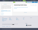
A new interactive map created by Ian Webster, curator of the internet's largest dinosaur database, places our planet's ever-shifting surface into stark relief. Using plate tectonics and paleogeographic maps by C.R. Scotese of the PALEOMAP Project, Webster's map can show you how the earth under your current address changed over the course of some 750 million years.
Introduces mechanics of rock deformation. Discusses recognition, interpretation, and mechanics of faults, …
Introduces mechanics of rock deformation. Discusses recognition, interpretation, and mechanics of faults, folds, structural features of igneous and metamorphic rocks, and superposed deformations. Introduces regional structural geology and tectonics. Laboratory includes techniques of structural analysis, recognition and interpretation of structures on geologic maps, and construction of interpretive cross sections. Structural geology is the study of processes and products of rock deformation. This course introduces the techniques of structural geology through a survey of the mechanics of rock deformation, a survey of the features and geometries of faults and folds, and techniques of strain analysis. Regional structural geology and tectonics are introduced. Class lectures are supplemented by lab exercises and demonstrations as well as field trips to local outcrops.
No restrictions on your remixing, redistributing, or making derivative works. Give credit to the author, as required.
Your remixing, redistributing, or making derivatives works comes with some restrictions, including how it is shared.
Your redistributing comes with some restrictions. Do not remix or make derivative works.
Most restrictive license type. Prohibits most uses, sharing, and any changes.
Copyrighted materials, available under Fair Use and the TEACH Act for US-based educators, or other custom arrangements. Go to the resource provider to see their individual restrictions.