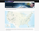
America's geoheritage arises from the features, landforms, and landscapes characteristic of the United States. These locations are valued for many reasons, including significant scientific, educational, cultural, aesthetic, and recreational purposes. They are conserved so that their lessons and beauty will remain as a legacy for future generations.*
The places stewarded by the U.S. National Park Service hold many stories about our shared geoheritage. There is a national park within a day's drive of most communities in the U.S. where you can connect in person with the land and stories that shaped the character of our nation. You can also experience these parks in another way - from space.
On this DVD you can visit over 60 national parks from the vantage point of space and read articles selected from NASA's Earth Observatory website describing how satellite observations can help people better understand our geoheritage. Space-based views provide useful information on natural processes and human impacts affecting the Earth's surface within and outside of protected areas. For example, landscape changes caused by shifting vegetation types (Great Smoky Mountains), rainfall (Death Valley), glacial retreat (Glacier Bay), fire (Tallgrass Prairie) and climate change can all be observed from space.
- Subject:
- Earth and Space Science
- Environmental Science
- Forestry and Agriculture
- Geology
- Life Science
- Material Type:
- Interactive
- Author:
- EOS Project Science Office
- NASA
- Date Added:
- 11/08/2018