Updating search results...

Search Resources

854 Results

View
Selected filters:
  • Lecture
Wisconsin Surface Water Data Viewer
Conditional Remix & Share Permitted
CC BY-NC
Rating
0.0 stars

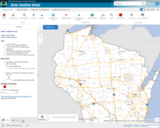
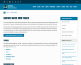
The Surface Water Data Viewer is a mapping tool for the State of Wisconsin. It provides interactive web mapping tools for a variety of datasets, including chemistry, physical, and biological data. The data managed in layers that can be turned on and off as needed. The Homepage of the Surface Water Data Viewer (SWDV) has many commonly used features labeled. Descriptions of the features are as follows:

Toolbars: There are a variety of toolbars with different themes to help complete tasks using the SWDV. The toolbars can be used to display the layers available to the map, add or remove shapes, text, or measurement features, identify points, print maps, and more!

Search Bar: Using the search bar, you can search monitoring stations by number, locations by keyword, and waterbodies by WBIC. Be careful when using the search bar, partial matches do not always appear in the results.

Navigation Pane: The navigation pane is where results will appear from searches, where you are able to select layers for the map, and features for printing. You will be able to refine the data that is shown here, if desired. You can hide the navigation pane by clicking the left-facing arrow at the top.

Coordinates and Coordinate System: The coordinates will display for any point moused-over on the map. Click the black triangle to select your preferred method for displaying lat/long (DD, DMS, DDM, Mercator). The right-most option in this pane allows you to manually manage thescale of the map. Click on the scale tool, and selected the desired scale at which you wish to view the map. Select Go to implement changes.

Scale Bar: The scale bar shows the current extent of the map.

Whole State View: This view describes what is being shown on the main map relative to the entire state. A blue rectangle will cover the region of the state being shown on the map. You can also navigate the map by moving the blue square around the state-view map. If you print a map, this whole state view will print in the corner as a reference. You can minimize this view by clicking the corner-facing arrow in the top left edge of the box.

Show/Hide Toolbar: Use this button to hide the toolbar for a larger view of the map. If you have hidden the toolbar, you can also use this button to show it again.

Subject:
Agriculture, Food and Natural Resources
American Indian Studies
Biology
Botany
Career and Technical Education
Earth and Space Science
Ecology
Education
Elementary Education
Environmental Science
Forestry and Agriculture
Geography
Geology
Higher Education
Hydrology
Life Science
Social Studies
Material Type:
Activity/Lab
Homework/Assignment
Learning Task
Lecture
Lesson
Author:
Wisconsin Department of Natural Resources
Date Added:
03/12/2024
Wisconsin Water Condition Viewer - Wisconsin DNR
Only Sharing Permitted
CC BY-NC-ND
Rating
0.0 stars

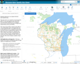
The Water Condition Viewer (WCV) is an interactive mapping tool that focuses on water condition, monitoring, assessment and management data. Data includes Clean Water Act, Monitoring Projects, Healthy Watersheds Assessments, Targeted Watershed Assessments, Wastewater Evaluation, Watershed Planning, County Land and Water Plans, Nine Key Element Plans and more. All datasets from specialized themes are available from this main, general set of layers.

Subject:
Agriculture, Food and Natural Resources
Biology
Botany
Career and Technical Education
Earth and Space Science
Ecology
Education
Elementary Education
Environmental Literacy and Sustainability
Environmental Science
Family and Consumer Sciences
Forestry and Agriculture
Geology
Health Education
Health Science
Hydrology
Life Science
Marketing, Management and Entrepreneurship
Material Type:
Activity/Lab
Homework/Assignment
Lecture
Lesson
Author:
Wisconsin Department of Natural Resources
Date Added:
03/12/2024
Wisconsin Water Quantity Data Viewer - Wisconsin DNR
Only Sharing Permitted
CC BY-NC-ND
Rating
0.0 stars

This map viewer was created for use by the general public to view water quantity data collected by Wisconsin DNR (WDNR), the US Geological Survey (UGSG) and the Wisconsin Geological and Natural History Survey (WGNHS).

This viewer also provides a means for the public to view pending high capacity well applications and recently approved wells. As required by Wisconsin law, these locations are generalized to display at the public land survey section level. Therefore, any well or surface water intake is symbolized by the section in which is located. Clicking identify on sections may return multiple records, one for each data point. This viewer contains a number of layer groups:

Well Applications and Approvals – This layer displays the locations of pending and approved high capacity well applications. It includes:
High capacity wells that have been applied for by the owner but have not yet been approved by the Department
High capacity wells approved in the last 30 days
High capacity wells approved by WDNR but that have not yet been constructed

High Capacity Withdrawal Locations – This layer show the location of high capacity wells constructed and available for use as well as currently registered high capacity surface water withdrawals. It includes:

Existing high capacity wells
Existing surface water withdrawals

USGS Water Quantity Monitoring – This layer shows the locations of groundwater level monitoring points, streamflow gages, and lake level gages monitored and recorded by USGS. It includes currently active monitoring locations as well as historical monitoring locations. Symbol sizes are scaled according to the number of measurements taken at each location.

WDNR Water Quantity Monitoring Groundwater Protection Features – This layer shows the locations of streamflow and lake level measurements maintained by WDNR. It includes a variety of measurement types taken by WDNR staff, partner organizations, county staff and volunteers.

WGNHS Spring Monitoring – This layer shows the location of springs surveyed by WGNHS staff between 2015 and 2017. Note that spring flow varies seasonally and annually. In addition, many spring locations are located on private land and not accessible by the public without landowner permission.

Groundwater Protection Features – This layer displays the locations of groundwater protection features as defined by Wisconsin Rule NR820. It includes trout streams, outstanding and exceptional water resources, and springs with a flow rate surveyed by WGNHS of 1 cubic foot per second (CFS) or greater. Note that all 1 CFS may not have been surveyed.

Guidance for how to use WDNR Geocortex viewers can be found here. For more information, please contact the water use section at 608-266-2299 or at DNRWATERUSEREGISTRATION@wisconsin.gov

Subject:
Agriculture, Food and Natural Resources
Biology
Business and Information Technology
Career and Technical Education
Earth and Space Science
Ecology
Education
Elementary Education
Environmental Science
Forestry and Agriculture
Geology
Health Science
Higher Education
Hydrology
Life Science
Marketing, Management and Entrepreneurship
Material Type:
Activity/Lab
Homework/Assignment
Lecture
Lesson
Author:
Wisconsin Department of Natural Resources
Date Added:
03/12/2024
Wisconsin's historical Earthquakes - Latest Earthquakes in World - USGS
Only Sharing Permitted
CC BY-NC-ND
Rating
0.0 stars

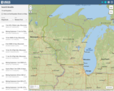
This is a map showing the location and severity of each of the Earthquakes which have occurred in Wisconsin in recorded history. This site is also where one can find recent or historic earthquakes, lists, information on selected significant earthquakes, earthquake resources by state, or find webservices.

Subject:
Earth and Space Science
Education
Elementary Education
Forestry and Agriculture
Geography
Geology
Life Science
Social Studies
Material Type:
Activity/Lab
Diagram/Illustration
Homework/Assignment
Lecture
Author:
USGS (US Geological Survey)
Date Added:
03/12/2024
Wonderful Worms
Read the Fine Print
Educational Use
Rating
0.0 stars

This video segment from WILD TV features a teenager who is fascinated with worms and talks about their value to the environment.

Subject:
Fine Arts
Material Type:
Lecture
Provider:
PBS LearningMedia
Provider Set:
Teachers' Domain
Date Added:
10/07/2008
Word Problem Clues
Read the Fine Print
Rating
0.0 stars

Students work to understand the language of word problems, using specific words as clues to the mathematical operations embedded in the problem. Teacher will use examples of student work to uncover misconceptions and errors and help support the students in developing the ability to critically evaluate their own strategies.Mathematics tasks include: Ability to read a problem in context and choose an operation to solve the problem; Ability to set up a number sentence that represents the problem; Accurately and efficiently solves two-digit addition and subtraction equations; Understands how to compose and decompose numbers; Can prove a sum or difference is correct using pictures, words, and/or symbols. (2nd Grade Math)

Subject:
Mathematics
Material Type:
Activity/Lab
Lecture
Lesson Plan
Teaching/Learning Strategy
Provider:
Noyce Foundation
Provider Set:
Inside Mathematics
Author:
Lewis, Tracy
Date Added:
10/10/2017
Work Abroad
Read the Fine Print
Educational Use
Rating
0.0 stars

In this video segment from Wide Angle, Mary, a college educated Zimbabwean migrant, describes her life and work in Botswana.

Subject:
Education
Material Type:
Lecture
Provider:
PBS LearningMedia
Provider Set:
Teachers' Domain
Date Added:
11/03/2017
Yorùbá Yé Mi
Only Sharing Permitted
CC BY-NC-ND
Rating
0.0 stars

Yoruba‡ YŽ Mi is an interactive, communicative, introductory, multimedia program intended to provide college/university students with basic listening, speaking, reading, and writing skills of language learning in Yoruba‡. It exposes the learner not only to Yoruba‡ language in meaningful situations but also to the culture of the Yorb‡-speaking people of South-western Nigeria. It contains effective techniques for teaching and learning Yorb‡ including tones, and is user-friendly in its approach.

Subject:
World Languages
Material Type:
Activity/Lab
Lecture
Textbook
Provider:
University of Texas at Austin
Provider Set:
COERLL
Author:
Fehintola
Mosadomi
Date Added:
10/10/2017
nanoHUB.org
Conditional Remix & Share Permitted
CC BY-NC-SA
Rating
0.0 stars

This site provides online simulations, learning modules, and interactive tools for learning about nanotechnology -- the design and production of structures, devices, and systems one atom or one molecule at a time. Analyze the electronic properties of different nano materials and the optical properties of nanoparticles. Explore molecular conduction, nanofluids, and nanowires. Create simulations of nanoelectronic and nanoelectromechanical systems. Registration required.

Subject:
Career and Technical Education
Technology and Engineering
Material Type:
Activity/Lab
Lecture
Lecture Notes
Simulation
Syllabus
Provider:
Purdue University
Provider Set:
nanoHUB.org
Date Added:
05/23/2006
won't you celebrate with me, by Lucille Clifton
Read the Fine Print
Educational Use
Rating
0.0 stars

Explore themes of identity, race, and gender as contemporary poet Lucille Clifton reads her poem, "Won't you celebrate with me" in this video segment from Poetry Everywhere.

Subject:
Fine Arts
Gender Studies
Social Studies
Material Type:
Lecture
Provider:
PBS LearningMedia
Provider Set:
Teachers' Domain
Date Added:
11/03/2017