Updating search results...

Search Resources

317 Results

View
Selected filters:
  • Ecology
WGNHS – Wisconsin Geological and Natural History Survey – UW–Madison
Only Sharing Permitted
CC BY-NC-ND
Rating
0.0 stars

The Wisconsin Geological and Natural History Survey (WGNHS) has been serving Wisconsin for over 125 years. Part of the Division of Extension at the University of Wisconsin–Madison, WGNHS provides objective scientific information about the geology, mineral resources, and water resources of Wisconsin. We conduct research, map Wisconsin’s geology, and share information through our publications and outreach.

WGNHS has been producing geologic maps, scientific reports, and more for over 125 years. Our publications catalog offers thousands of maps, reports, datasets, and other publications—all of which are available to view and download for free.

The Wisconsin Geological and Natural History Survey (WGNHS) was created by the Wisconsin Legislature in 1897. It is the descendant of earlier state surveys in Wisconsin, which date back to 1854.

WGNHS, part of the Division of Extension at the University of Wisconsin–Madison, is an interdisciplinary organization that conducts natural resources surveys and research to produce information used for decision-making, problem-solving, planning, management, development, and education. Survey is defined to include resource inventory as well as basic and applied research and analysis. WGNHS has no specific regulatory or enforcement responsibilities.

Mission of WGNHS:
Understanding the earth • Charting its history • Sustaining its resources
The Survey conducts earth-science surveys, field studies, and research.

We provide objective scientific information about the geology, water resources, and mineral resources of Wisconsin.

We collect, interpret, disseminate, and archive natural resource information.

We communicate the results of our activities through publications, technical talks, our website, social media, and responses to inquiries from the public.

These activities support informed decision making by government, industry, business, and individual residents of Wisconsin.

Subject:
Agriculture, Food and Natural Resources
Archaeology
Biology
Botany
Career and Technical Education
Civics and Government
Earth and Space Science
Ecology
Education
Environmental Science
Forestry and Agriculture
Geography
Geology
Higher Education
Hydrology
Life Science
Social Studies
Material Type:
Activity/Lab
Diagram/Illustration
Homework/Assignment
Other
Date Added:
03/04/2024
"Waddle: A Penguin's Tale" on Meta Quest
Rating
0.0 stars

Named after the collective noun for a group of penguins on land, Wadde: A Penguin’s Tale introduces players to polar research at Cape Royds, Antarctica. We worked closely on this project with Jean Pennycook, a polar researcher and educator who has been studying Adelie penguins at the South Pole for more than twenty years. The game immerses players in a beautiful, distant world they wouldn’t otherwise be able to experience: the Antarctic ice. Take on the role of a penguin, play some adorable mini games, and learn how penguins build nests and defend their eggs against the predatory skua.

Subject:
Ecology
Life Science
Material Type:
Game
Author:
Field Day Lab
Field Day Learning Games
field day lab
Date Added:
02/01/2024
Wake: Tales from the Aqualab
Restricted Use
Copyright Restricted
Rating
0.0 stars

Wake is a science game that challenges students with engaging and authentic missions in a variety of ocean-based ecosystems, designed to target the NGSS science practices of experimentation, modeling, and argumentation, in the context of middle school life sciences.

In the game, students take the role of a scientist studying ocean ecosystems, traveling to different ocean research sites to answer questions and solve problems. Students play the game at their own pace, working individually, and taking on gradually more complex science challenges in an open-ended environment.

Check out the Teacher Support Site for curriculum ideas and resources: https://sites.google.com/wisc.edu/waketeacherguide/home

Subject:
Biology
Earth and Space Science
Ecology
Environmental Science
Life Science
Mathematics
Measurement and Data
Oceanography
Zoology
Material Type:
Game
Author:
Field Day
Date Added:
02/06/2024
Warming Climate and Invasive Species
Read the Fine Print
Educational Use
Rating
0.0 stars

In this video segment adapted from the College of Menominee Nation, learn about the emergence of invasive forest species and diseases and their possible impact on the Menominee tribal forest.

Subject:
Ecology
Environmental Science
Forestry and Agriculture
Life Science
Material Type:
Lesson
Provider:
PBS LearningMedia
Provider Set:
PBS Learning Media Common Core Collection
Author:
NASA
WGBH Educational Foundation
Date Added:
03/23/2012
Waste Containment and Remediation Technology, Spring 2004
Conditional Remix & Share Permitted
CC BY-NC-SA
Rating
0.0 stars

Focuses on the geotechnical aspects of hazardous waste management, with specific emphasis on the design of land-based waste containment structures and hazardous waste remediation. Introduction to hazardous waste; definition of hazardous waste, regulatory requirements, waste characteristics, geo-chemistry, and contaminant transport. The design and operation of waste containment structures, landfills, impoundments, and mine-waste disposal. The characterization and remediation of contaminated sites, the superfund law, preliminary site assessment, site investigation techniques, and remediation technologies. Monitoring requirements.

Subject:
Career and Technical Education
Ecology
Education
Environmental Science
Forestry and Agriculture
Life Science
Technology and Engineering
Material Type:
Full Course
Provider:
M.I.T.
Provider Set:
M.I.T. OpenCourseWare
Author:
Shanahan, P. J. (Peter J.)
Shanahan, Peter
Date Added:
01/01/2004
Water Clarity Monitoring - Extension Lakes
Unrestricted Use
Public Domain
Rating
0.0 stars

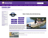
Water clarity monitoring is a process in which the volunteer lowers an 8” diameter, black & white disc (“Secchi disc”) into the deepest part of the lake to determine how far down they can see the disc as it is lowered. Water clarity monitoring is done every 10-14 days throughout the open-water season. Water clarity is a quick way to estimate lake health, and it plays an important role in determining the types of plants and animals that a water body can support.

Can also add in collected data for Water Chemistry analysis along with Secchi disc collected data.

This site includes data collection forms for individuals or groups to add their data from their own lake to this dataset.

Subject:
Agriculture, Food and Natural Resources
Biology
Career and Technical Education
Ecology
Environmental Science
Life Science
Material Type:
Activity/Lab
Homework/Assignment
Lesson
Author:
Paul Skawinski
college of Natural Resources
University of Wisconsin Stevens Point
Date Added:
04/24/2024
Water Resources of the United States—National Water Information System (NWIS) Mapper - USGS
Only Sharing Permitted
CC BY-NC-ND
Rating
0.0 stars

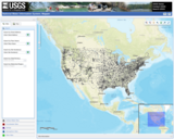
The National Water Information System (NWIS) Mapper provides access to over 1.5 million sites contained in the USGS National Water Information System (NWIS), including sites where current and historical surface-water, groundwater, springs, and atmospheric data has been collected. Users can search by site type, data type, site number, or place.

Subject:
Agriculture, Food and Natural Resources
Atmospheric Science
Business and Information Technology
Career and Technical Education
Earth and Space Science
Ecology
Education
Elementary Education
English Language Arts
Environmental Literacy and Sustainability
Environmental Science
Forestry and Agriculture
Geography
Geology
Health Education
Health Science
Higher Education
Hydrology
Life Science
Literature
Marketing, Management and Entrepreneurship
Oceanography
Social Studies
Technology and Engineering
Material Type:
Activity/Lab
Homework/Assignment
Author:
USGS (US Geological Survey)
Date Added:
03/12/2024
What Killed Tweety? An Ecological Exploration of West Nile Virus
Conditional Remix & Share Permitted
CC BY-NC-SA
Rating
0.0 stars

This activity is an internet exploration of West Nile Virus and the effects this virus has directly on bird populations. Students will also see the secondary effects on human populations and the interrelationships of the three populations.

Subject:
Biology
Ecology
Life Science
Material Type:
Activity/Lab
Assessment
Lesson Plan
Provider:
Science Education Resource Center (SERC) at Carleton College
Provider Set:
Pedagogy in Action
Author:
Christine Salokar
Date Added:
02/10/2023
What Will Biodegrade?
Read the Fine Print
Educational Use
Rating
0.0 stars

Students investigate what types of materials biodegrade in the soil, and learn what happens to their trash after they throw it away. The concepts of landfills and compost piles will be explained, and the students will have an opportunity to create their own miniature landfill in which the difference between organic and inorganic waste will become clear.

Subject:
Career and Technical Education
Ecology
Life Science
Technology and Engineering
Material Type:
Activity/Lab
Lesson Plan
Provider:
TeachEngineering
Provider Set:
TeachEngineering NGSS Aligned Resources
Author:
Engineering K-PhD Program,
Roarke Horstmeyer
Date Added:
09/18/2014
Where Shall We Go Swimming?
Conditional Remix & Share Permitted
CC BY-NC-SA
Rating
0.0 stars

This activity is a water study investigation showing how biotic and abiotic factors are influenced by human activity.

Subject:
Ecology
Life Science
Material Type:
Activity/Lab
Assessment
Lesson Plan
Provider:
Science Education Resource Center (SERC) at Carleton College
Provider Set:
Pedagogy in Action
Author:
Marj Ostgaard
Date Added:
02/10/2023
Why Does Climate Change Matter?
Read the Fine Print
Educational Use
Rating
0.0 stars

In this video segment adapted from United Tribes Technical College, listen as six Native American students share their concerns, hopes, and knowledge about climate change.

Subject:
Ecology
Environmental Science
Forestry and Agriculture
Life Science
Material Type:
Lesson
Provider:
PBS LearningMedia
Provider Set:
PBS Learning Media Common Core Collection
Author:
NASA
WGBH Educational Foundation
Date Added:
03/19/2012
Why Is Coco Orange? Book on Air Quality and Asthma - Publications Page
Rating
0.0 stars

This website has a picture book about a chameleon who has asthma. Through this story, students will learn all about air quality, asthma, and how to stay healthy when the air quality is bad such as reading an air quality chart.

Subject:
Anatomy/Physiology
Atmospheric Science
Biology
Career and Technical Education
Earth and Space Science
Ecology
Education
Elementary Education
English Language Arts
Environmental Literacy and Sustainability
Environmental Science
Global Education
Health Science
Life Science
Literature
Reading Informational Text
Material Type:
Reading
Author:
Air Now
United States Enviornmental Protection Agency
Date Added:
03/26/2024
Wildlife Detectives
Only Sharing Permitted
CC BY-NC-ND
Rating
0.0 stars

Students will have the opportunity to learn about animal signs, including tracks, sounds and coats and how to infer that information through a series of “mystery scenes.” Each mystery scene incorporates a basic biology concept appropriate for early elementary.

Subject:
Agriculture, Food and Natural Resources
Career and Technical Education
Ecology
Environmental Science
Forestry and Agriculture
Life Science
Material Type:
Lesson
Lesson Plan
Date Added:
05/08/2019
Winter Sevity Index
Conditional Remix & Share Permitted
CC BY-NC
Rating
0.0 stars

The winter severity index (WSI) is a measurement to help gauge the effects of the winter weather on
deer survival. The index was developed in the early 1970’s and is calculated by adding the number of
days with 18 inches or more of snow on the ground to the number of days when the minimum
temperatures were 0◦
F or below. In general, the severity of the winter is based on the total number of
points accumulated over the collection period. A winter with an index of less than 50 is considered mild,
50 to 79 is moderate, 80 to 99 is severe, and over 100 is very severe.

Subject:
Ecology
Life Science
Mathematics
Measurement and Data
Material Type:
Data Set
Learning Task
Date Added:
01/23/2019
Wisconsin Critter Count
Only Sharing Permitted
CC BY-NC-ND
Rating
0.0 stars

The Wisconsin Department of Natural Resources uses a variety of tools and techniques to monitor wildlife, and to produce population estimates to better inform management decisions. Population estimates are used to look at long term trends, as well as setting harvest limits during hunting seasons for potentially vulnerable species. There are two count methods for generating population information: sample counts and total counts. In total counts, every individual of an intended geographic area is counted. For sample counts, a smaller fraction of individuals are counted and the data is used to interpolate population information for the entire geographic area. In this activity, you will create a model for these two different count methods and explore the advantages and disadvantages to both approaches.

Subject:
Agriculture, Food and Natural Resources
Career and Technical Education
Ecology
Environmental Literacy and Sustainability
Life Science
Material Type:
Lesson
Lesson Plan
Date Added:
05/08/2019
Wisconsin DNR Open Data Portal
Only Sharing Permitted
CC BY-NC-ND
Rating
0.0 stars

This is the Wisconsin Department of Natural Resources GIS Open Data Portal. It is a free resource for locating, viewing, and downloading data developed and/or maintained by the Wisconsin DNR.

This site also has categories of: Water, Fish and Wildlife, Managed Lands, Cimate, Parks and Recreation, Forestry, Transportation, Indexess and PLSS, Boundaries and Land Cover and Vegetation.

The site also has Applications that include: PFAS in Wisconsin Data Viewer, Western Coulee and Ridges Regional Master Plan, North Central Forest Regional Master Plan, Wildfires Dashboard App, Report Invasive Species, CWD reporting, etc

Subject:
Agriculture, Food and Natural Resources
Biology
Botany
Career and Technical Education
Civics and Government
Earth and Space Science
Ecology
Education
Elementary Education
Environmental Literacy and Sustainability
Environmental Science
Forestry and Agriculture
Geography
Geology
Health Education
Health Science
Higher Education
Hydrology
Life Science
Social Studies
Zoology
Material Type:
Activity/Lab
Homework/Assignment
Learning Task
Lecture
Lesson
Lesson Plan
Author:
Wisconsin Department of Natural Resources
Date Added:
03/12/2024
Wisconsin Geological and Natural History Survey - Publications Catalog
Only Sharing Permitted
CC BY-NC-ND
Rating
0.0 stars

The Wisconsin Geological and Natural History Survey (WGNHS) has been serving Wisconsin for over 125 years. Part of the Division of Extension at the University of Wisconsin–Madison, WGNHS provides objective scientific information about the geology, mineral resources, and water resources of Wisconsin. We conduct research, map Wisconsin’s geology, and share information through our publications and outreach.

This is the link to the Publications Catalog that includes Wisconsin Data sets and maps for: Bedrock Geology, Groundwater, Surficial Geology, Rocks and Minerals, Soils, Precambrian Bedrock, Surface Water, Metallic Minerals, Topography, Nonmetallic Minerals, Climate and Weather, and Frac Sand.

Subject:
Biology
Career and Technical Education
Earth and Space Science
Ecology
Education
Elementary Education
Environmental Science
Family and Consumer Sciences
Forestry and Agriculture
Geology
Health Science
Higher Education
Hydrology
Life Science
Marketing, Management and Entrepreneurship
Material Type:
Activity/Lab
Diagram/Illustration
Interactive
Lecture
Author:
Wisconsin Geological and Natural History Survey
Date Added:
03/12/2024
Wisconsin Historic Climate Data
Unrestricted Use
Public Domain
Rating
0.0 stars

Wisconsin’s climate is typically continental with some modification by Lakes Michigan and Superior. The cold, snowy winters favor a variety of winter sports, and the warm summers appeal to thousands of vacationers each year. About two-thirds of the annual precipitation falls during the growing season (freeze-free period). It is normally adequate for vegetation, although drought is occasionally reported. This climate is most favorable for dairy farming; the primary crops are corn, small grains, hay, and vegetables. The rapid succession of storms moving from west to east or southwest to northeast account for the stimulating climate.

Select from Climate by Location, Division, Normals, Statewide Extremes, Longterm Annual Variability, and Daily Climate data.

Subject:
Agriculture, Food and Natural Resources
Atmospheric Science
Biology
Botany
Career and Technical Education
Earth and Space Science
Ecology
Education
Elementary Education
Environmental Science
Family and Consumer Sciences
Forestry and Agriculture
Health Science
Higher Education
Hydrology
Life Science
Marketing, Management and Entrepreneurship
Material Type:
Activity/Lab
Diagram/Illustration
Homework/Assignment
Interactive
Author:
Wisconsin State Climatology Office and Nelson Institute for Environmental Studies
Date Added:
04/28/2024