Updating search results...

Search Resources

191 Results

View
Selected filters:
  • wisconsin
Wisconsin Water Condition Viewer - Wisconsin DNR
Only Sharing Permitted
CC BY-NC-ND
Rating
0.0 stars

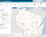
The Water Condition Viewer (WCV) is an interactive mapping tool that focuses on water condition, monitoring, assessment and management data. Data includes Clean Water Act, Monitoring Projects, Healthy Watersheds Assessments, Targeted Watershed Assessments, Wastewater Evaluation, Watershed Planning, County Land and Water Plans, Nine Key Element Plans and more. All datasets from specialized themes are available from this main, general set of layers.

Subject:
Agriculture, Food and Natural Resources
Biology
Botany
Career and Technical Education
Earth and Space Science
Ecology
Education
Elementary Education
Environmental Literacy and Sustainability
Environmental Science
Family and Consumer Sciences
Forestry and Agriculture
Geology
Health Education
Health Science
Hydrology
Life Science
Marketing, Management and Entrepreneurship
Material Type:
Activity/Lab
Homework/Assignment
Lecture
Lesson
Author:
Wisconsin Department of Natural Resources
Date Added:
03/12/2024
Wisconsin Water Quantity Data Viewer - Wisconsin DNR
Only Sharing Permitted
CC BY-NC-ND
Rating
0.0 stars

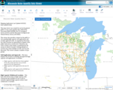
This map viewer was created for use by the general public to view water quantity data collected by Wisconsin DNR (WDNR), the US Geological Survey (UGSG) and the Wisconsin Geological and Natural History Survey (WGNHS).

This viewer also provides a means for the public to view pending high capacity well applications and recently approved wells. As required by Wisconsin law, these locations are generalized to display at the public land survey section level. Therefore, any well or surface water intake is symbolized by the section in which is located. Clicking identify on sections may return multiple records, one for each data point. This viewer contains a number of layer groups:

Well Applications and Approvals – This layer displays the locations of pending and approved high capacity well applications. It includes:
High capacity wells that have been applied for by the owner but have not yet been approved by the Department
High capacity wells approved in the last 30 days
High capacity wells approved by WDNR but that have not yet been constructed

High Capacity Withdrawal Locations – This layer show the location of high capacity wells constructed and available for use as well as currently registered high capacity surface water withdrawals. It includes:

Existing high capacity wells
Existing surface water withdrawals

USGS Water Quantity Monitoring – This layer shows the locations of groundwater level monitoring points, streamflow gages, and lake level gages monitored and recorded by USGS. It includes currently active monitoring locations as well as historical monitoring locations. Symbol sizes are scaled according to the number of measurements taken at each location.

WDNR Water Quantity Monitoring Groundwater Protection Features – This layer shows the locations of streamflow and lake level measurements maintained by WDNR. It includes a variety of measurement types taken by WDNR staff, partner organizations, county staff and volunteers.

WGNHS Spring Monitoring – This layer shows the location of springs surveyed by WGNHS staff between 2015 and 2017. Note that spring flow varies seasonally and annually. In addition, many spring locations are located on private land and not accessible by the public without landowner permission.

Groundwater Protection Features – This layer displays the locations of groundwater protection features as defined by Wisconsin Rule NR820. It includes trout streams, outstanding and exceptional water resources, and springs with a flow rate surveyed by WGNHS of 1 cubic foot per second (CFS) or greater. Note that all 1 CFS may not have been surveyed.

Guidance for how to use WDNR Geocortex viewers can be found here. For more information, please contact the water use section at 608-266-2299 or at DNRWATERUSEREGISTRATION@wisconsin.gov
Subject:
Agriculture, Food and Natural Resources
Biology
Business and Information Technology
Career and Technical Education
Earth and Space Science
Ecology
Education
Elementary Education
Environmental Science
Forestry and Agriculture
Geology
Health Science
Higher Education
Hydrology
Life Science
Marketing, Management and Entrepreneurship
Material Type:
Activity/Lab
Homework/Assignment
Lecture
Lesson
Author:
Wisconsin Department of Natural Resources
Date Added:
03/12/2024
Wisconsin Weather and Soil Monitoring Station Interactive map Mesonet - Wisconsin State Climatology Office
Unrestricted Use
Public Domain
Rating
0.0 stars

The Wisconsin Environmental Mesonet (WiscoNet) is a growing network of weather and soil monitoring stations across Wisconsin, designed to provide high quality data at high spatial and temporal resolutions. There are currently 14 Wisconet stations with plans to expand to around 90 by 2026. Each Wisconet station provides more than one dozen measurements every 5 minutes.

The stations measure temperature, dew point, wind, rain, soil moisture and temperature, and more.

You can view data through an interactive map or a list of stations.

Subject:
Agriculture, Food and Natural Resources
Career and Technical Education
Material Type:
Activity/Lab
Diagram/Illustration
Homework/Assignment
Interactive
Author:
Wisconsin State Climatology Office and Nelson Institute for Environmental Studies
Date Added:
04/28/2024
Wisconsin Wetland Inventory - Wetlands Data
Conditional Remix & Share Permitted
CC BY-NC
Rating
0.0 stars

The Wisconsin Wetland Inventory (WWI) regulatory maps show graphic representations of the type, size and location of wetlands in Wisconsin. These maps have been prepared from the analysis of high altitude imagery in conjunction with soil surveys, topographic maps, previous wetland inventories and field work. The Wisconsin Department of Natural Resources (DNR) manages the WWI.

The U.S. Fish and Wildlife Service (USFWS) began producing non-regulatory, polygonal, geospatial wetland maps for the United States via their National Wetlands Inventory (NWI) in the mid-1970s. While DNR does provide WWI data to USFWS, there can be a significant lag before those updates appear in the NWI.

STATEWIDE: Digital wetlands data are available from the Wisconsin DNR for the state. Alternatively, wetlands are available for free viewing as a layer in the DNR Surface Water Data Viewer.

Wisconsin Wetland Inventory Geodatabase – free download
App: Wisconsin DNR Surface Water Data Viewer

NATIONAL: The NWI is slightly more detailed than WWI since NWI also maps deep water systems including lakes, streams and rivers. The Wisconsin DNR provides their WWI data to the U.S. Fish and Wildlife service for integration into the NWI, but users should be cautioned that Wisconsin updates to NWI can reportedly take months, and in some cases years. Users requiring Wisconsin wetlands data are strongly encouraged to start with the Wisconsin Wetland Inventory.

National Wetlands Inventory Data

Subject:
Agriculture, Food and Natural Resources
Biology
Career and Technical Education
Earth and Space Science
Ecology
Environmental Literacy and Sustainability
Environmental Science
Forestry and Agriculture
Geology
Hydrology
Life Science
Material Type:
Data Set
Interactive
Reading
Reference Material
Author:
Wisconsin State Cartographer’s Office (SCO)
Date Added:
03/25/2024
Wisconsin's Champion Trees
Conditional Remix & Share Permitted
CC BY-NC
Rating
0.0 stars

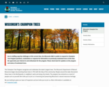
The Champion Tree Program recognizes and celebrates the state’s largest trees. The Wisconsin Department of Natural Resources began documenting these trees in 1941 with the help of the community. People around the state discovered these trees in the Northwoods, in neighbors’ yards and along city streets. The program has endured as a result of people such as yourself. We invite you to join us in honoring and preserving Wisconsin’s natural resources heritage.

Subject:
Agriculture, Food and Natural Resources
Art and Design
Biology
Botany
Career and Technical Education
Early Learning
Ecology
Education
Elementary Education
Environmental Literacy and Sustainability
Environmental Science
Fine Arts
Forestry and Agriculture
Higher Education
Life Science
Media Arts
Material Type:
Data Set
Diagram/Illustration
Other
Reference Material
Author:
Wisconsin Department of Natural Resources
Date Added:
04/21/2024
Wisconsin's Fishes
Conditional Remix & Share Permitted
CC BY-NC
Rating
0.0 stars

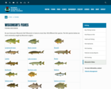
Do you know your Wisconsin fish? Wisconsin is home to more than 160 different fish species. The fish species below are most commonly caught by Wisconsin anglers.

Also links to these resources:
Wisconsin's state record fish
Hooked on Wisconsin Anglers' Club
Game fish of Wisconsin poster
Fish Wildcards - A set of 45 fish, plus games, knots, basic fish anatomy, a common fish parasite, and a handy trick to estimate your fish’s weight with a ruler! Two versions:
Match Your Catch, Low-Res Version [PDF] or
Match Your Catch, Hi-Res Version [PDF]
Fish of Wisconsin [exit DNR]
Fish identification database [exit DNR]
Burbot, bowfin and snakehead identification
Wisconsin fish species list [PDF] - a printable document with Wisconsin's fish species.

Subject:
Agriculture, Food and Natural Resources
Art and Design
Biology
Career and Technical Education
Early Learning
Ecology
Education
Elementary Education
Environmental Science
Family and Consumer Sciences
Fine Arts
Health Science
Life Science
Marketing, Management and Entrepreneurship
Media Arts
Zoology
Material Type:
Activity/Lab
Data Set
Interactive
Reference Material
Author:
Wisconsin Department of Natural Resources
Date Added:
04/21/2024
Wisconsin's historical Earthquakes - Latest Earthquakes in World - USGS
Only Sharing Permitted
CC BY-NC-ND
Rating
0.0 stars

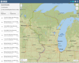
This is a map showing the location and severity of each of the Earthquakes which have occurred in Wisconsin in recorded history. This site is also where one can find recent or historic earthquakes, lists, information on selected significant earthquakes, earthquake resources by state, or find webservices.

Subject:
Earth and Space Science
Education
Elementary Education
Forestry and Agriculture
Geography
Geology
Life Science
Social Studies
Material Type:
Activity/Lab
Diagram/Illustration
Homework/Assignment
Lecture
Author:
USGS (US Geological Survey)
Date Added:
03/12/2024
Wisconsin's record fish program
Conditional Remix & Share Permitted
CC BY-NC
Rating
0.0 stars

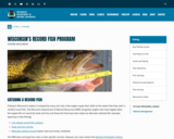
Fishing in Wisconsin's waters is enjoyed by many, but only a few anglers apply their skills to the extent that they catch a verified record fish. The Wisconsin Department of Natural Resources (DNR) recognizes anglers who have legally taken the largest fish on record by hook and line and those fish that have been taken by alternate methods (for example, spearing or bow fishing).

Live release record fish category
Hook and line records
Alternate method records (spear, bow and arrow, crossbow)
The DNR does not keep line-class or lake-specific records. However, you may contact the National Freshwater Fishing Hall of Fame [exit DNR] for national line class records.

DO YOU THINK YOU'VE CAUGHT A RECORD FISH?
If you think you or someone you know has caught a fish that might be a state record, there are several things you should do:

don't clean or freeze the fish
keep the fish cool - preferably on ice
get the fish weighed as soon as possible on a certified scale (found in grocery, hardware stores, etc.) and witnessed by an observer
contact the nearest DNR office to get the fish species positively identified and to find out whether the fish is a state record
obtain and complete a record fish application [PDF]
An official record fish application must accompany all prospective record fish entries.

Subject:
Agriculture, Food and Natural Resources
Career and Technical Education
Environmental Science
Forestry and Agriculture
Life Science
Marketing, Management and Entrepreneurship
Zoology
Material Type:
Data Set
Diagram/Illustration
Other
Author:
Wisconsin Department of Natural Resources
Date Added:
04/21/2024
Wolves in Wisconsin
Conditional Remix & Share Permitted
CC BY-NC
Rating
0.0 stars

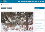
Wisconsin Department of Natural Resources dataset of current Wolf population and distribution of wolf packs found throughout Wisconsin.

Following a federal court ruling on Feb. 10, 2022, gray wolves are listed as an endangered species in the lower 48 states (excluding the northern Rocky Mountains region). As such, wolves are federally protected. Harvest and lethal depredation control are prohibited.

Wisconsin's wolf population remains healthy and secure in the state. The department will continue its robust wolf population monitoring program and the development of an updated wolf management plan.

The DNR will continue to partner with USDA-Wildlife Services to address wolf conflicts in Wisconsin. If you suspect wolves in the depredation of livestock, pets or hunting dogs, or if wolves are exhibiting threatening or dangerous behavior, contact USDA-Wildlife Services staff immediately. If in northern Wisconsin, call 1-800-228-1368 or 715-369-5221; in southern Wisconsin, call 1-800-433-0663 or 920-324-4514. While gray wolves are listed as a federally endangered species, it remains unlawful to shoot a wolf unless there is an immediate threat to human safety.

Subject:
Agriculture, Food and Natural Resources
Biology
Business and Information Technology
Career and Technical Education
Ecology
Education
Elementary Education
Environmental Literacy and Sustainability
Environmental Science
Forestry and Agriculture
Life Science
Marketing, Management and Entrepreneurship
Zoology
Material Type:
Data Set
Diagram/Illustration
Other
Reference Material
Author:
Wisconsin Department of Natural Resources
Date Added:
03/25/2024
A difficult drought ‣ Data Nuggets
Unrestricted Use
Public Domain
Rating
0.0 stars

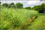
Biofuels are made from plants that are growing today, and are being considered as an alternative to fossil fuels. To become biofuels, plants need to go through a series of chemical and physical processes that transform the sugars into ethanol. Scientists are interested in seeing how yeast’s ability to transform sugar into fuel is affected by environmental conditions in fields, such as droughts.

This resource has been evaluated using the HQUIM rubric linked here. https://docs.google.com/spreadsheets/d/1y6pUBeJXq-dZLdIjWx_5rNjaj4JCttLpDm5fOt9mNsA/edit?usp=sharing

Subject:
Agriculture, Food and Natural Resources
Career and Technical Education
Earth and Space Science
Life Science
Material Type:
Activity/Lab
Assessment
Formative Assessment
Author:
Trey Sato
Marina Kerekes
Date Added:
04/02/2024
The end of winter as we’ve known it? ‣ Data Nuggets
Unrestricted Use
Public Domain
Rating
0.0 stars

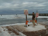
Lake Superior plays a vital role in the lives of people who live and work on its shores, and therefore all sorts of data are recorded to help understand and take care of it. Forrest, a high school student, used data from archives to figure out if the ice season was getting shorter each winter in his home town. The length of the ice season is important because it frees the island residents from working around a ferry schedule, allowing them to drive on the ice to get to the mainland.

This resource has been evaluated using the HQIM Rubric found here: https://docs.google.com/spreadsheets/d/1ppn2frk888P0KwW6IJ8wDJNTa32Pa2T0nzrR6K8Tzos/edit?usp=drive_link

Subject:
Atmospheric Science
Earth and Space Science
Environmental Science
Life Science
Material Type:
Activity/Lab
Author:
Richard Erickson
Date Added:
04/01/2024