
Wisconsin's State organization for art teachers.

Wisconsin's State organization for art teachers.

A reference book with a information about Wisconsin local government, voting, and elections.
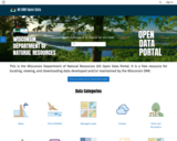
This is the Wisconsin Department of Natural Resources GIS Open Data Portal. It is a free resource for locating, viewing, and downloading data developed and/or maintained by the Wisconsin DNR.
This site also has categories of: Water, Fish and Wildlife, Managed Lands, Cimate, Parks and Recreation, Forestry, Transportation, Indexess and PLSS, Boundaries and Land Cover and Vegetation.
The site also has Applications that include: PFAS in Wisconsin Data Viewer, Western Coulee and Ridges Regional Master Plan, North Central Forest Regional Master Plan, Wildfires Dashboard App, Report Invasive Species, CWD reporting, etc
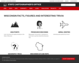
The WI Facts page on the website for the State Cartographer's Office offers different fun trivia such as interesting sites from aerial photography, geography trivia, and blank Wisconsin outline maps.
Use of this webpage alone does not meet any social studies standards. Teachers are encouraged to consider the use of inquiry and social studies/geographic disciplinary literacy to help students meet curricular goals.

Explore a rich collection of educational videos, teacher professional development resources, lesson plans for all grades, and learning tools for your classroom and library!
This collection of resources provides educators and pre-service teachers accurate and authentic educational materials for teaching about the American Indian Nations of Wisconsin.

Alfred, Lord Tennyson wrote “In the Spring a young man's fancy lightly turns to thoughts of love.” But in much of Wisconsin, once the lakes thaw, some men’s (and women’s) thoughts turn to sport fishing, particularly on the first Saturday in May which signals the opening of fishing season.
This online exhibit features images from Recollection Wisconsin content partners documenting our state's rich history of recreational fishing.
The Wisconsin Geological and Natural History Survey (WGNHS) has been serving Wisconsin for over 125 years. Part of the Division of Extension at the University of Wisconsin–Madison, WGNHS provides objective scientific information about the geology, mineral resources, and water resources of Wisconsin. We conduct research, map Wisconsin’s geology, and share information through our publications and outreach.
This is the link to the Publications Catalog that includes Wisconsin Data sets and maps for: Bedrock Geology, Groundwater, Surficial Geology, Rocks and Minerals, Soils, Precambrian Bedrock, Surface Water, Metallic Minerals, Topography, Nonmetallic Minerals, Climate and Weather, and Frac Sand.
Wisconsin’s climate is typically continental with some modification by Lakes Michigan and Superior. The cold, snowy winters favor a variety of winter sports, and the warm summers appeal to thousands of vacationers each year. About two-thirds of the annual precipitation falls during the growing season (freeze-free period). It is normally adequate for vegetation, although drought is occasionally reported. This climate is most favorable for dairy farming; the primary crops are corn, small grains, hay, and vegetables. The rapid succession of storms moving from west to east or southwest to northeast account for the stimulating climate.
Select from Climate by Location, Division, Normals, Statewide Extremes, Longterm Annual Variability, and Daily Climate data.

The Wiscsonsin Historical Society has gathered and organized an immense collection of resources in a user friendly manner for the teacher and student. Connecting local history to national and global developments, this website has such a variety of content that a teacher or student can find rich primary and secondary sources on virtually any trend or topic in history. The site also includes lesson and unit plans, information about museums and historic sites in the state, and resources for exploring one's family history.

Each Wisconsin Hometown Stories program is a celebration of the evolution of a town/city in Wisconsin, its residents and the stories they have to tell that paint the picture of specific communities across the state.
In this episode, historians, local citizens, and experts tell stories of tourism, cherries, art, and geology that capture the history of Door County. Viewers will also explore ethnic heritages that still thrive across the land, its art history, and efforts to preserve both the land and the natural beauty that define one of Wisconsin’s most charming places.

Each Wisconsin Hometown Stories program is a celebration of the evolution of a town/city in Wisconsin, its residents and the stories they have to tell that paint the picture of specific communities across the state.
In this episode, discover Eau Claire, a community that was both shaped and empowered by the convergence of two rivers. Follow the origins of the Native people who lived on the land and the growth of timber milling, tire manufacturing, and cookware industries that provided employment for Eau Claire residents. Also learn about a feathered mascot named Old Abe who led area troops into Civil War battles, as well as the influential role the city played in the fight for civil rights in baseball.

Each Wisconsin Hometown Stories program is a celebration of the evolution of a town/city in Wisconsin, its residents and the stories they have to tell that paint the picture of specific communities across the state.
In this episode, explore the story of two Wisconsin cities with a contentious beginning that grew to be collaborative communities of innovation and service. Film, archival images, and interviews with historians, local citizens and experts illustrate the two cities' rich stories and their role in shaping international manufacturing and retailing.

These slides provide the mathematical modeling routines, "If I knew...then I could" and "Mathematizing the World," also know as Notice and Wonder, using sites from all over the state of Wisconsin. This Wisconsin resource was inspired by math modeling information and resources found on the www.eqstemm.org website.
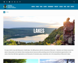
Wisconsin's 15,000 lakes. The DNR partners with the University of Wisconsin - Extension and citizens around the state to help protect and maintain these amazing natural resources while providing some of the best recreational opportunities in the nation. More than 600 lake organizations and thousands of volunteers play a leadership role in the stewardship of Wisconsin's lakes.
Find a Lake, Lake Water Quality Data, Lake Maps, Plants and Aquatic invasive Insects - are all linked to this site.

Volunteers, DNR staff, county staff and others collect water clarity, temperature and dissolved oxygen, as well as other water quality data, on lakes across Wisconsin. Around 1,000 volunteers are currently active, and the network has been going strong since 1986. Water clarity is measured with a black and white disk called a "Secchi Disk".
Satellite images are used to retrieve water clarity data for lakes across the state. This effort began in 1999 when the University of Wisconsin-Madison Environmental Remote Sensing Center (ERSC) developed a model for the retrieval of water clarity data from satellite images and Citizen Lake Monitoring Network volunteers provided on-the-ground Secchi data to calibrate this model for each satellite image. Water clarity data was retrieved for over 8,000 lakes statewide between 1999 and 2001. The DNR continues to analyze data in this way today in its remote sensing program.

Wisconsin Life celebrates the people, places, history and culture of the state. Come with us as we kayak the Mississippi River, interview musicians in Milwaukee, and bake pasties in Rhinelander. We connect you with diverse people and ideas through short stories updated twice a week.
This resource is informational; the podcast alone will not meet any social studies standards.
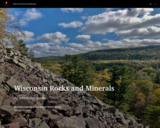
The Badger State is home to a wide variety of rocks and minerals, some of which you may find familiar and others you may not recognize. In this interactive guide, the Wisconsin Geological and Natural History Survey takes you on a journey through the state, exploring our most important rocks and minerals.
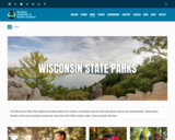
The Wisconsin State Park System provides places for outdoor recreation and for learning about nature and conservation. State parks, forests, trails and recreation areas see more than 20 million visits a year. Come and join the fun!
This site has links to all of the State Parks, Forests, Trails and recreation areas in Wisconsin.

The Surface Water Data Viewer is a mapping tool for the State of Wisconsin. It provides interactive web mapping tools for a variety of datasets, including chemistry, physical, and biological data. The data managed in layers that can be turned on and off as needed. The Homepage of the Surface Water Data Viewer (SWDV) has many commonly used features labeled. Descriptions of the features are as follows:
Toolbars: There are a variety of toolbars with different themes to help complete tasks using the SWDV. The toolbars can be used to display the layers available to the map, add or remove shapes, text, or measurement features, identify points, print maps, and more!
Search Bar: Using the search bar, you can search monitoring stations by number, locations by keyword, and waterbodies by WBIC. Be careful when using the search bar, partial matches do not always appear in the results.
Navigation Pane: The navigation pane is where results will appear from searches, where you are able to select layers for the map, and features for printing. You will be able to refine the data that is shown here, if desired. You can hide the navigation pane by clicking the left-facing arrow at the top.
Coordinates and Coordinate System: The coordinates will display for any point moused-over on the map. Click the black triangle to select your preferred method for displaying lat/long (DD, DMS, DDM, Mercator). The right-most option in this pane allows you to manually manage thescale of the map. Click on the scale tool, and selected the desired scale at which you wish to view the map. Select Go to implement changes.
Scale Bar: The scale bar shows the current extent of the map.
Whole State View: This view describes what is being shown on the main map relative to the entire state. A blue rectangle will cover the region of the state being shown on the map. You can also navigate the map by moving the blue square around the state-view map. If you print a map, this whole state view will print in the corner as a reference. You can minimize this view by clicking the corner-facing arrow in the top left edge of the box.
Show/Hide Toolbar: Use this button to hide the toolbar for a larger view of the map. If you have hidden the toolbar, you can also use this button to show it again.
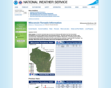
Wisconsin's Tornadoes for the current and a link to find historical tornadoes from past years (shown on map with details of each tornado). From National Weather Service.